Advisory Archive
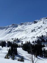
The sound of wind chimes on my front porch at 3am told me winter is back with a complex storm system overhead today. A deep trough of low pressure is moving over the western US today with a large band of moisture in eastern Idaho this morning trying to move north into Montana. Adding complexity, winds are spinning around from the east in much of our forecast area.
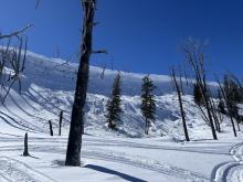
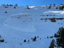
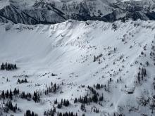
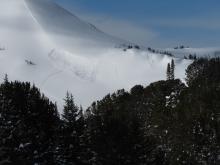
This morning it’s snowing in most areas. As of 6am, 2 inches accumulated near West Yellowstone and Island Park, an inch near Big Sky, and a trace at Bridger and near Cooke. Temperatures are mostly in the mid to upper teens F. Light winds are blowing from the E and NE. At the Bridger Ridge, east winds are averaging 30 mph gusting to 48 mph.
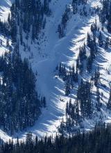
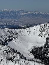
Today will be cloudy and snowy. Winds from the E and NE will increase through the day gusting in the 40s this afternoon. Snowfall amounts are tricky to forecast with east winds. Most areas will get a few inches. Mountains near West Yellowstone and Island Park are supposed to get 8-12 inches if moisture in Idaho is able to move north. My money is on Red Lodge where it was snowing hard at 4am and a foot of snow could easily stack up today.
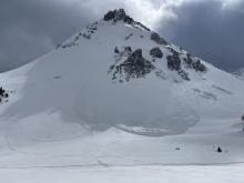
This morning temperatures are in the upper teens F in most areas and a few degrees warmer in the Bridgers. Winds picked up a bit yesterday afternoon/evening at upper elevations and are blowing 7-14 mph with gusts 20-30 mph from the west this morning. Gusts in Hyalite Canyon hit 40 mph. Near Cooke City, an inch of snow fell early this morning.
Today will have a mix of sun and clouds with more clouds near West Yellowstone, Island Park, and Cooke City. High temperatures will range from 25-30 degrees F. Winds will continue as they are this morning, but should be decreasing and becoming light by the end of the day.
Snow comes tomorrow (Thursday) favoring southern parts of the forecast area with about 5 inches of snow and a few inches further north. The next chance of snow comes the middle of next week.


This morning, mountain temperatures are in the teens F, with 5-10 mph winds from the west through the north. The mountains around Bozeman received 2-4” of new snow, with 1-2” in Big Sky and none in the mountains around Cooke City, West Yellowstone and Island Park.
Today, temperatures will be in the mid-20s to low-30s F, with 5-10 mph winds shifting from the northwest to the southwest. By tomorrow morning, a trace to 1” of snow will fall across most of the advisory area. The next chance for significant snow is Thursday.


Temperatures are high 20s to mid-30s F this morning. Yesterday wind was light from the east, southeast and southwest, and this morning wind shifted to west, northwest and north at 5-15 mph with gusts of 15-25 mph.
Today skies will be mostly cloudy with temperatures in the 20s and low 30s F. Wind will be northerly at 5-15 mph with gusts to 25 mph. Snow showers late this afternoon will favor the mountains near Bozeman with 3-5” possible by morning and 1-2” elsewhere.
This morning temperatures are high 20s to mid-30s F, 5-10 degrees warmer than yesterday morning. Winds are westerly at 5-15 mph with gusts of 15-30 mph.
Today, cloud cover will increase, temperatures will reach high 30s to mid-40s F, and wind will remain calm to light. Cooler temperatures return tomorrow with a chance for snow tomorrow afternoon into Tuesday.

Warm, springlike weather continues today. This morning, temperatures are in the 20s and low 30s F. Winds are 10-20 mph out of the west and northwest with gusts of 20-30 mph.
High temperatures today will be above freezing in most locations, rising into the 30s and 40s F. Skies will be mostly sunny and winds will be light and westerly.
Cooler temperatures return on Monday along with the next chance for snowfall.

This morning, skies are clear, temperatures are in the 20s F, and winds are 10-20 mph out of the west and northwest with gusts into the 30s and 40s mph.
It’s going to be another beautiful spring day. High temperatures will be similar to yesterday, rising into the 30s and 40s at the lower elevations and to near freezing even in the high peaks. Winds will remain moderate, shifting more southerly in places this afternoon.
Snowfall returns on Sunday night or Monday.


It really feels like spring with warm sunny weather and a ridge of high pressure overhead for the next four days until Sunday night when the leading edge of a trough of low pressure arrives bringing cooler air and snowfall.
This morning temperatures are mostly in the upper teens and low 20s F; a bit warmer in the Bridgers and a bit cooler near West Yellowstone and Cooke City. The strongest winds blew two days ago, and this morning are averaging 10-15 mph with gusts in the 20s from W and NW.
Today will be another gorgeous day that will warm quickly into the 30s F under mostly sunny skies. Winds will continue at similar speeds but blow more from the SW. The tricky thing to gauge will be how much heat the snow receives today. A few clouds overhead with some wind could keep this snow from warming too much despite strong sunshine. There’s still lots of great dry, settled powder in the mountains.


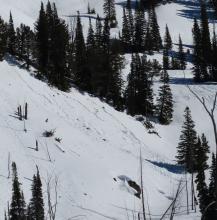
This morning, temperatures are in the teens F, with 10-20 mph winds from the west and southwest. The mountains around Cooke City received 3” of snow in the last 24 hours, Big Sky and Bozeman 1”, and West Yellowstone and Island Park got skipped.
Today, high temperatures will be in the 20s to low 30s F, with 5-15 mph winds from the west and southwest under clearing skies. We are heading into warmer and generally quiet weather through the weekend—snowfall returns on Monday.

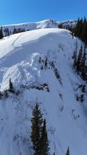
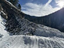
It is snowing and windy this morning, with temperatures in the 20s F and 20-25 mph winds gusting around 70 mph from the west and southwest. In the last 24 hours, the mountains received 1-3” of snow.
Today, high temperatures will be in the 20s to low 30s F with 15-35 mph winds from the west and southwest. By tomorrow morning, the mountains around Cooke City, Big Sky and Bozeman will receive 2-4” of snow, with 1-3” in Island Park and West Yellowstone.