AVALANCHE WARNING
ISSUED ON MARCH 18 2012 AT 2:00 pm
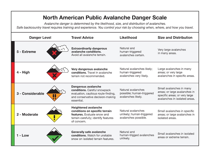
The Gallatin National Forest Avalanche Center is issuing a Backcountry Avalanche Warning for the southern Gallatin Range, southern Madison Range and Lionhead area near West Yellowstone. Heavy snowfall and strong winds are creating unstable, dangerous conditions in the backcountry. Natural avalanches are currently large and destructive. The snowpack is weak and unable to support the new snow. The avalanche danger is rated HIGH on all slopes. Human triggered avalanches are very likely. Avalanche terrain including avalanche runout zones should be avoided.
This warning will either be terminated or updated by 6:00 AM on Tuesday, March 20, 2012
Good Morning.This is Eric Knoff with the Gallatin National Forest Avalanche Advisory issued on Sunday, March 18 at 7:30 a.m. The Montana Import Group, in partnership with the Friends of the Avalanche Center, sponsors today’s advisory. This advisory does not apply to operating ski areas.
Over the past 24 hours the mountains around West Yellowstone picked up 6-8 inches of high density snow; all other areas picked up 3-5 inches. Currently mountain temperatures are in the mid-twenties to low thirties and winds are blowing out of the SSW at 15-30 mph with gusts in Hyalite and Big Sky reaching close to 50 mph. Today, temperatures will warm into the mid to upper thirties and winds will continue to blow 15-30 mph out of the SSW. A moist southerly flow will produce a strong chance of mountain snow showers through the day. The southern mountains should pick up 4-6 inches by the tonight and 8-10 inches by tomorrow morning. The mountains around Bozeman and Big Sky will likely pick up 3-5 inches by tomorrow morning.
The southern Gallatin and southern Madison Ranges and the Lionhead area near West Yellowstone:
The snowpack is complicated, but the avalanche problem is easy. Weak, faceted layers buried deep in the pack are reacting to the two+ feet of heavy, dense snow that has fallen over the past week. This new load is pushing many slopes past their breaking point, which was evident during our ride into the Lionhead area yesterday (photo).
Mark and I were impressed by the size and distribution of the natural activity we observed in the area. We also triggered a large slide from Lionhead Ridge, which initiated as a cornice drop, but triggered the entire slope below (video). We were at least twenty feet away from the cornice when it broke. More natural activity was observed in Trapper Creek above Hebgen Lake as well as the Two Top area outside of West Yellowstone. When slopes are failing naturally, there is little doubt they will fail under the weight of a skier or rider.
Slides are running on a near surface facet layer three feet above the ground or on depth hoar at or near the ground (photo). Any slide that is triggered will likely be large and unmanageable (photo1, photo2).
Today, very dangerous avalanche conditions exist and human triggered avalanches are very likely creating a HIGH avalanche danger.
The northern Madison Range:
The mountains around Big Sky have the same buried faceted layers as the mountains near West Yellowstone; they just haven’t received the load. However, the northern Madison Range has picked up 4-6 inches of dense snow over the past few days, which has been transported onto north and east facing slopes by strong south/southwest winds. Yesterday, the Big Sky Ski Patrol triggered fresh wind slabs 6-10 inches deep during control work.
Today, wind loaded slopes are the primary avalanche concern for the northern Madison Range. Slides should stay confined to the recent storm snow, but they could potentially step down to faceted layers buried deeper in the pack.
With more snow and wind forecasted through the day, human triggered avalanches will remain likely on wind loaded slopes which have a CONSIDERABLE avalanche danger. Non-wind loaded slopes have a MODERATE avalanche danger.
The Bridger Range, northern Gallatin Range and the mountains around Cooke City:
The Bridger Range, northern Gallatin Range and mountains around Cooke City are not much different and most slopes have faceted layers both at the ground and 2-3 above the ground. Without a significant load, these layers are becoming less reactive. However, if a skier or rider does manage to impact one of these layers, the resulting slide will likely be large and destructive. A good example of this was observed in the Bridger Range on Friday (photo).
Areas where the snowpack is thinner, primarily in steep, rocky terrain will be high probability areas for triggering a slide. Also, cornices have grown large and can break back farther than one might think. Cornices should be given a wide berth along ridgelines and slopes directly below large cornices should be avoided.
Today, the avalanche danger for the mountains around Bozeman and Cooke City is rated MODERATE. The danger could rise to CONSIDERABLE on wind loaded slopes if the storm arrives earlier than expected.
Wet snow avalanche danger:
Warm temperatures and rain have weakened the snowpack on mid and low elevation slopes. Multiple wet snow avalanches have been reported throughout our advisory are over the past few days. With more rain in the forecast, wet snow avalanches are a significant concern on mid to low elevation slopes which have a CONSIDERABLE avalanche danger.
I will issue the next advisory tomorrow morning at 7:30 a.m. If you have any snowpack or avalanche observations, drop us a line at mtavalanche@gmail.com or call us at 587-6984.
Events/Education
1-hour Avalanche Awareness at REI, Bozeman
Tuesday, March 20 at 6:30 pm. Sign up for this FREE class here.