Photos
|
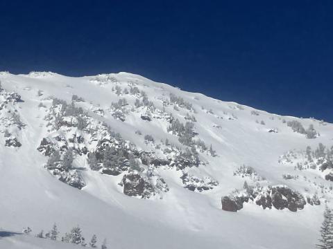
Northern Gallatin, 2025-03-08 From obs: "Multiple natural loose avalanches in the steep terrain of mt Blackmore. All originated at the base of cliffs or trees. Counted 4 prominent ones." Photo: M. Stern Link to Avalanche Details |
|
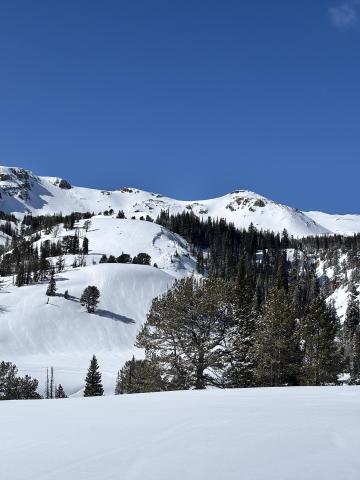
Lionhead Range, 2025-03-08 From obs: "Looks like a recent naturally triggered slide towards the Idaho wilderness boundary on lionhead." Photo: M. Klahr |
|
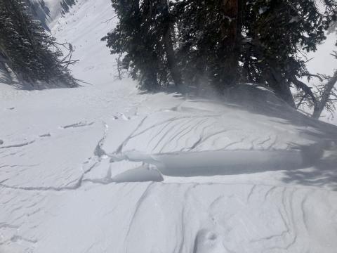
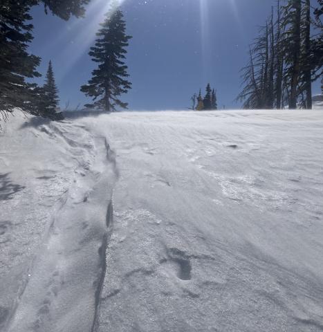
Bridger Range, 2025-03-07 Mar 7 obs: "...There was 6" of low density snow from yesterday. Winds were stronger than expected, from the north at the top of the Throne, and increased through the morning.... We found fresh drifts that were reactive, cracking easily and 5-10' wide out from our skis, on south and east facing slopes around 8000-8300'." Photo: GNFAC Link to Avalanche Details |
|
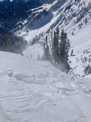
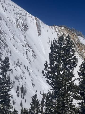
Bridger Range, 2025-03-07 Mar 7 obs: "...There was 6" of low density snow from yesterday. Winds were stronger than expected, from the north at the top of the Throne, and increased through the morning.... We found fresh drifts that were reactive, cracking easily and 5-10' wide out from our skis, on south and east facing slopes around 8000-8300'." Photo: GNFAC |
|
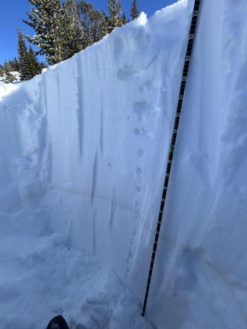
Bridger Range, 2025-03-07 Mar 7 obs: "There was 6" of low density snow from yesterday.... The new snow was low density and sluffed easily on steep shady northerlies. On steep slopes facing the sun (south and east, and probably west) the new snow sat on a crust and became moist as the sun warmed it up and started to slide under skis. We saw a couple very small natural loose snow slides below rock outcrops on south facing slopes. Air temperatures were well below freezing, especially with wind chill, but the sun quickly warmed the recent new snow." Photo: GNFAC Link to Avalanche Details |
|
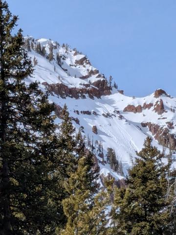
Cooke City, 2025-03-07 Above Goose Creek -hard, dense, strong, and deep snow. Facets from late January are 1F+ hardness |
|
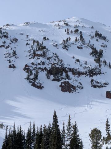
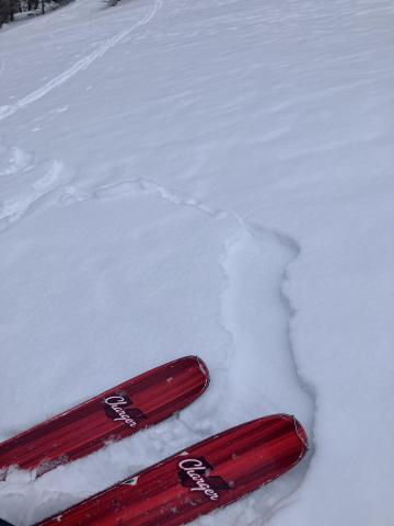
Northern Gallatin, 2025-03-06 Saw lots of small loose avalanches on Mt Blackmore and nearby slopes, some appeared to be natural and others skier triggered. We saw multiple dry loose on N and E aspects and a wet loose on a southeast aspect. Photo: H Meyers Link to Avalanche Details |
|
Northern Gallatin, 2025-03-06 Saw lots of small loose avalanches on Mt Blackmore and nearby slopes, some appeared to be natural and others skier triggered. We saw multiple dry loose on N and E aspects and a wet loose on a southeast aspect. Photo: H Meyers Link to Avalanche Details |
|
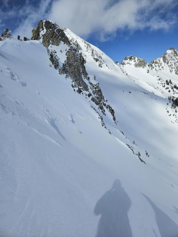
Out of Advisory Area, 2025-03-06 Toured into the emigrant gulch area today. At around 7600’, I found some touchy storm slabs. These only seemed to be reactive on solar aspects (crust). Photo: J Alford |
|
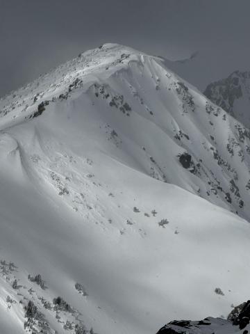
Northern Madison, 2025-03-05 Came across a old slide in the hell roaring drainage heading towards Gallatin. East facing. Happened sometime before the recent snow but not long ago. Initial crown seemed to be 12-18 inches and stepped down further down the slope. Was a fairly large debris pile. Photo: S Knowles Link to Avalanche Details |
|
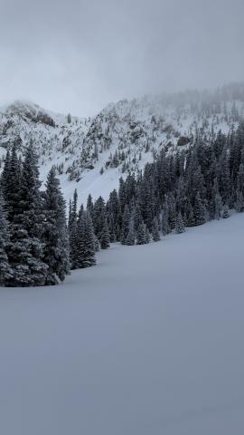
Northern Madison, 2025-03-05 Old Avalanche spotted from Wilson yesterday looking North. Possible cornice fall trigger during the warm up but difficult to tell as it was quite a ways away. Photo attached. Photo: Anonymous Link to Avalanche Details |
|
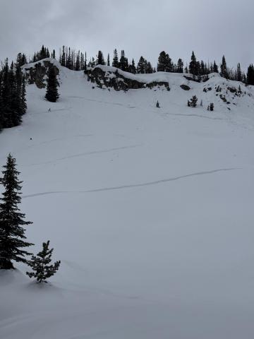
Bridger Range, 2025-03-04 From obs on 3/4/25: "Saw a few sluffs in the new snow triggered by skiers in the very steep terrain just north of the Bridger Bowl ski area boundary (see photo). These sluffs were small, definitely not large enough to bury someone." |
|
Northern Madison, 2025-03-04 PWL avalanche (R3-D2), east-facing, deep in Muddy Creek. This was drifted in and likely broke around 2.5 weeks ago during the last significant storm cycle. Photo: GNFAC Link to Avalanche Details |

|
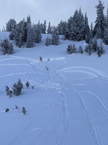
Northern Madison, 2025-03-04 We dug a snowpit near the lower flank of the avalanche path and noted that these weak layers had gained strength over time. We did get propagation on a stout melt-freeze crust near the surface (ECTP5) but did not get propagation lower down on faceted grains. Photo: GNFAC |
|
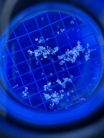
Northern Madison, 2025-03-04 We saw a small north-facing avalanche in the First Yellow Mule (R1-D1) that was snowmobile triggered. It looked to be around a week old. Photo: GNFAC Link to Avalanche Details |
|
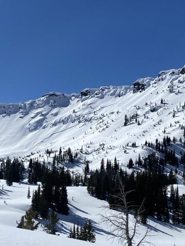
Northern Gallatin, 2025-03-03 "Toured up Flanders Creek to the main cirque. I was wondering what the snow surface was doing with the high pressure. I dug a pit on a NNW aspect at 8900'. HS 205cm, light SW wind, clear skies and air temp was 2.1 C at 4pm. Dust layer was down 60cm from the surface. I didn't get any propagating results in my pit and the snowpack was right side up. I did notice a strong temperature gradient in the top few centimeters of snow. I only found this on sheltered, shaded slopes with dry powdery snow. I did not find a strong temp gradient or facets in dense wind affected snow. Something to keep in mind if we get a big dump of snow in the near future." Photo: B. Oackes |
|
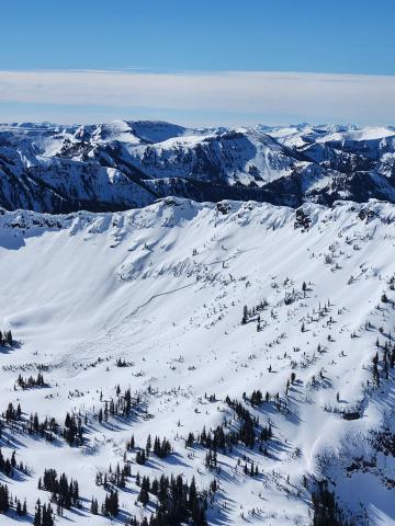
Northern Gallatin, 2025-03-02 Ridge line just west of divide peak in Hyalite canyon. Photo: O Silitch Link to Avalanche Details |
|
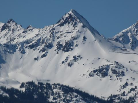
Northern Gallatin, 2025-03-02 Saw a fairly fresh avalanche up Hyalite from the top of the Fat and Skinny Maids, I think that would put the avalanche in the Storm Castle Creek basin. Photo: F Miller Link to Avalanche Details |
|
Southern Madison, 2025-03-02 Another day of warm temps and clear skies allowed us to cover a lot of ground in the Southern Madisons. We rode into the Taylor Fork, up to the weather station, to the top of Carrot Basin, through Sage Basin, up and over into Cabin Creek, and all the way up to the head of Red Canyon. There were a handful of small wet-loose avalanches on solar aspects that we noted throughout the day. While northerly aspects stayed cold, solar aspects became wet a couple inches down. Photo: GNFAC Link to Avalanche Details |
