Photos
|
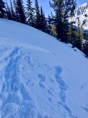
Cooke City, 2025-04-06 Apr 5 Wind slabs were still reactive. We triggered 3 small, 3-8" deep x 5-15' wide, hard wind (1F+) slabs on convex test slopes well below the main ridgelines. 9,800', NE aspects. Photo: GNFAC Link to Avalanche Details |
|
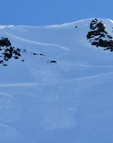
Cooke City, 2025-04-06 Apr 5 Wind slabs were still reactive. We triggered 3 small, 3-8" deep x 5-15' wide, hard wind (1F+) slabs on convex test slopes well below the main ridgelines. 9,800', NE aspects. Also triggered one softer (4F) wind slab just below the high ridgeline, 10,200', NE aspect. 10-15' wide x 6-8" deep (Pictured). Photo: GNFAC Link to Avalanche Details |
|
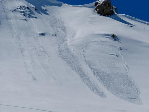
Cooke City, 2025-04-06 Apr 5 We saw a couple 3-6" deep natural wind slab avalanches and a few dry loose slides that looked to have happened within the last 24 hours. Photo: GNFAC Link to Avalanche Details |
|
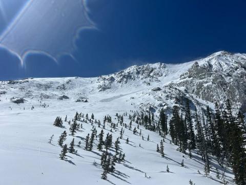
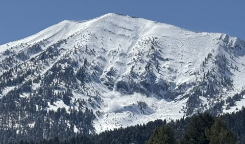
Bridger Range, 2025-04-06 "We went on a tour in the Bridgers today [Apr 5], we ascended the east ridge of Naya Nuki to the entrance of the Great One. Wind was blowing and we were being careful about potential wind slabs up high. Skier 1 ski cut the top of the chute and produced a small wind slab that ran to the break in the chute and continued another 100 vert down the east apron. After all meeting up halfway down, skier 2 proceeded to ski the E facing apron. A wind slab propagated and carried skier 2 roughly 300 vert down the apron where skier 2 was able to swim out of the fall line and came to a rest on top of the debris. Everyone was okay aside two missing ski poles." Link to Avalanche Details |
|
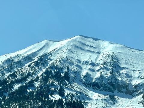
Bridger Range, 2025-04-06 From BBSP: " At 2.45?pm [Apr 5] a... solo skier triggered a wind loaded pocket on the main face of Saddle Peak that ran down over the cliff and produced an impressive powder cloud.... I met him... and confirm he was alone and no one was in front of him. The avalanche looked to be 2' deep on the southern flank and 5" deep on the northern flank... It entrained more snow on the way down, one 2' deep downhill wind loaded pocket and some loose wet snow. It ran into the bottom of the going home chute, gouging a large hole and then 100ft downhill left a 200ft by 30ft wide shallow debris pile." Link to Avalanche Details |
|
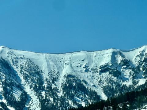
Bridger Range, 2025-04-06 (Apr 5) "...Also observed one small wind slab occurring between Saddle & the Football Field, possibly skier-triggered." Photo: G. Antonioli Link to Avalanche Details |
|
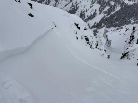
Bridger Range, 2025-04-06 (Apr 5 ) "Observed multiple D1-1.5 natural dry loose avalanches (and some tiny wind slab pockets under the ridge cornice) that likely occurred during peak warming around 2-3 PM. North/sheltered aspects from ~9- 8.5k held an average of 8+ inches of dry, drifted snow...." Photo: G. Antonioli Link to Avalanche Details |
|
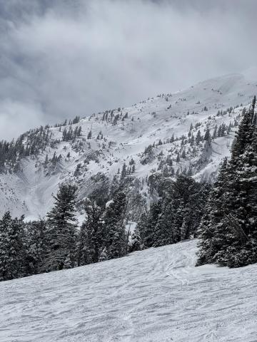
Cooke City, 2025-04-04 Wind slab near Cooke City from yesterday. Intentionally triggered. North aspect, 10,100'. 1' deep, 20' wide. Photo: B Fredlund Link to Avalanche Details |
|
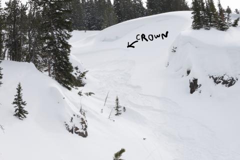
Bridger Range, 2025-04-03 There was a pair of R1, D1 avalanches on Saddle Peak. One appears to be a loose snow avalanche triggered by a skier coming off of north Saddle Peak That ran a couple hundred feet. The second was a small slab coming out of Spencer’s with debris running into Going Home Chute. Photo: GNFAC Link to Avalanche Details |
|
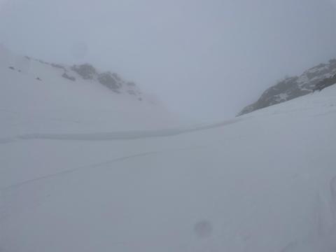
Cooke City, 2025-04-03 Skier took a left turn under cornices to scrub speed and released a 6-10" windslab 40' wide which ran 10' at most. Super soft and easy to ski through. Photo: J Lee Link to Avalanche Details |
|
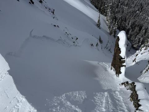
Northern Madison, 2025-04-03 The slope at the my skis broke about 15-20 meters wide and 15 cm deep at the flanks to 40cm deep in the gut, SS-ASu-R1-D1.5-I-M(L)-TK. About 30 meters downhill, the slab rode up onto the new snow and ran out of momentum before reaching the runout. Photo: J Negri Link to Avalanche Details |
|
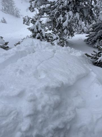
Cooke City, 2025-04-01 From email: "Ski touring near Cooke City today we intentionally triggered a storm slab/ wind slab on a steep north aspect around 9600'. It was about 6" deep, and 30' wide." Photo: B Fredlund |
|
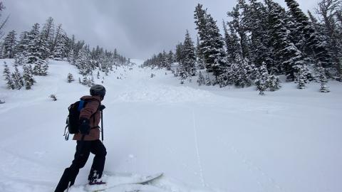
Bridger Range, 2025-04-01 In one steeper roll over, I got shooting cracks and a small storm slab to break at my ski tips. Photo: GNFAC
|
|
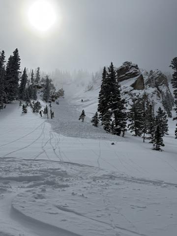
Bridger Range, 2025-03-31 Heavy, wet slide of recent snow released while skiing off South Saddle. The photo is from South Central. Photo: E. Volk Link to Avalanche Details |

|
Bridger Range, 2025-03-31 Heavy, wet slide of recent snow released while skiing off South Saddle. The photo is from South Central. Photo: E. Volk Link to Avalanche Details |
|
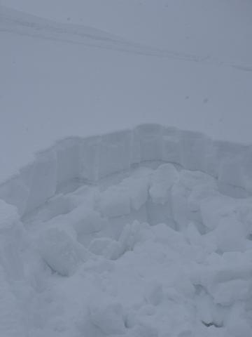
Bridger Range, 2025-03-31 "Skied the north chutes above fairy lake around 8,400 ft. Found 8-12" of new snow, with the bottom 2" consisting of large graupel. In steep terrain our sluff entrained lots of snow making for some large debris piles. Overall the snow was generally well bonded." Photo: S. Lipsteuer Link to Avalanche Details |
|
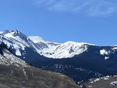
Northern Gallatin, 2025-03-30 The 12" of snow since yesterday fell right-side-up and had little to no slab properties. This new snow rests on a stout melt-freeze crust from the high temperatures last week. Photo: GNFAC |
|
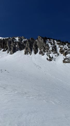
Southern Gallatin, 2025-03-26 I noticed a couple of wet slides that came off Electric and it’s sun-ridge today. Photo: Anonymous |
|
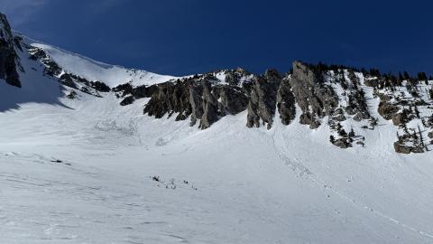
Bridger Range, 2025-03-26 There were a number of wet loose avalanches in Airplane Bowl. All on E/S aspects near rocks or cliffs. Most were relatively small and had not entrained much snow from the surface or gouged deeper than a few inches. Photo: GNFAC Link to Avalanche Details |
|
Bridger Range, 2025-03-26 There were a number of wet loose avalanches in Airplane Bowl. All on E/S aspects near rocks or cliffs. Most were relatively small and had not entrained much snow from the surface or gouged deeper than a few inches. Photo: GNFAC Link to Avalanche Details |
