Snow Observations List
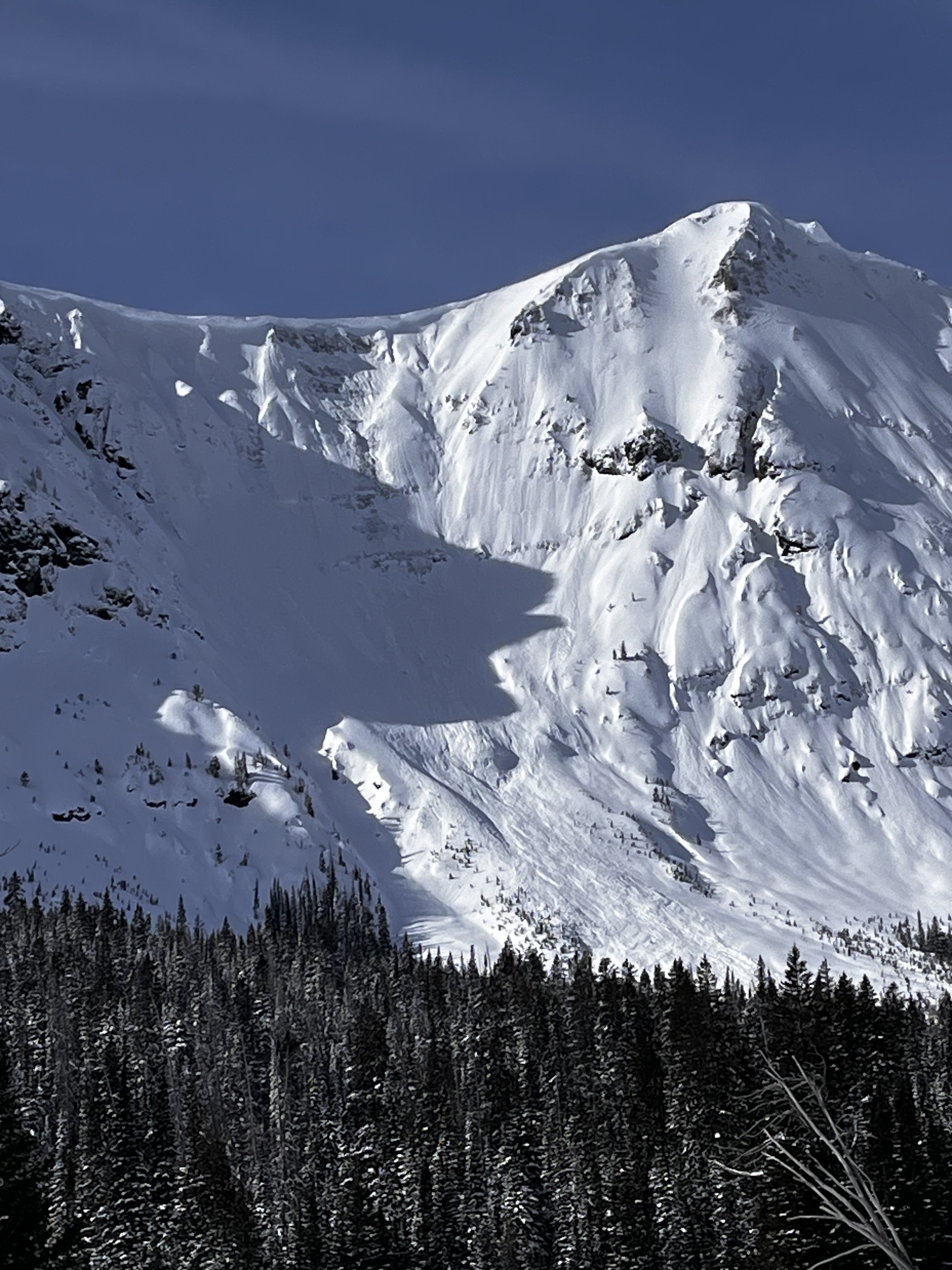
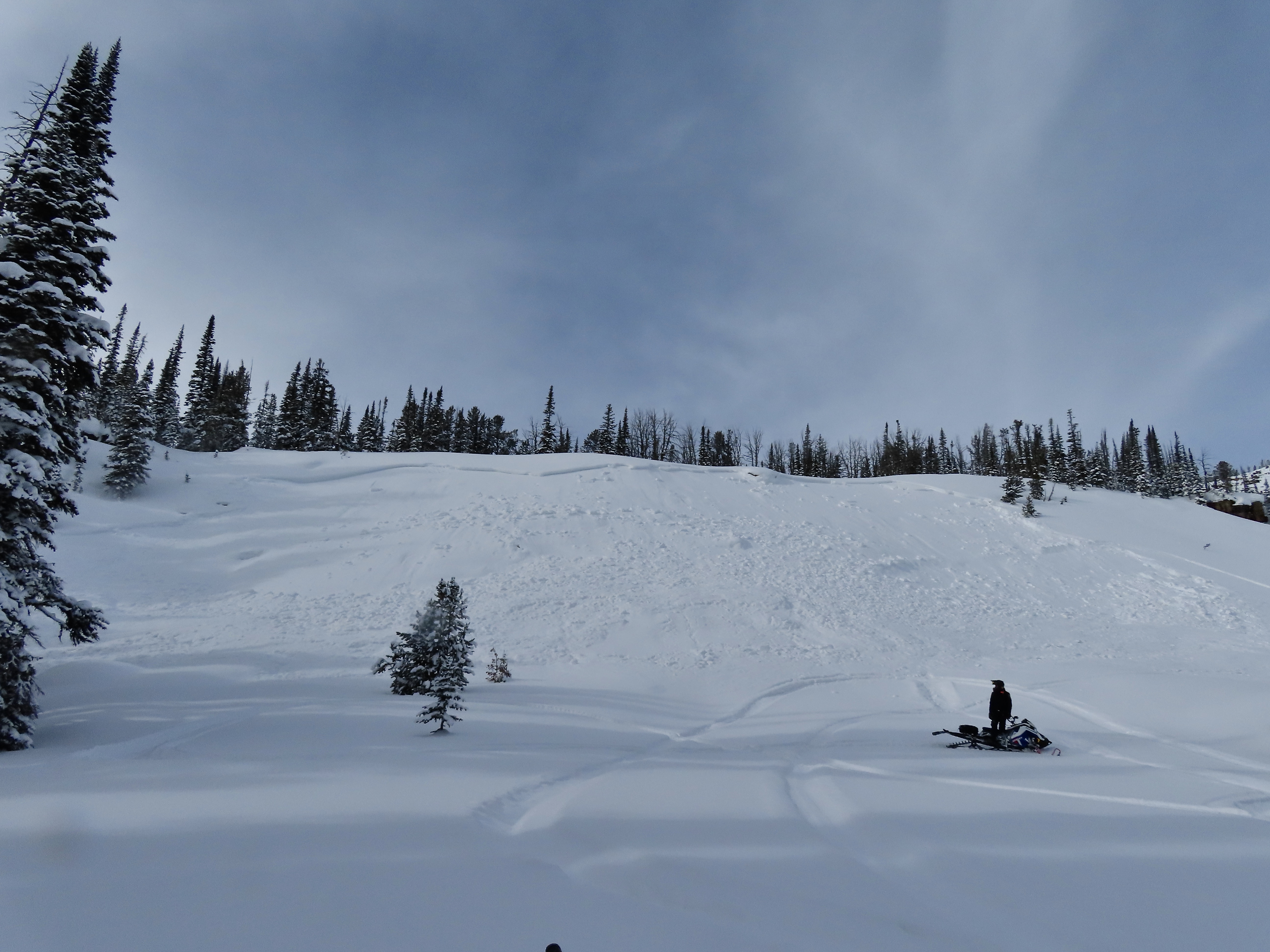
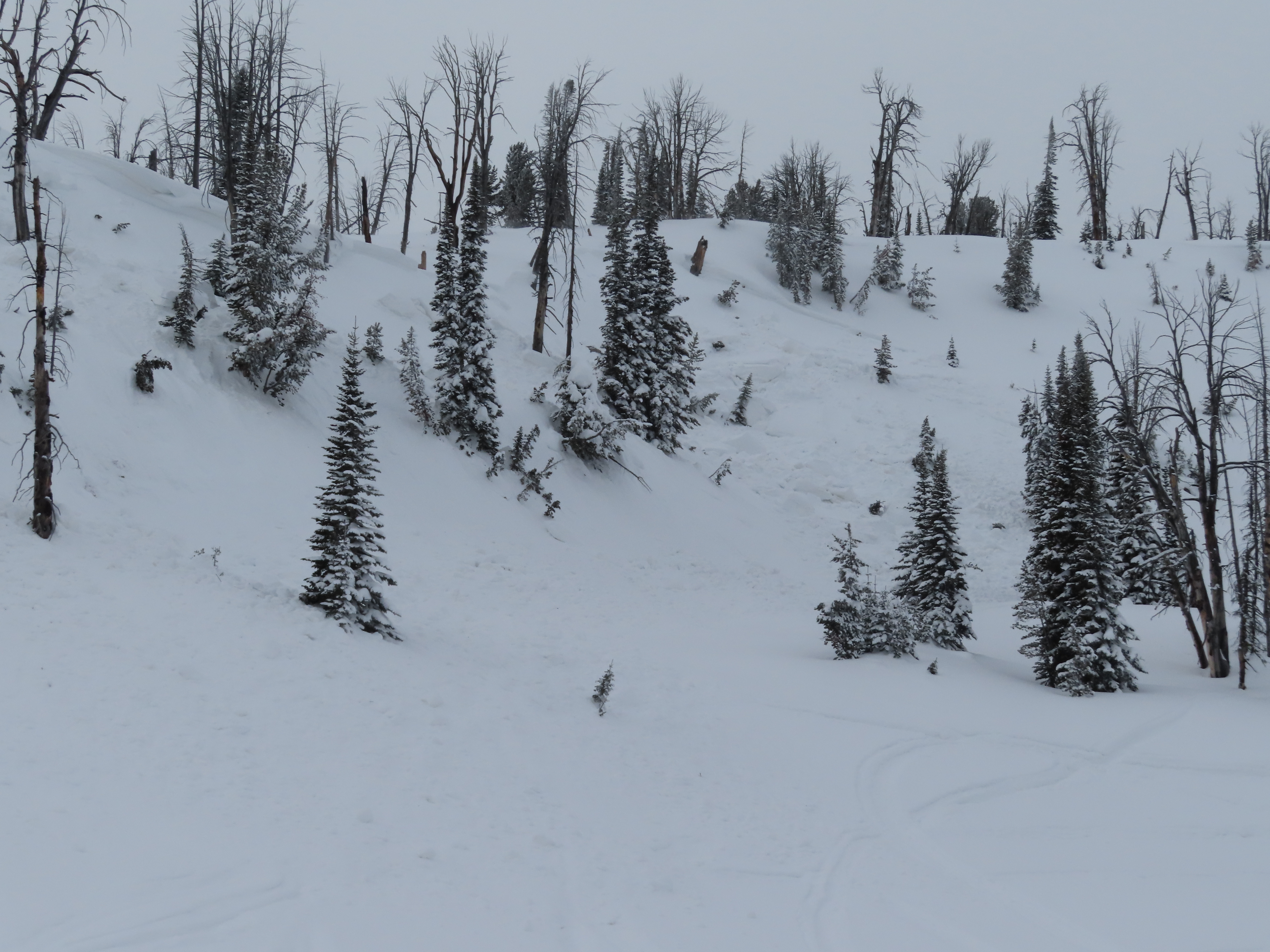
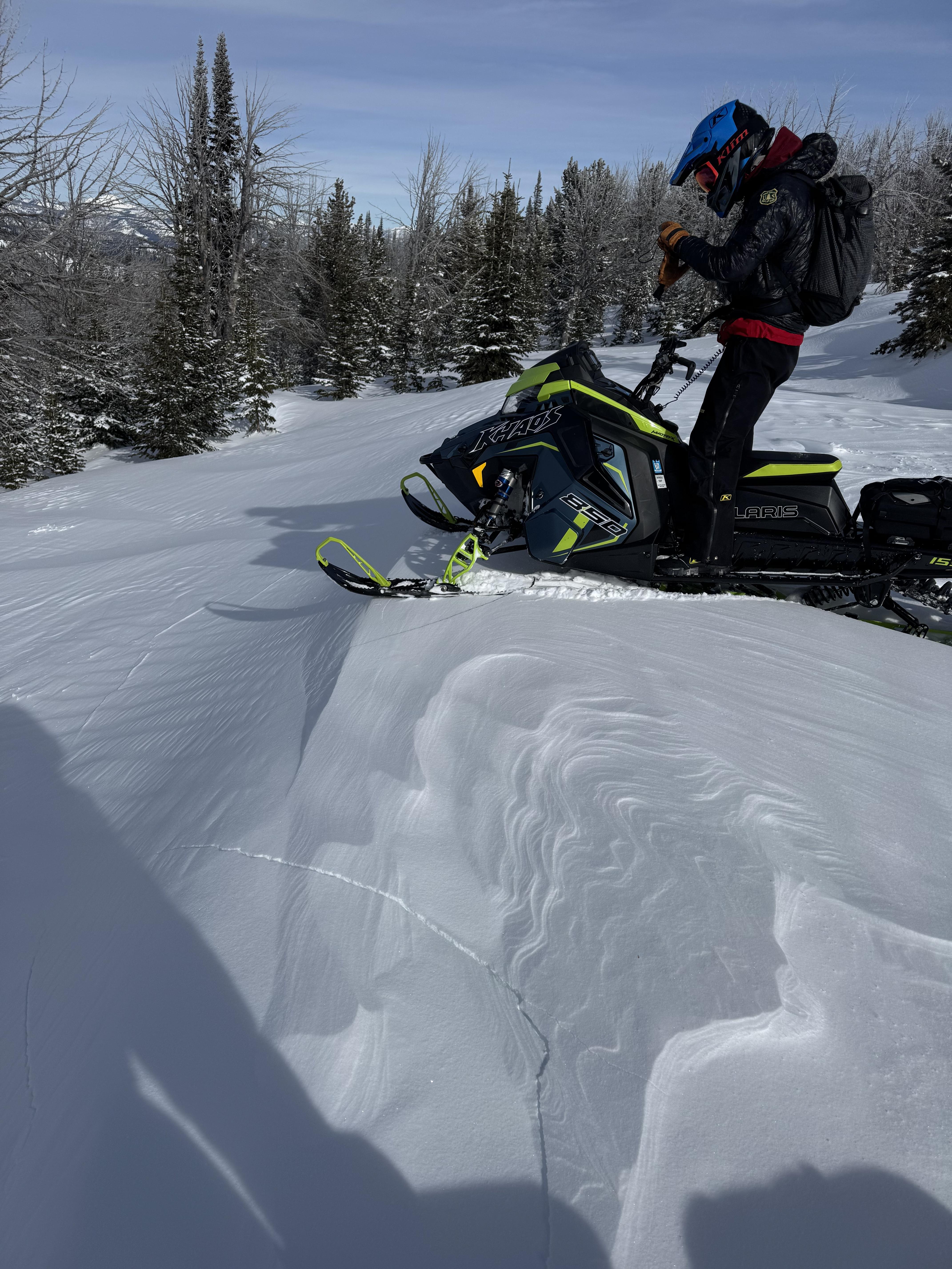
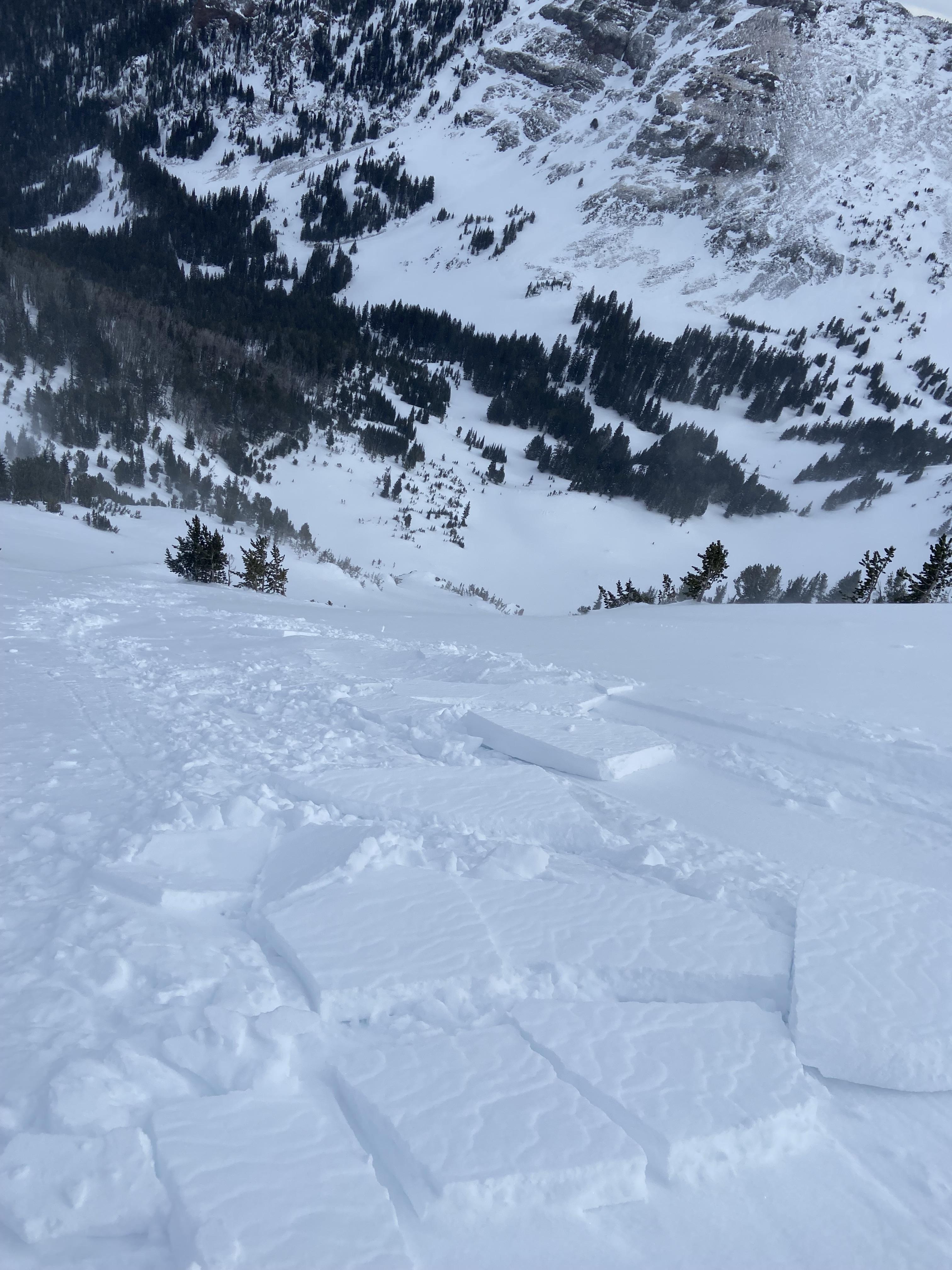
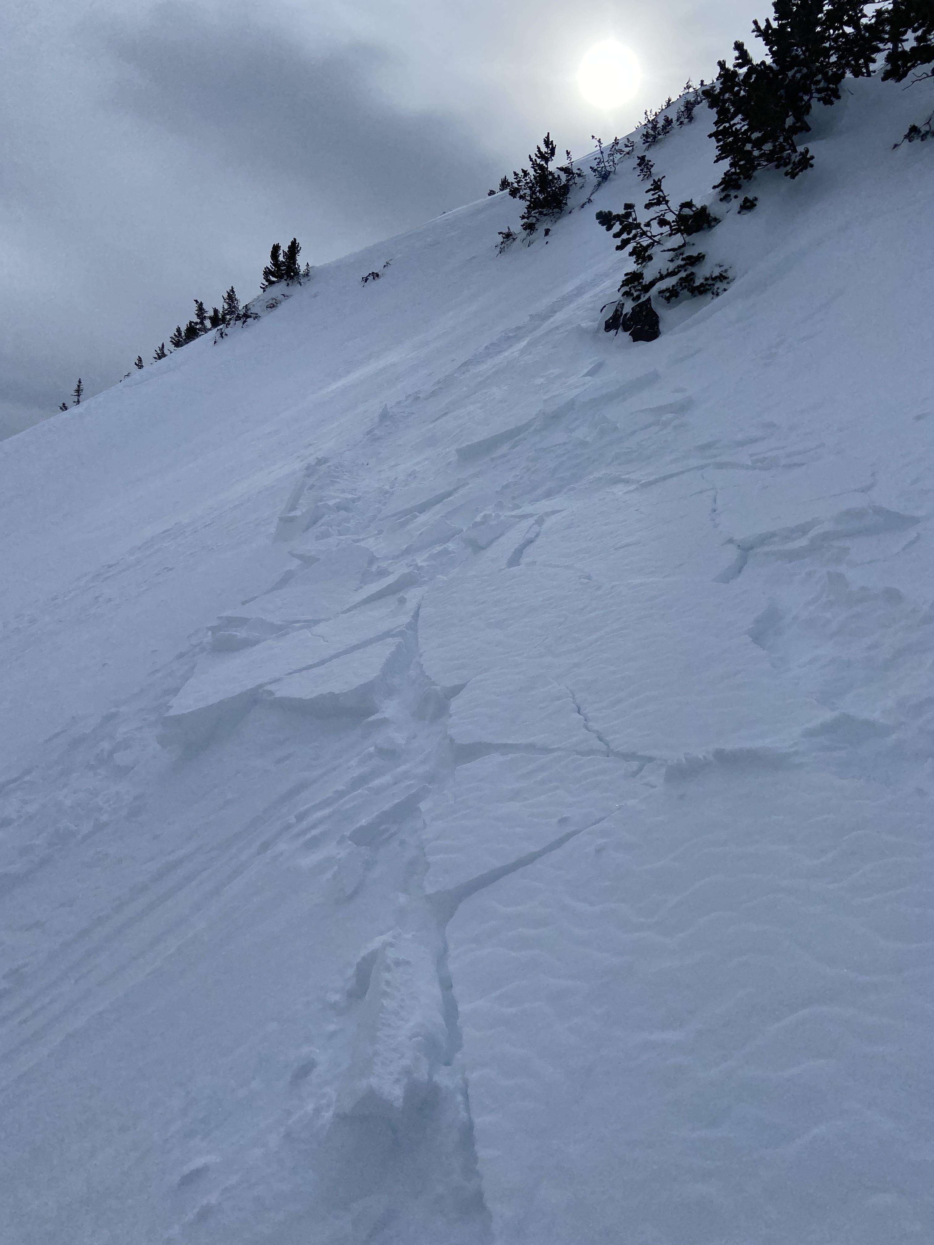
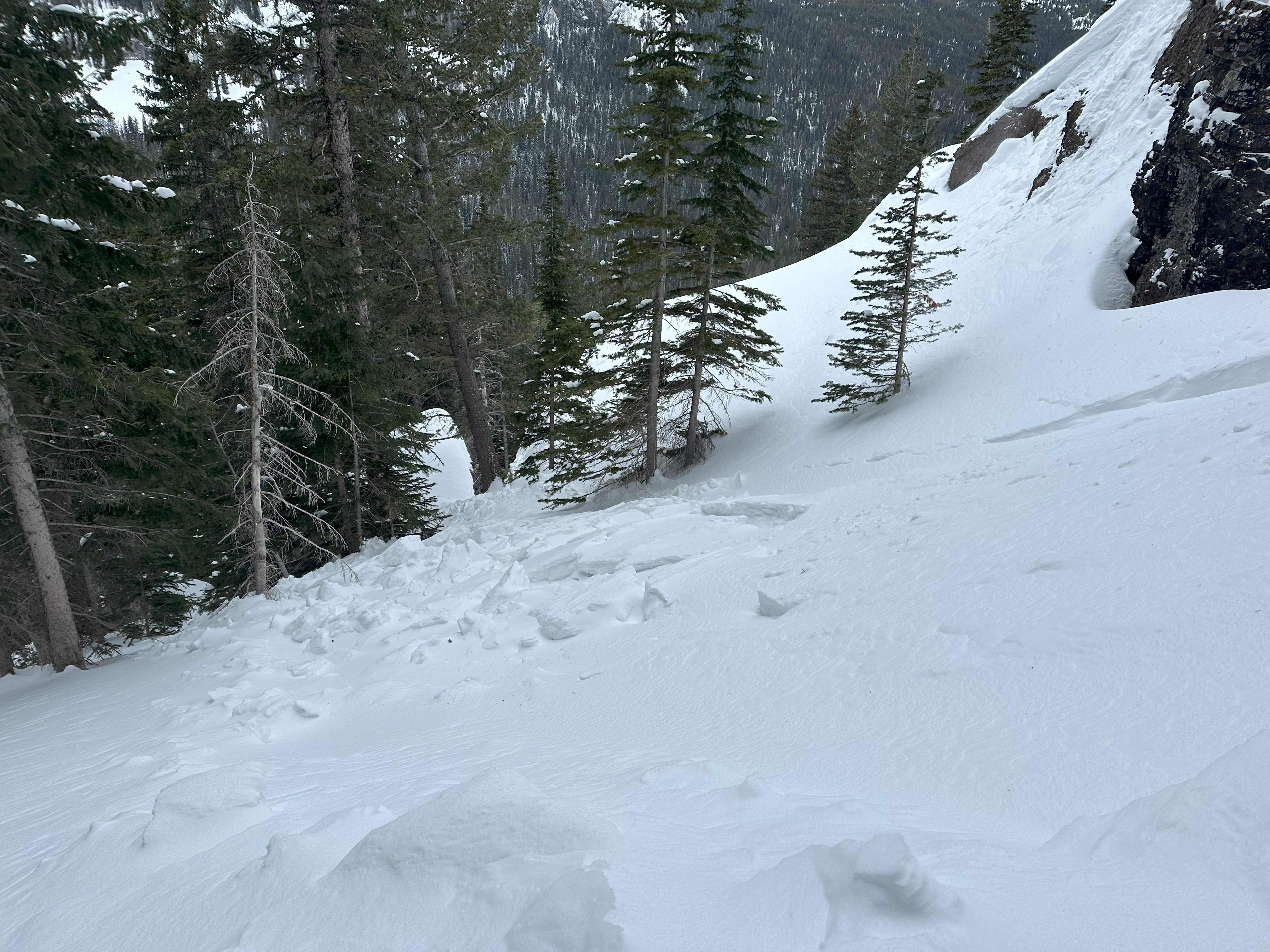
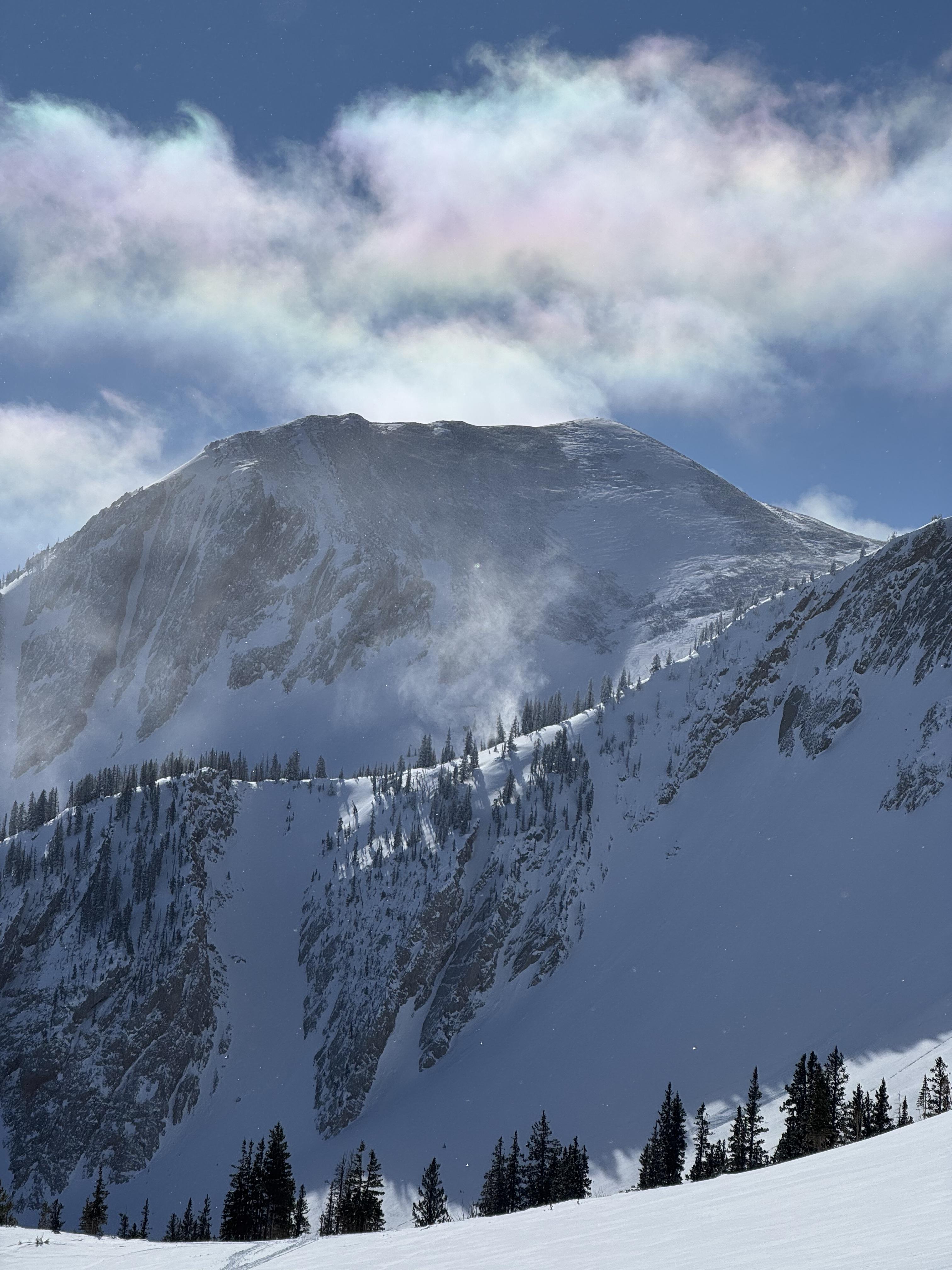
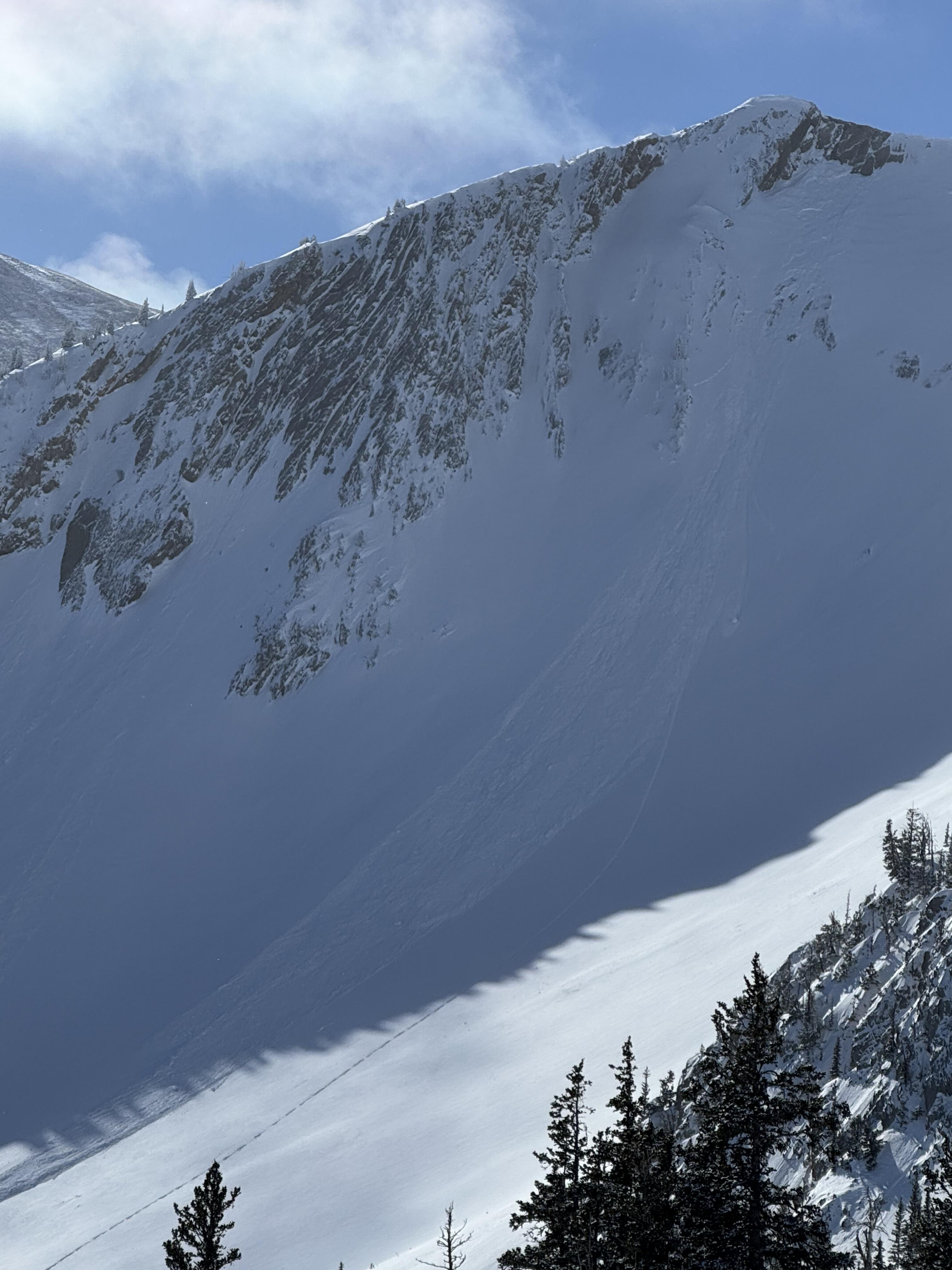
Noticed a large cornice triggered avalanche on Mineral Mtn today. Likely broke on 2/12 or early am 2/13. E aspect ran almost to the valley floor. Active Loading today with Strong Gusts from N-S. There were some other small cornice avalanches to the north of this slide that did not trigger larger avalanches.
Full Snow Observation ReportLots of snow transport above treeline today south of Cooke City. Wind gusts were strong.
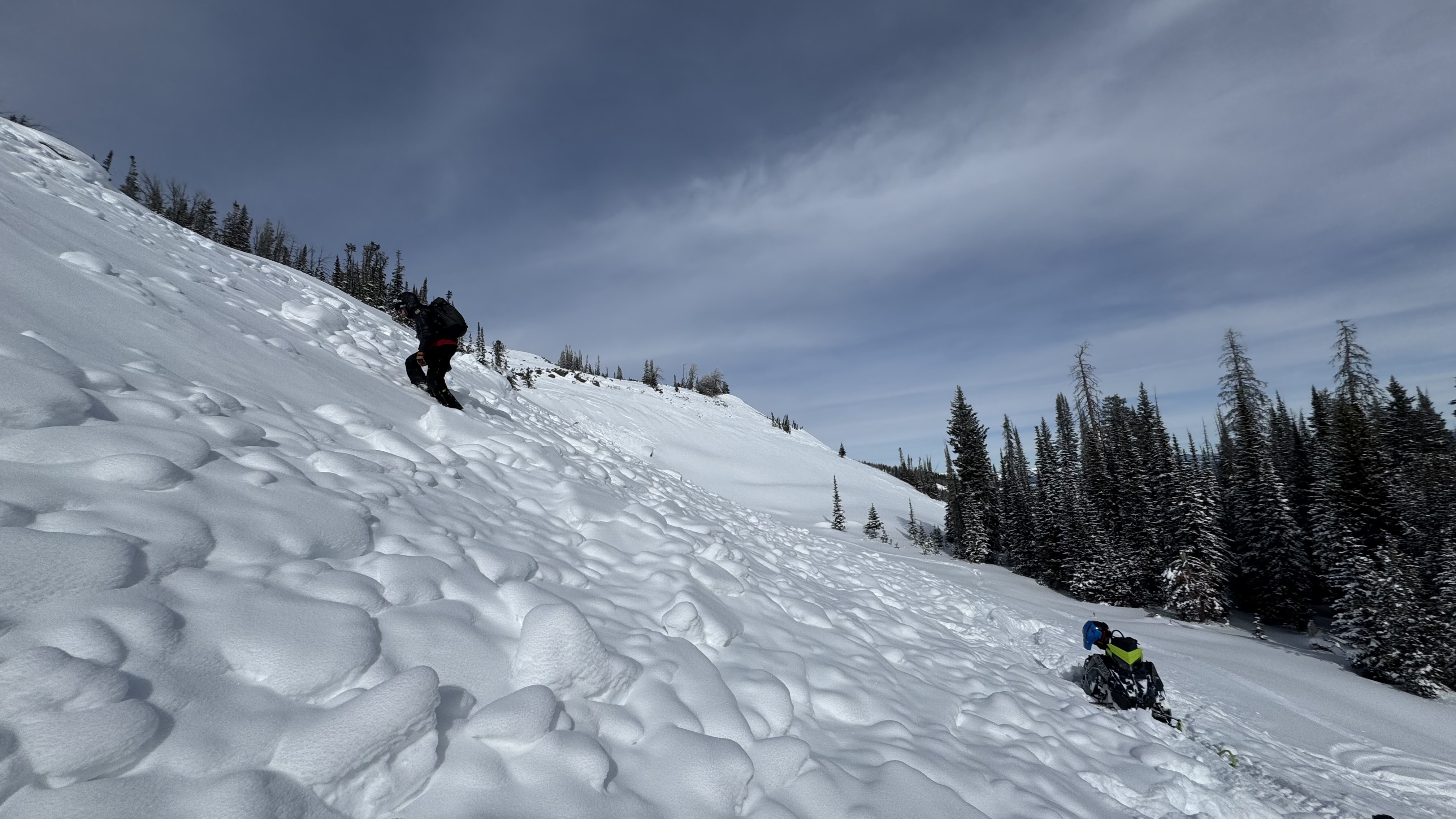
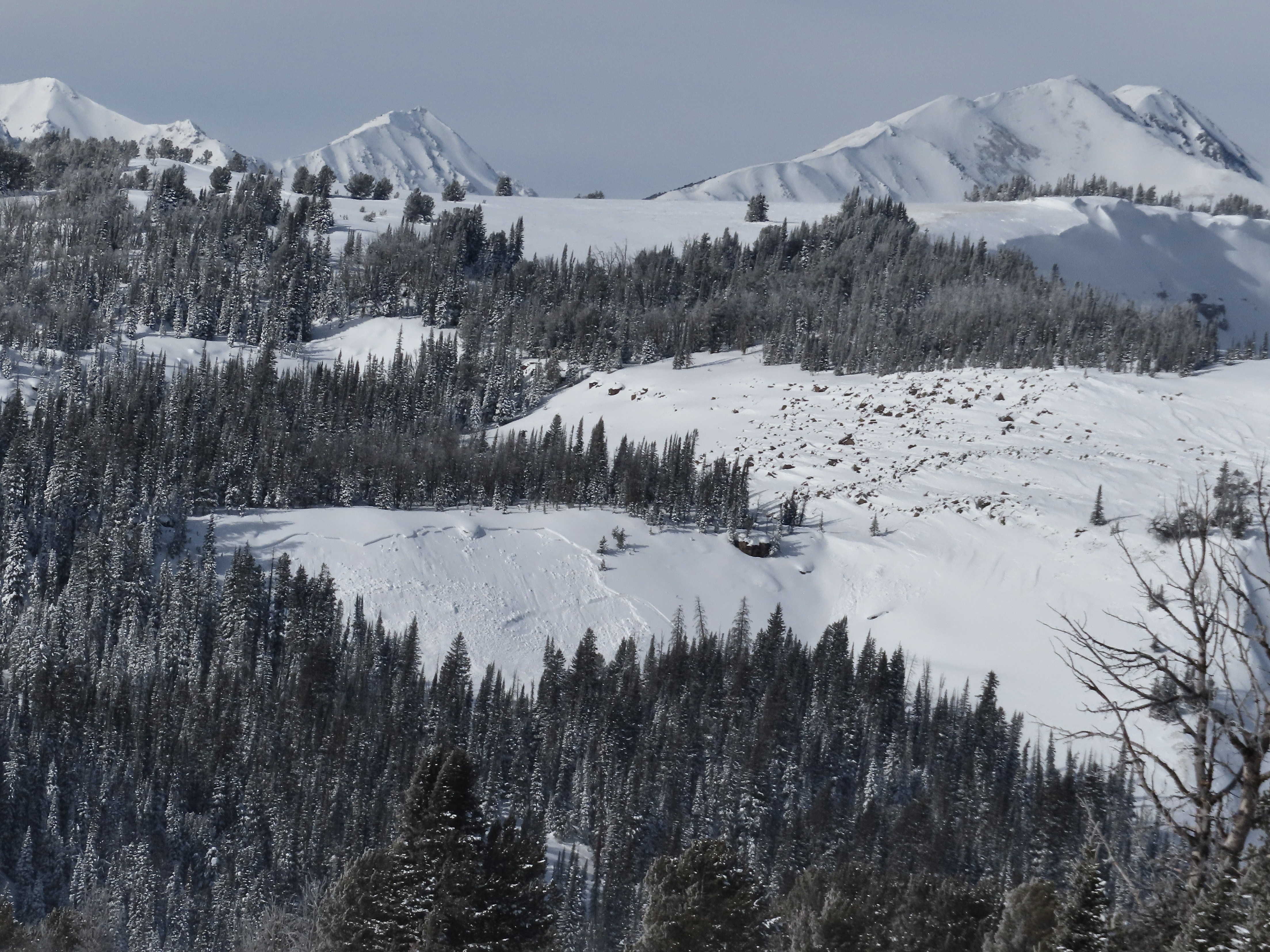
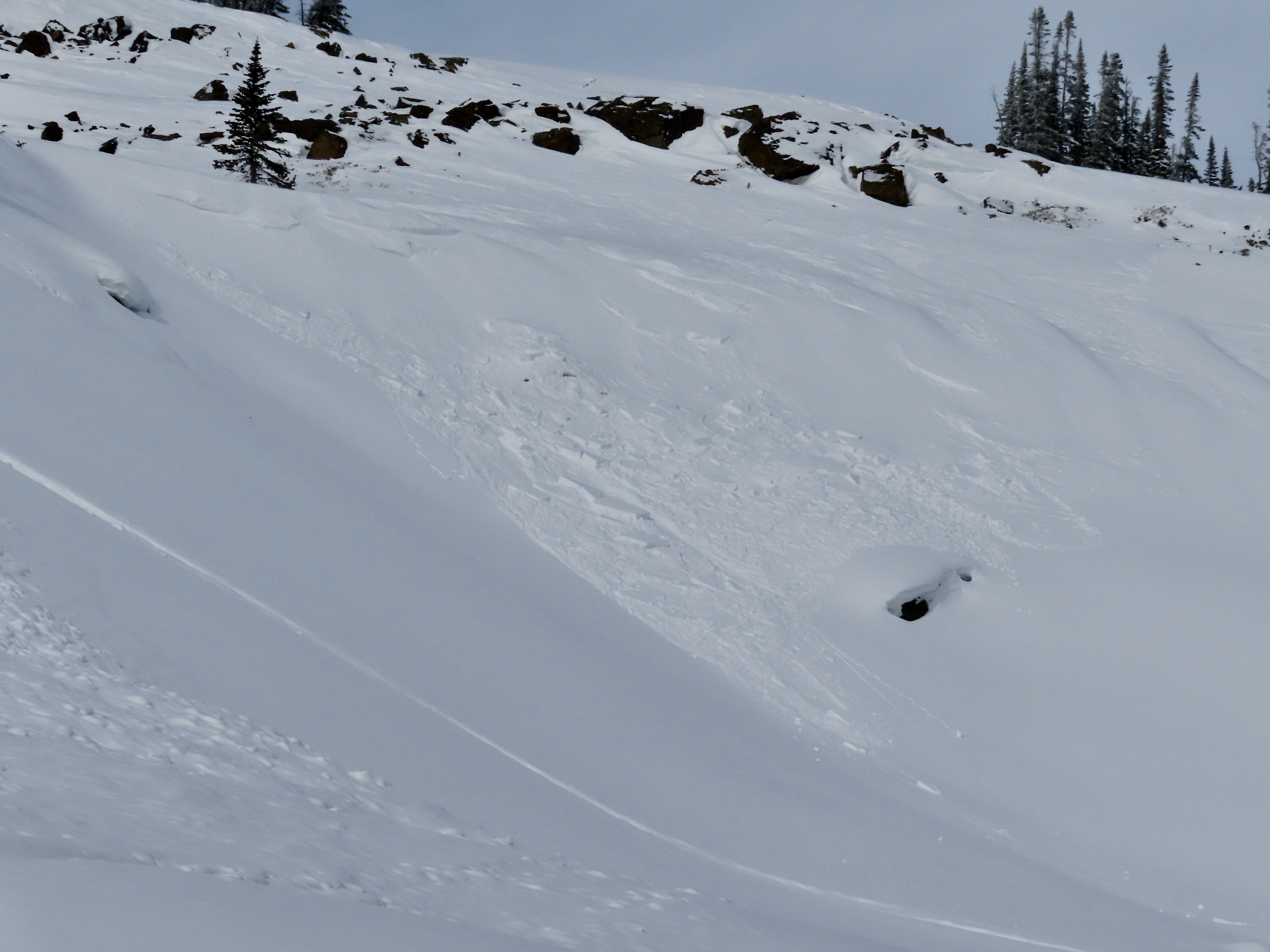
Full Snow Observation ReportWe rode into the Taylor Fork, down into the bottom of Sunlight Basin, across Carrot Basin and to the Wilderness Boundary. We saw four persistent slab avalanches that likely broke last weekend or at the beginning of the week. All appeared to be snowmobiler-triggered R1-2, D1.5-2 avalanches at broke of the January layer of near-surface facets and surface hoar. Additionally, we saw one wind slab avalanche (R1, D1) in Sunlight Basin. This slide was fresh from this morning or yesterday.
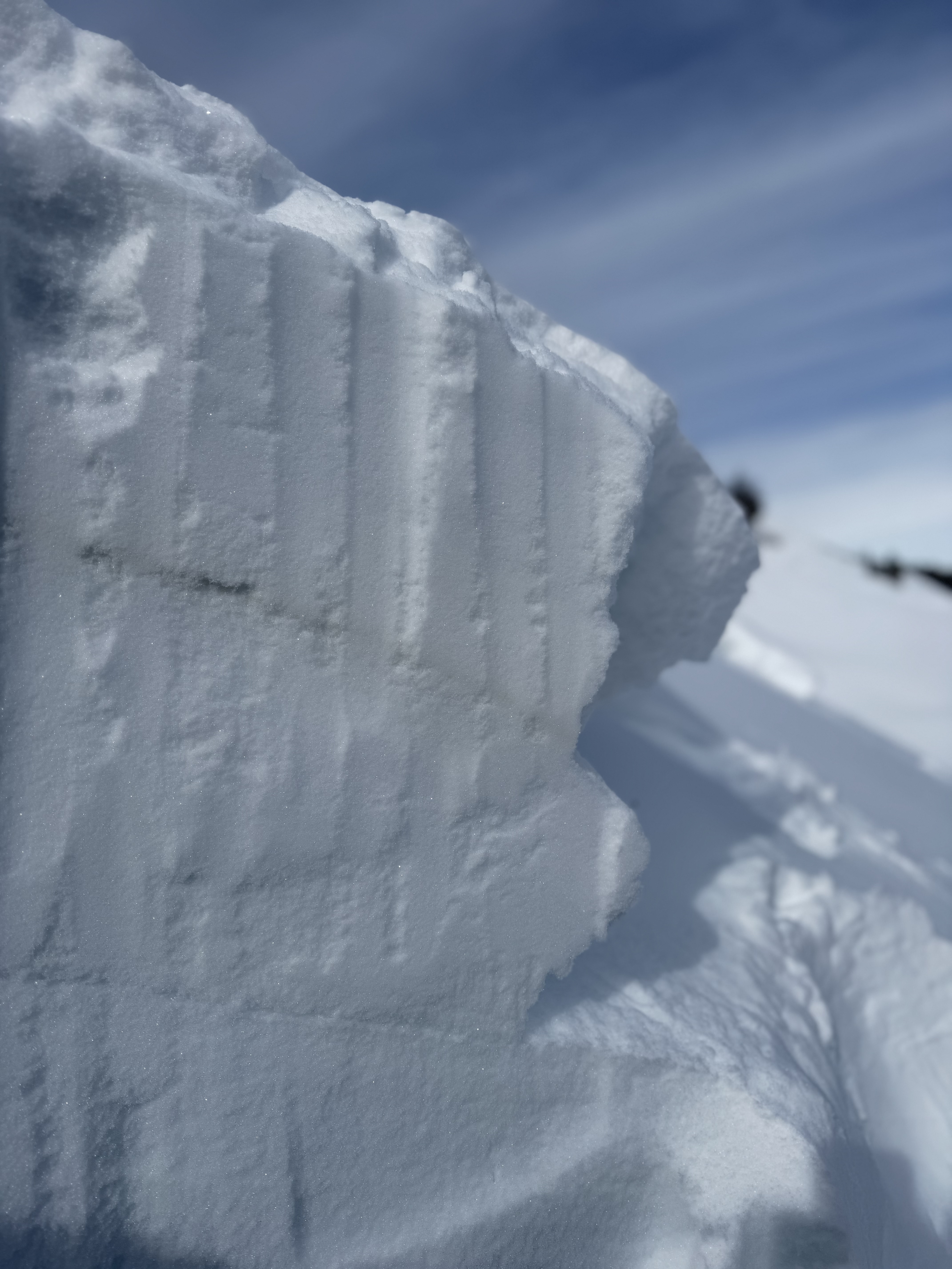
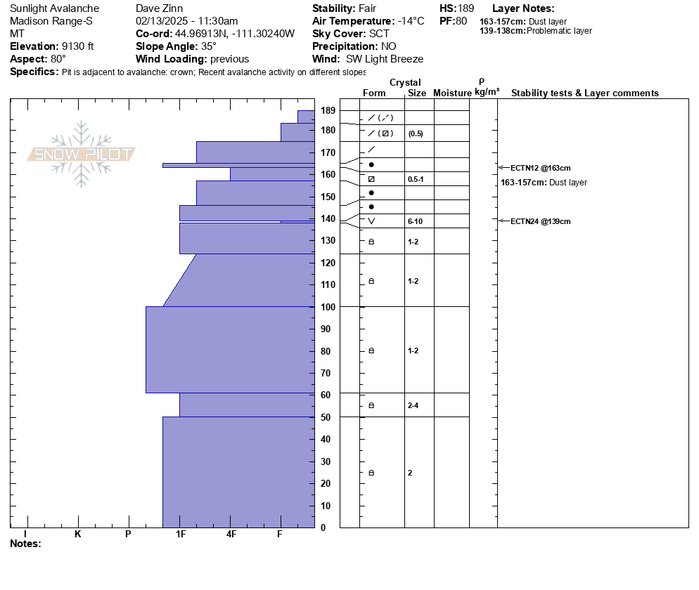
We dug a crown profile for the persistent slab avalanche in Sunlight (attached). ECTN24 on the SH layer buried 50 cm (20") deep.
We also dug above Carrot Basin on a northeast-facing slope: ECTP14 & ECTN15 on the NSF layer 50 cm deep.
Near the Wilderness Boundary on a southeast-facing slope: ECTX
Persistent slab avalanches still seem possible, but it they have reached an equilibrium on most slopes that feels like the bottom end of MODERATE danger. Wind slab avalanches are certainly possible with the fresh slide as evidence as well are shooting crack in a drift as we rode in. Outside of large terrain, these will not be that large.
New snow and increasing wind starting tonight will change the equation. The snowpack can take 0.5" of SWE without notching up the danger, but 0.75" with more coming would make human-triggered avalanches likely.
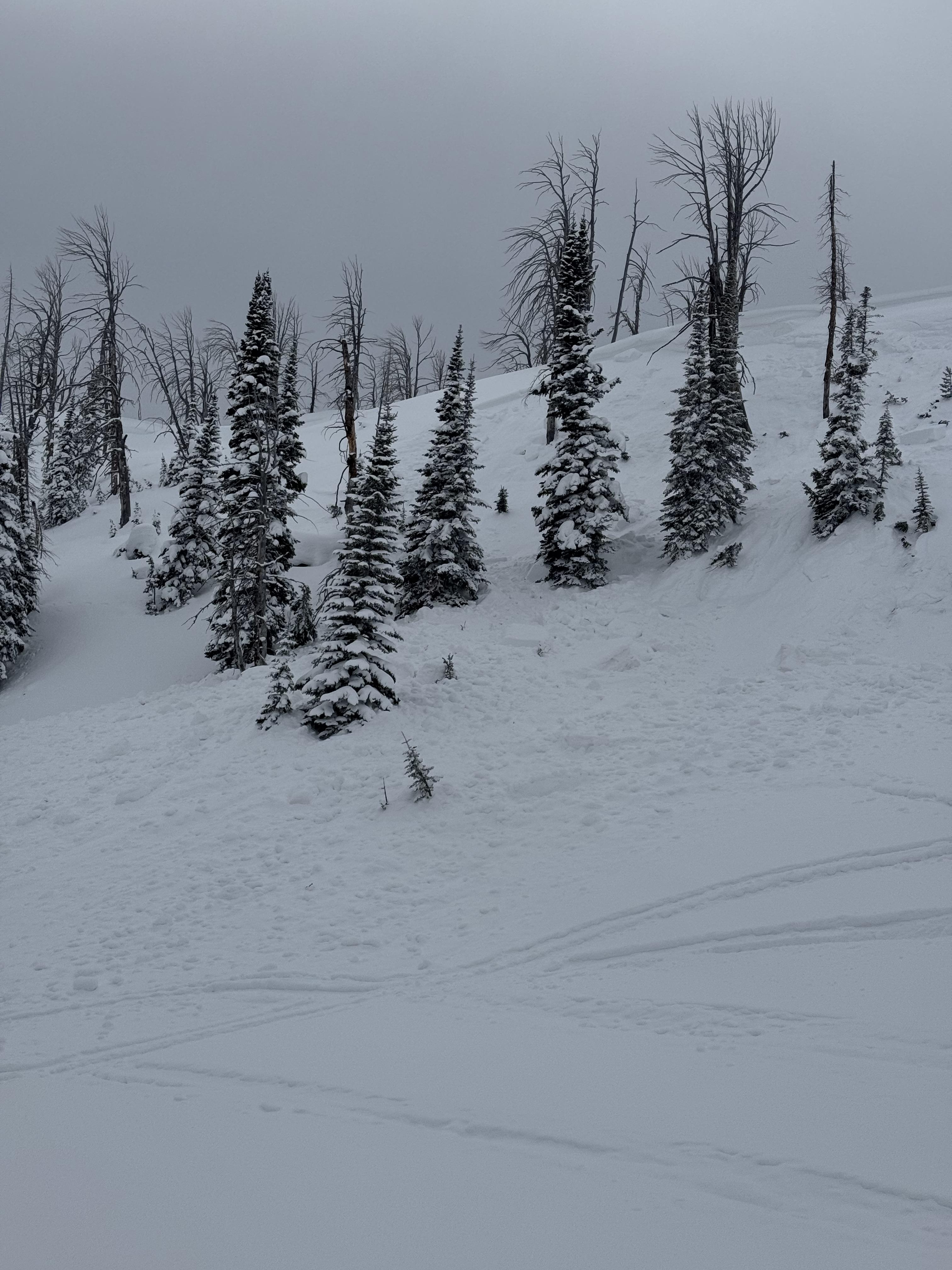
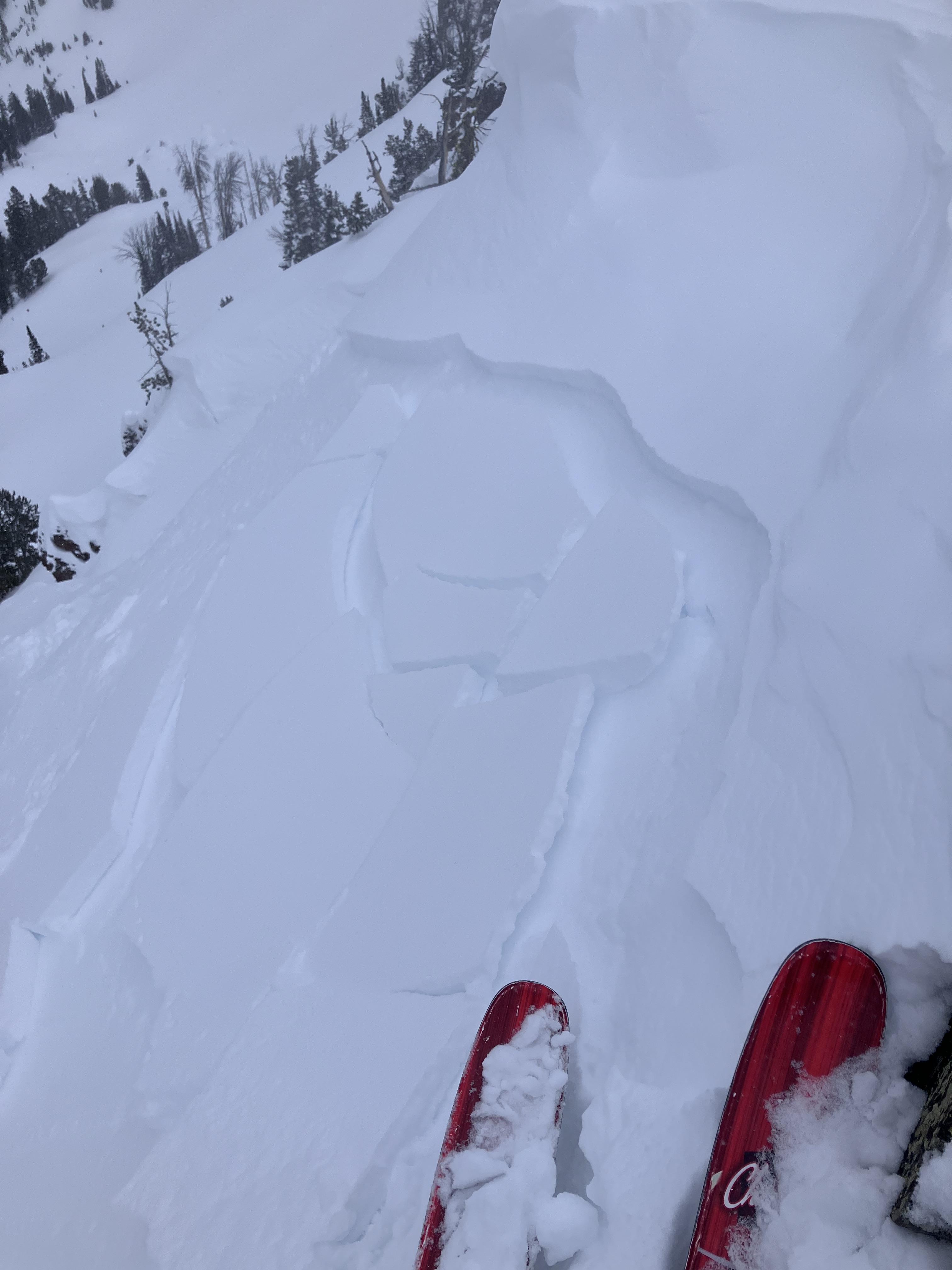
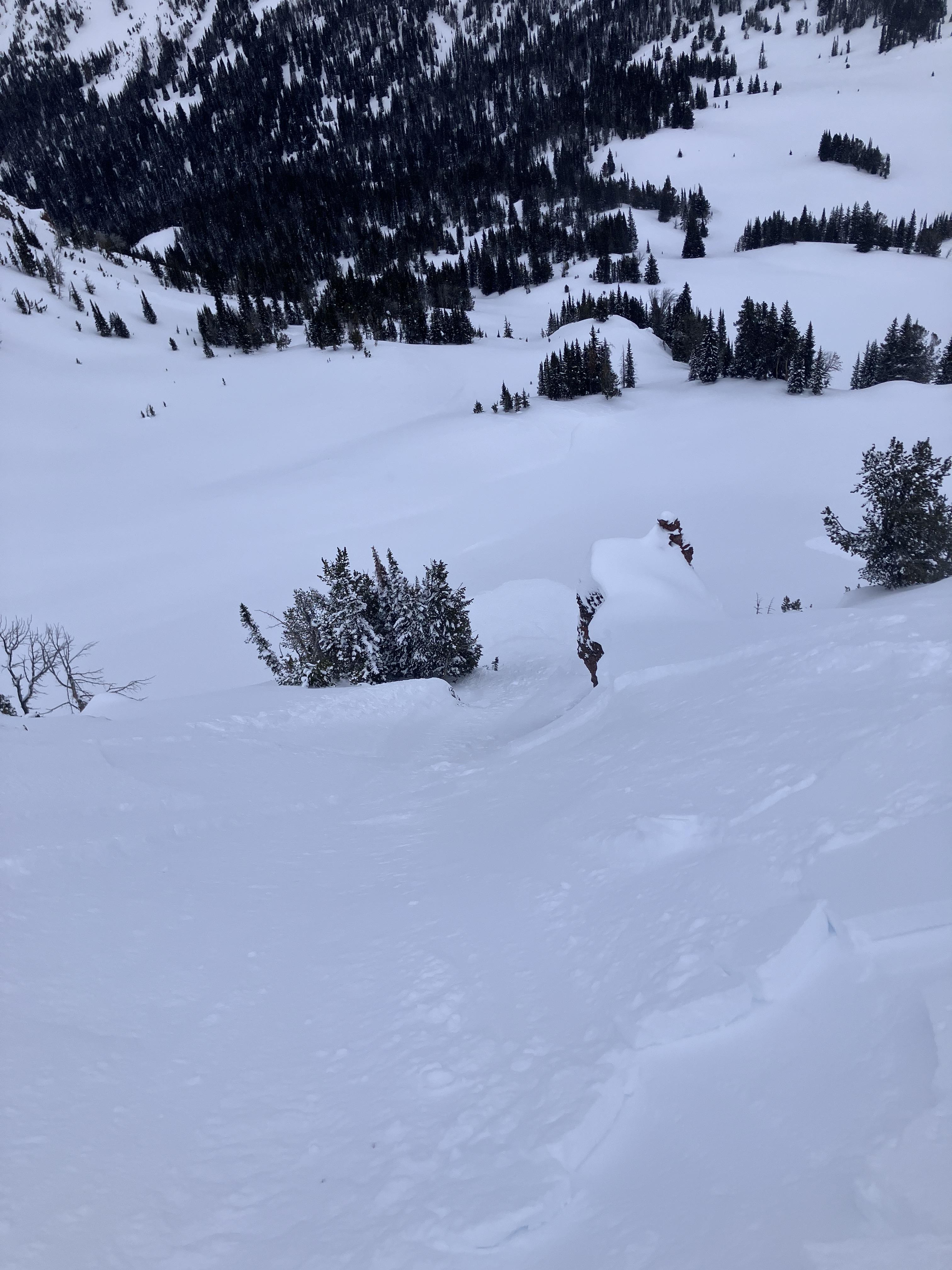
Full Snow Observation ReportTriggered a small wind slab avalanche on the east face of mt Blackmore today at 9850 ft elevation. Around 5 inches thick, ~ 20 ft wide, and ran for 100 ft. No skiers were caught but the slab was very reactive. We were assessing the snow as we climbed but skied a slightly more eastern aspect than we were planning and it was more reactive than expected. Strong winds gusting all day, no active transport observed but obvious that the wind slabs have not settled.
Full Snow Observation ReportClimbed in the Mummy II area in Hyalite today. West facing ~7,500'. Lots of spindrift coming down onto the climbs in the area and we noticed lots of snow blowing around up high. No snow fell while we were there but our trail in was almost fully filled in and covered with a few inches to a couple feet of wind slab on the way out. Saw a small natural slide that started at the bottom of Cyptorchid. Crown was 10' wide and 8-18" deep, it ran 150' down a very shallow slope and covered the climbers trail.
Full Snow Observation ReportClimbing at the Unnamed Wall in the vicinity of The Fat One, there are some 3"–8" wind slabs formed. At least three small pockets had released from 2" to 5" deep. Lots of spindrift and heavy winds filled in parts of our trail in a few minutes.
Full Snow Observation ReportOn a cold day we rode to Frazier Basin and quickly answered the question, “Are wind slab avalanches still possible or have they stabilized?” We saw a natural avalanche (R2, D1.5) that released on a steep headwall just to the south (I believe I’ve heard this referred to as October Bowl).
Wind has affected most of the snow above forested terrain in some fashion. While most soft snow has already been redistributed, some transport continued. We looked at skiing Thing Two but the wind slab problem and poor skiing quality deterred us. I did dig a pit with an ECTP11 breaking 5” down below the slab. Surfaces had hardened and I suspect terrain would have to be pretty steep for an avalanche to release (this type of steep terrain is abundant in Frazier).
We departed Frazier area without skiing and went to look at lower elevation terrain above the Carroll Creek Road. The wind had gotten to the snow here as well but no signs of instability and an ECTN15 18” deep. Triggering an avalanche outside of wind loaded terrain is unlikely.
Full Snow Observation ReportToured up around Blackmore and s cottonwood. Found an extremely reactive windslab in the afternoon. It was thin, but easily triggered and would propagate about the width of each terrain feature (20-50ft). Each slab ran the length of the slope (150-200 ft).
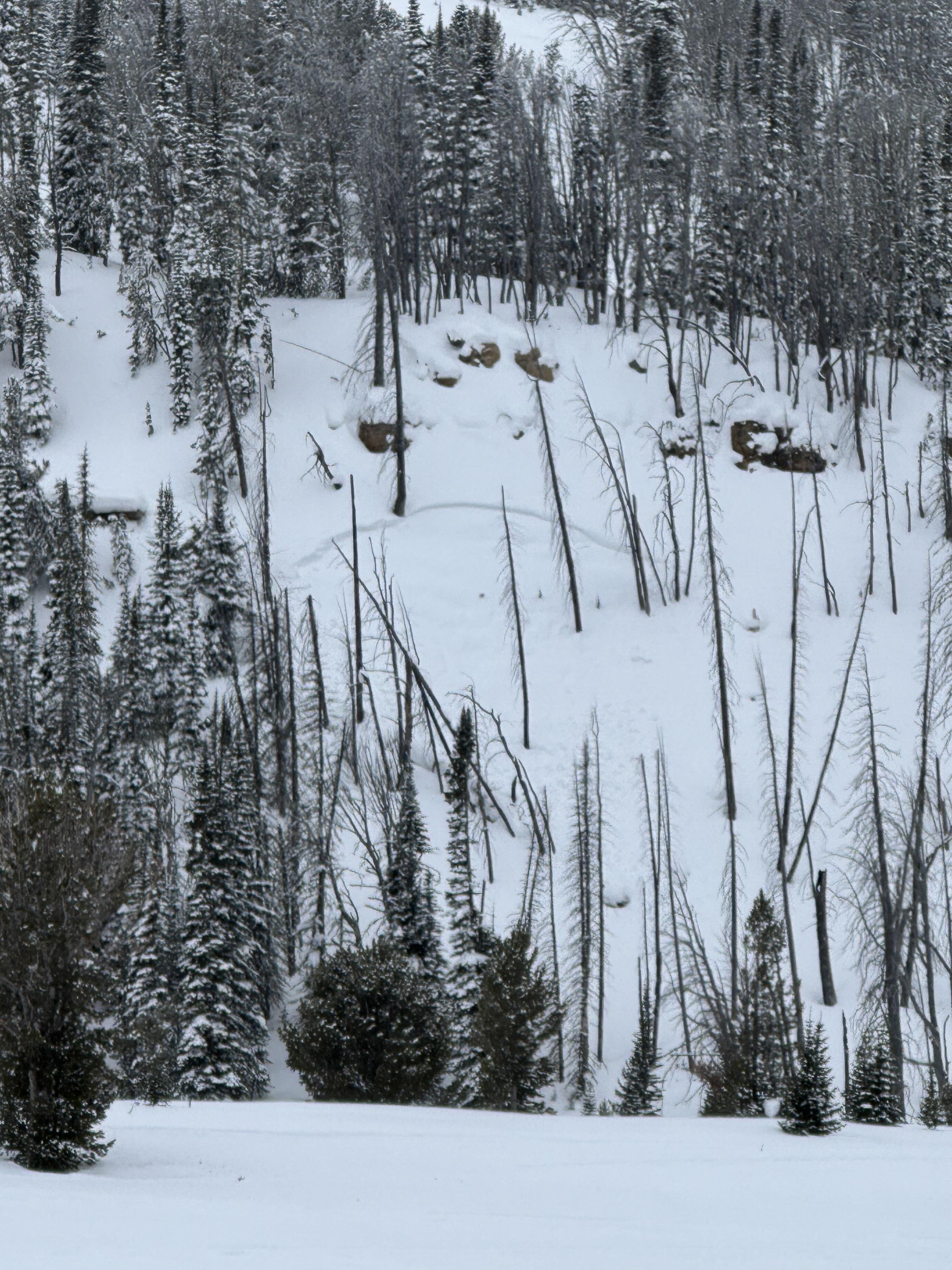
Full Snow Observation ReportFrom FB message: "Small slide in lower elevation back by lionshead"
Full Snow Observation ReportCold temps and sunny days starting to create some surface hoar forming seen on the primary ridge of big Ellis. Surface hoar was less widely distributed on the primary ski zone but was present all along the top of the ridge.
Full Snow Observation ReportExplored slopes in lower Hyalite Canyon between 6000-7000 ft in elevation. Really close to being skiable and good. Otherwise, we found snow depths ranging from 6 inches to 2 feet. Generally very weak and faceted with thick crusts on slopes with a southerly tilt. All this weak snow probably won't be an issue because this area only gets the scraps from storms and never has enough loading to make an avalanche problem.
Full Snow Observation ReportDug a pit and did an ECT near the NE entrance to Yellowstone. I dug at 9500ft, W aspect, on a 29 degree slope. HS 275cm. I got an ECTP12 55cm down, right above the obvious layer of dirt. Moderate winds from the west.
Full Snow Observation ReportModerate winds today north of Cooke City. Stronger winds than forecasted and lots of snow is being transported. Couple hand pits showed planar breaks on a crust on SW aspect around 9600 ft.
Full Snow Observation ReportWent into the beehive area today to do a bigger jaunt into the alpine and make it around the basins. Dug at 9200’ on an E aspect on the Beehive/Middle ridge and ripped two ECTs. First test result was ECTN12 on the dust layer. Second test yielded an ECTX. We went ahead with our plan to ski some fairly steep terrain throughout the basins, taking it slow, and making surface and visual observations throughout our day confirming our plan. Most of the surface snow was minimally wind affected and skied great. We saw only small sluffs on anything we could see (no slab avalanches). There was some small shooting cracks while setting skinners, but nothing especially concerning. There was evidence of a stubborn older wind slab underneath the newest snow on one of our lines. Overall, great day!
Full Snow Observation ReportI toured Big Creek today in the southern Paradise Valley, taking Donahue Creek trail up off of Big Creek to ski the low angle meadows above. The west face of the first meadow was fairly wind loaded and approximately 80cm deep.
The snowpack appeared to be approximately 20cm of soft powder over 30cm of a wind slab, all sitting on top of another 30cm of fairly loose, course, facets.
I conducted a compression test, and had a failure at 17 taps where the wind slab collapsed on the loose snow below. I did an extended column next, and recorded a score of ECT16P, with the failure propagating below the top layer of powder within the slab on the facets.
Prior to filling in the pits, I jumped on my skis approximately 4 feet upslope of them, and the second jump caused the snowpack on the back of the pit to collapse when the slab slid.
Went skiing south of Cooke City today near Hayden Creek. No avalanches seen and no signs of instability. Cold temps and light winds from the NW and W all day.
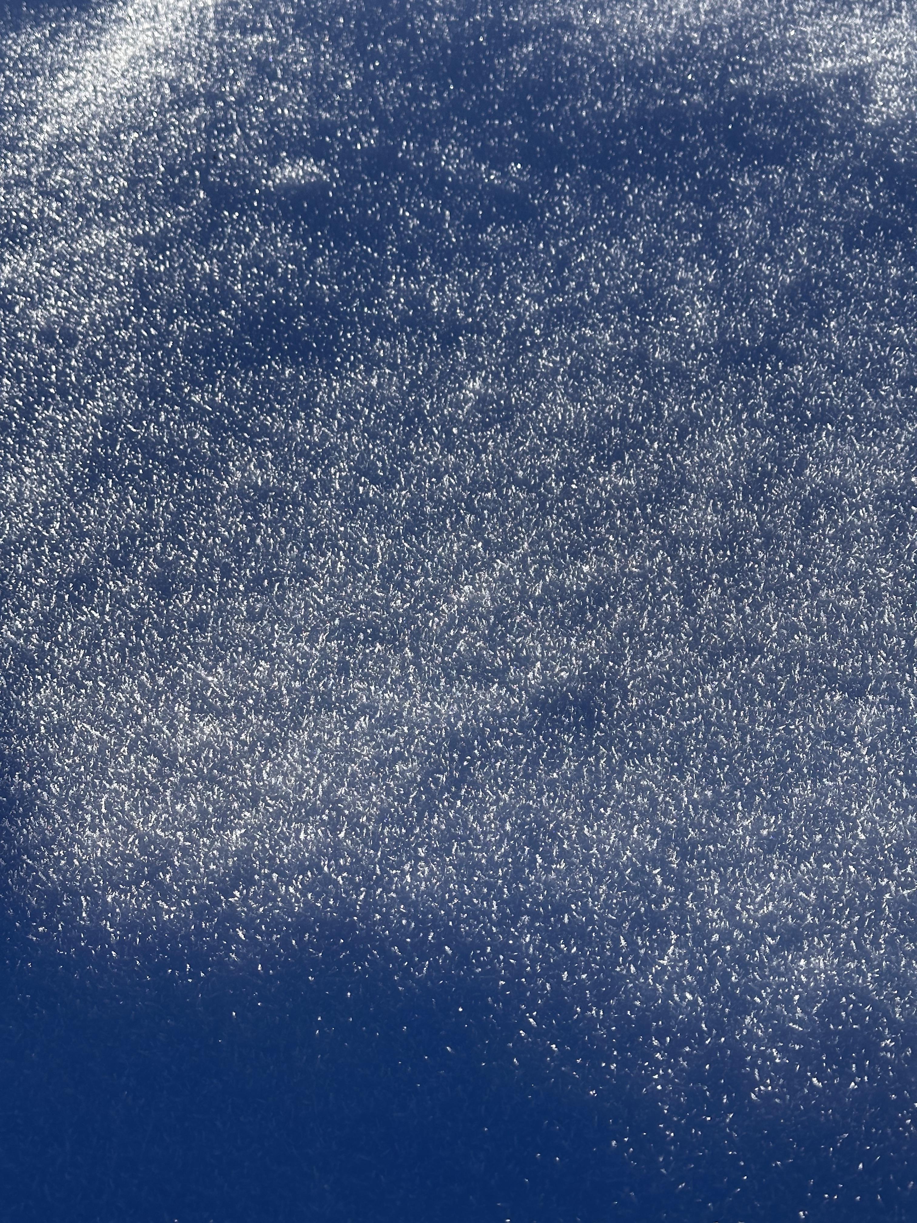
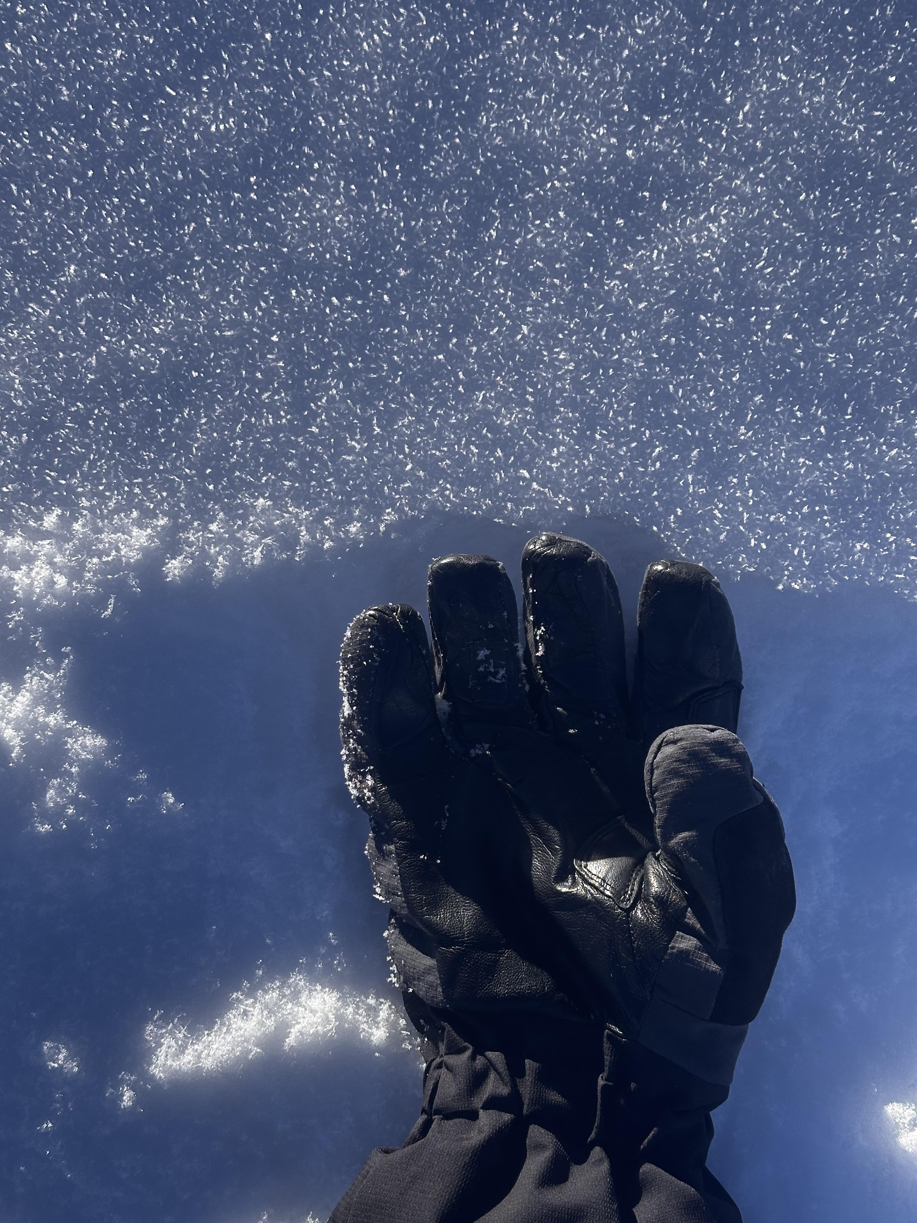
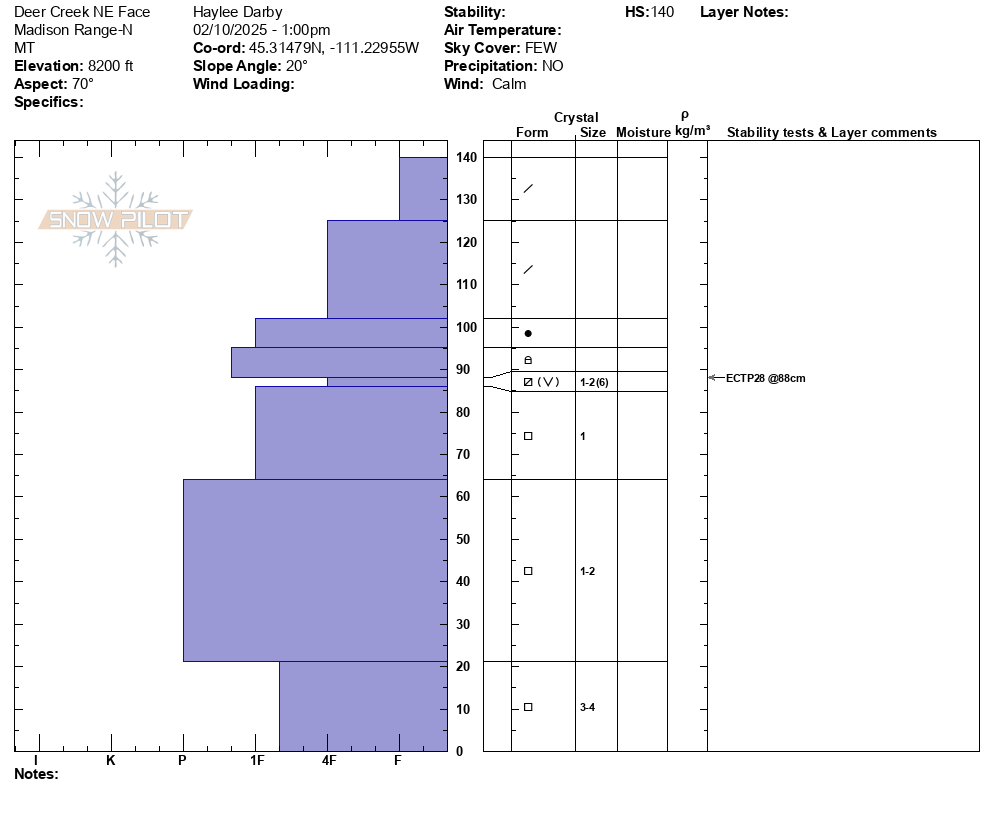
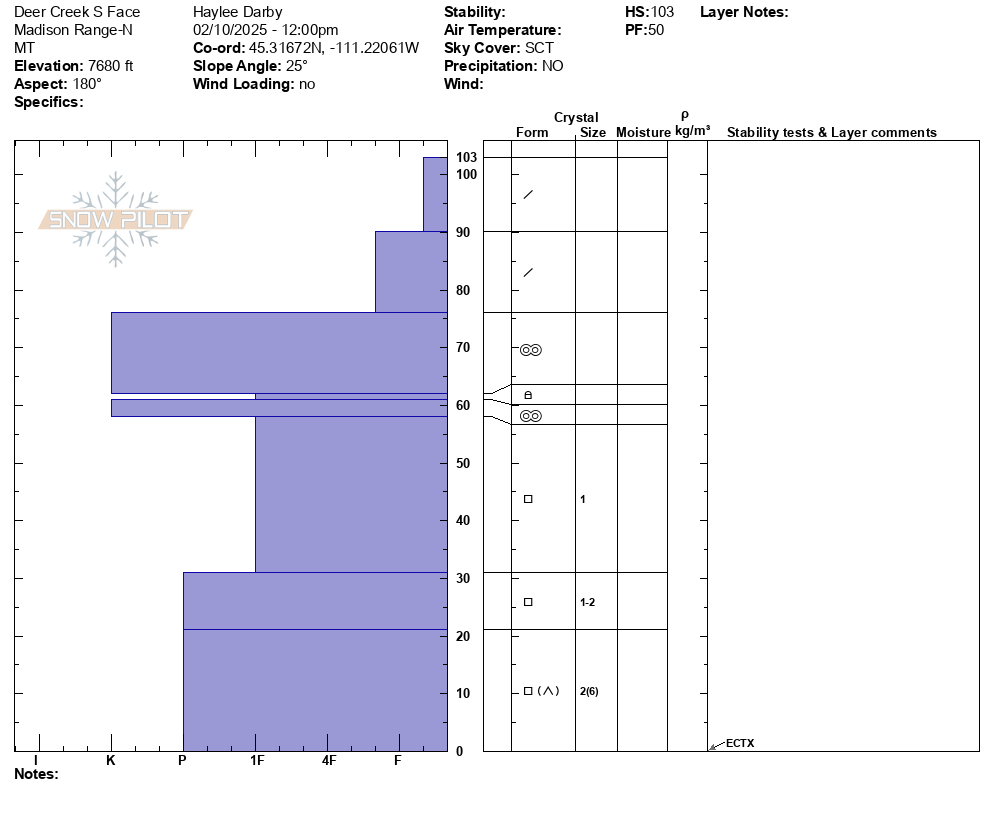
Full Snow Observation ReportToday, we traveled up the Deer Creek drainage north of Big Sky. We experienced no cracking or collapsing and saw no recent avalanches. We dug in the snow on a S aspect at 7680' with unremarkable results. We dug again on a NE aspect at 8200' and got an unstable test result (ECTP 28) on surface hoar and near-surface facets buried under a 2' slab (F - 1F+ hardness).
A few keys points from today:
- Mid to Low-elevation snow exists in many areas that typically do not hold rideable snow during the winter. These zones are typically much shallower and weaker. Avalanche terrain exists at mid to low-elevations too. Assume a shallow, weak snowpack in these areas and easily confirm by digging down to see what is going on underneath your feet.
- Persistent weak layers are still present and are reactive in snowpits. Surface hoar and near-surface facets exist around 2' deep in the snowpack. These layers do not exist on every slope and were stubborn in snowpit tests, but there is still a possibility of triggering an avalanche within this layer.
- Wind loaded terrain grows less sensitive by the day but is still where the likelihood of finding the most unstable snow is the highest.
There are a lot of abnormal, mid to lower-elevation zones out there holding great snow and riding conditions - just remember that there are still terrain and snowpack features to be on the lookout for and avoided. Step off the skin track, look out for signs of red flags and dig down to see what is going on beneath your feet before committing to ascending or descending steep slopes.
Full Snow Observation Report
From FB message: "Two snowmobiler triggered avalanches in Southern Madison. Riders did not have beacons or rescue equipment. Riders made it out safe luckily."
Full Snow Observation ReportWe saw this today after it happened. Looked like a snowmobile triggered it. I believe it is mostly south facing. Thanks.
Full Snow Observation ReportPleasantly surprised with what we found at Lionhead. Snow depths are 120-150 cm (4-5 ft)
Good visibility let us look at a huge area today and dig snow pits in 6 places mostly looking at the mid to late January near surface facets. They are generally buried ~2 feet deep.
Locations, test scores, and hardness for this layer:
- E aspect at 8700' ECTN, Fist hard
- NE aspect at 8900' ECTP25, 4F hard
- NW aspect at 9000' ECTP18, 4F hard
- N aspect at 9000' ECTN, 4F hard
- S aspect at 9000' nsf's have frozen perc columns over 10cm tall through the layer
- E aspect at 9200' ECTX, 4F hard
We saw two recent shallow wind slab avalanches. No recent slides breaking deeper. The extra loading from wind could make this nsf layer more likely to fracture and produce an avalanche. Otherwise, it seems to be losing its sensitivity and will only improve this week with minimal loading.
Weak snow deeper in the snowpack has gained hardness and I doubt it will make avalanches unless it gets a massive load very quickly.
Snow conditions are 5-star
Full Snow Observation ReportDanger feels like it's quickly becoming MOD barring any more snow and wind. I don't think that any snow flurries this week will raise the danger.
My suspicion is that the heat around Tuesday Feb 4th helped a lot. People reported wet mashed potato snow then.

