Snow Observations List
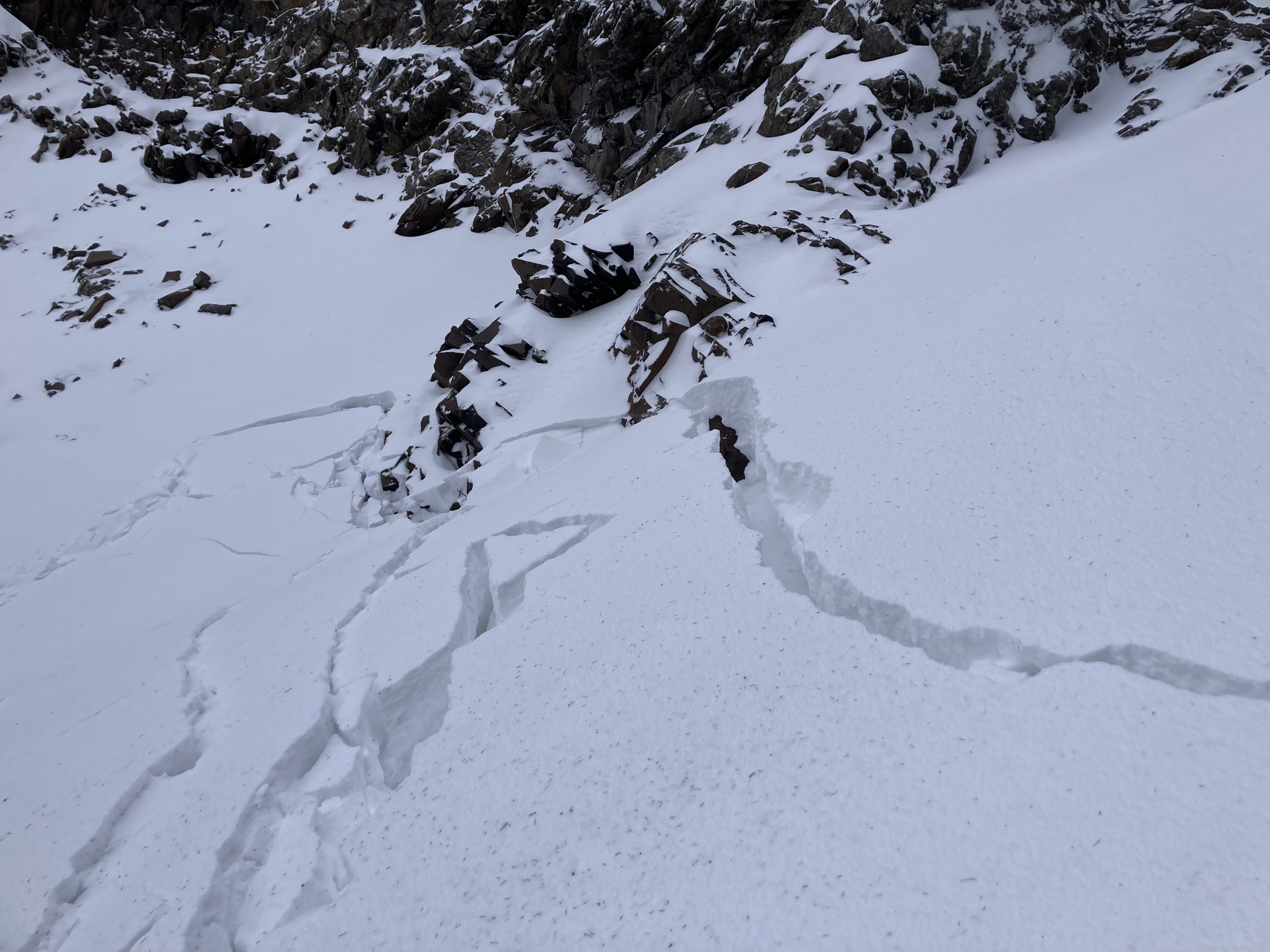
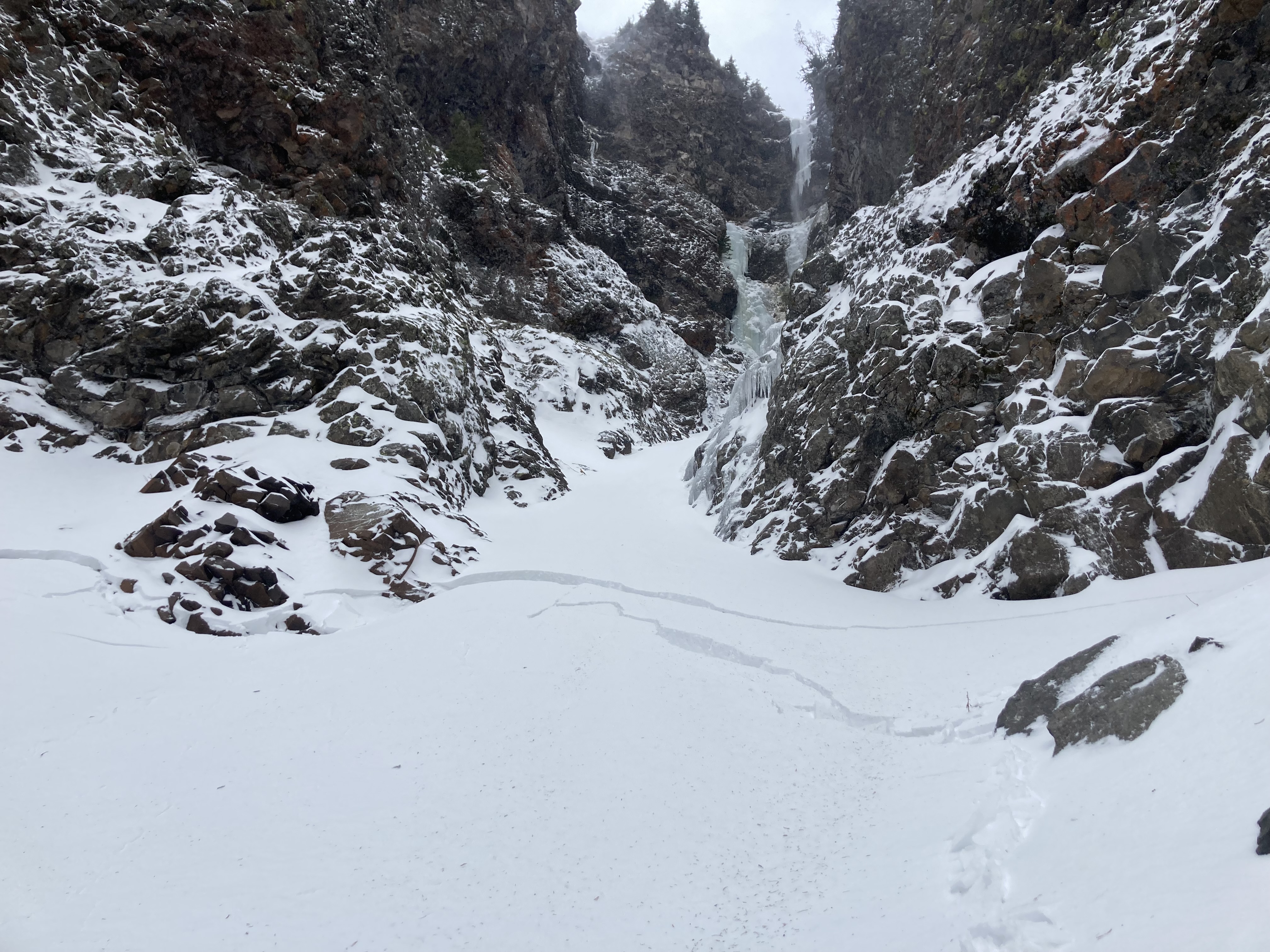
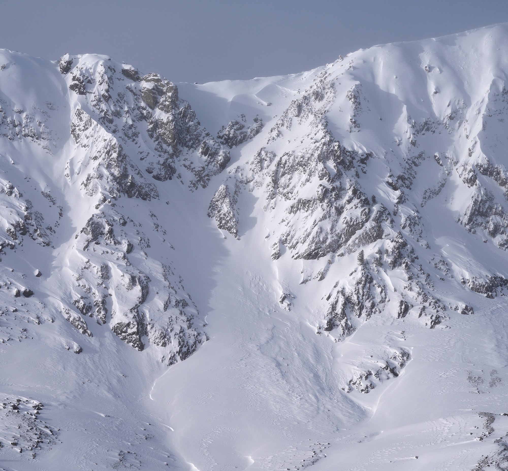
Climb above Dribbles today. No surprise but where yesterday/last nights new snow has been drifted onto old snow, there is a wind slab problem. We found this combo in gullys above 8000 ft, slab depths to 50 cm, interface is 1-2mm FC. There are also graupel layers within the new snow that were reactive but less concern about those. We experienced numerous collapses and triggered a size 1 pocket that moved 6 in downhill. Just needs a steeper slope angle or a bit more slab and things will get interesting.
Big picture with all the kooks coming to town for icefest it’s kind of funky conditions up there right now, lots of bare ice/rock making for a fall hazard in many places we normally don’t, and poor structure in the gullys, especially higher up. You can go from bare rock/ice to 1.5 m snow in just a couple steps. With continued wind and/or precip things could get active.
Full Snow Observation Report
I skied the E. facing meadows above the Erma Mine. 15 -20 cm new snow in meadows.
Cloudy and cool teens F. calm.
Good skinning/skiing on supportable m/f crust below new snow. This layer was quite reactive with cracking/sliding on steep side gully features.
Full Snow Observation ReportUser comment on FB: "Lotta slides in black canyon island park."
Full Snow Observation ReportFrom IG: “Skied in the lions head today on a northeast slope at 8,300 feet. Clear wind loading and reactive cornices, however storm snow was low energy with little movement. 10-14 inches of medium density snow. Whumpfing was noticed on all slopes on the eastern half of the compass.”
Full Snow Observation Report
Skied around Mt. Henderson today. Was finding around 28-35 cm of new snow at 9k'. Perhaps 10cms in town. Light density. Minor wind effect. Partly cloudy morning, turning mostly cloudy. Cold temps. Calm to light winds where I was, but lots of snow was being transported off the exposed ridgelines south of town. Quite a bit of cracking of the new snow this morning while breaking trail and while skiing, even though the wind effect was still Fist hardness. A couple of collapses noted as well in the deeper drifts.
Full Snow Observation Report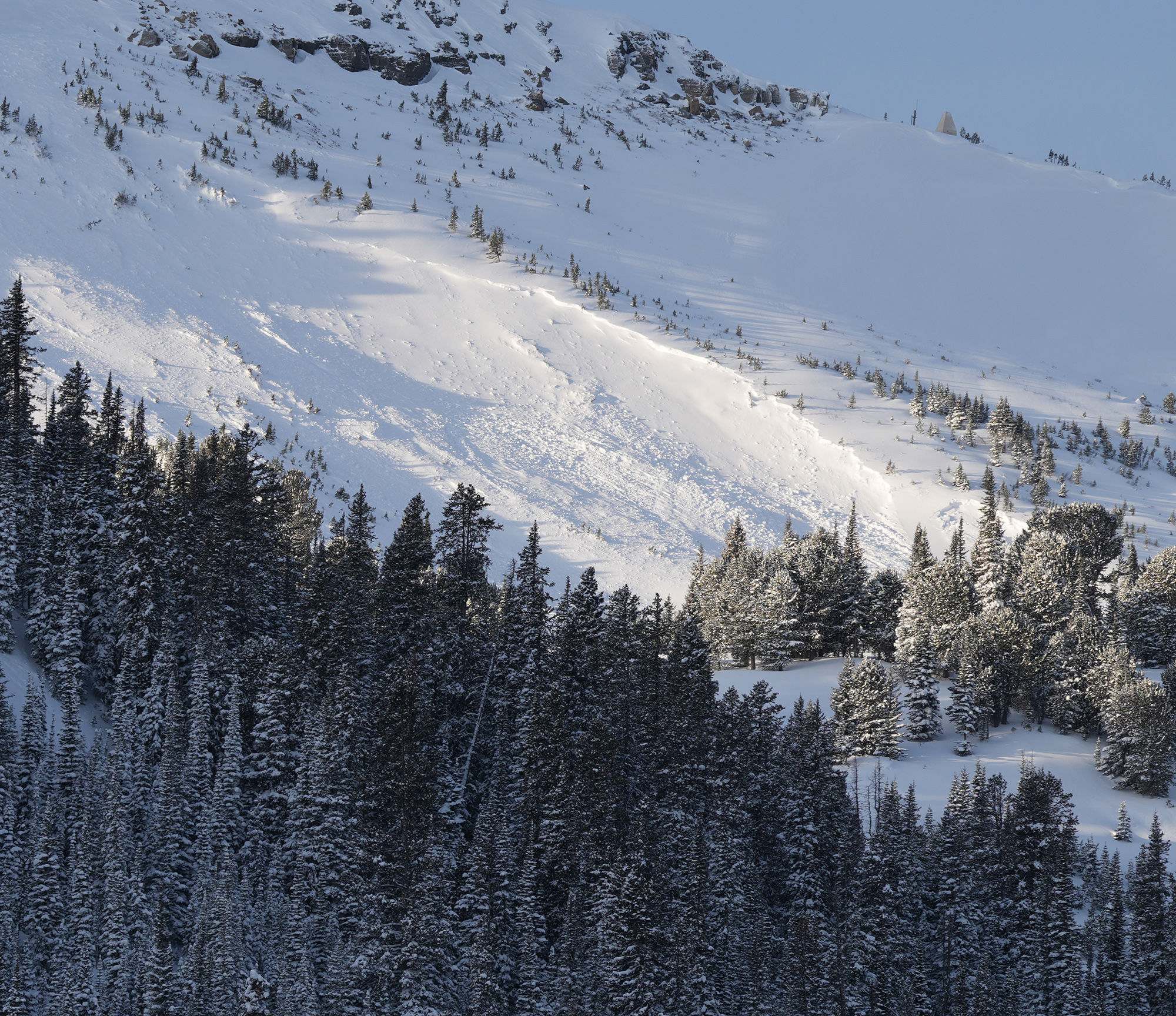
Was splitboarding up near lions head ridge today. Made some bad decisions and kicked off a good slide in a NE facing chute. Was with 2 buddies, 1 of which skied the line 3 weeks ago. Underneath about a foot of new powder snow there was a firm crust that seemed like it was old hard windslab in the gut of the chute, and I think a sun crust on the riders left side(East aspect). We had 2 spots where we were planning to re group at, first was a small cubby area right before a slight rollover about 75 ft from the top. I dropped first, made some turns down toward the pulloff, as I pulled in, I triggered a good size slab that propagated maybe 40-50 ft across, at the rollover as I carved into the pulloff. Pulled all snow out of the chute down to the ground. Seemed to have failed on sugary facets on ground/ice crust close to the ground...
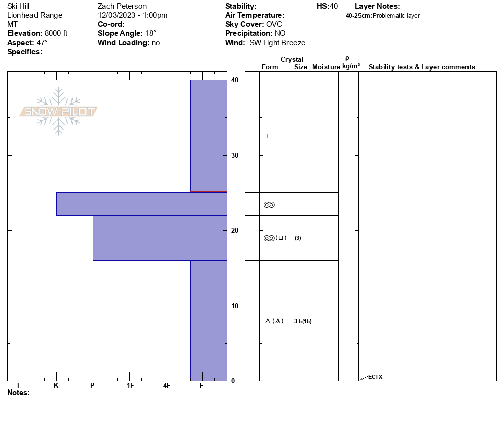
Full Snow Observation ReportWe rode to Ski Hill and dug on a NE aspect at 8000'. The HS was 40 cm with the top 15 cm being from yesterday's storm. This soft new snow was sitting on a thick supportable crust, and below that crust was weak-faceted snow. Stability tests showed no results, ECTX. From here we transitioned to skis and began walking towards the Lionhead Ridge. As we increased in elevation the amount of new snow increased and we experienced small whumpfs and cracking as we approached the ridge. Below the ridge, we dug on a NE aspect at 8700'. The HS was 56 cm and there was 22 cm of new and wind-drifted snow on top of similar layering. We got an ECTP1 at the interface between the new snow and weak snow just above the crust. We saw no recent avalanche activity but another party reported seeing a small avalanche further along the ridge.
Full Snow Observation Report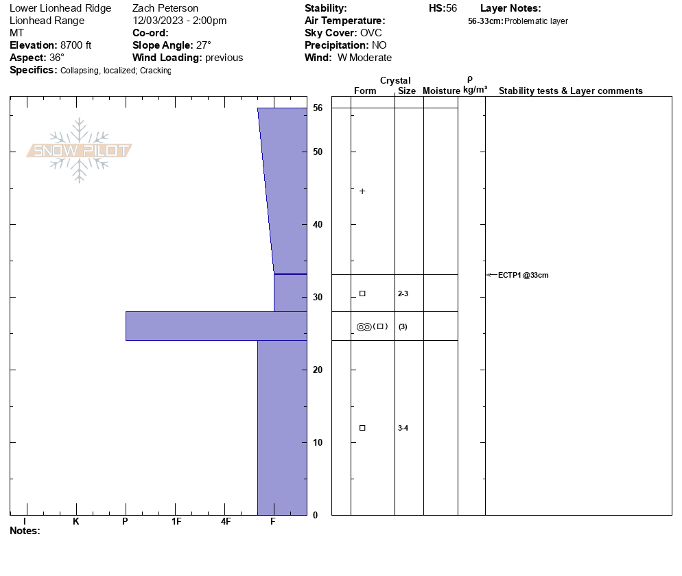

Skinned above alpine lift (just beyond the beacon checker) to get an idea for snowpack depth/ layers. A quick dig revealed a shallow, faceted snowpack!
Full Snow Observation Report
Shooting cracks on the apron. Shallow and firm but reactive windslab breaking on the faceted layer bellow it. About 10cm of new snow sitting atop the windslab as of this afternoon.
Full Snow Observation Report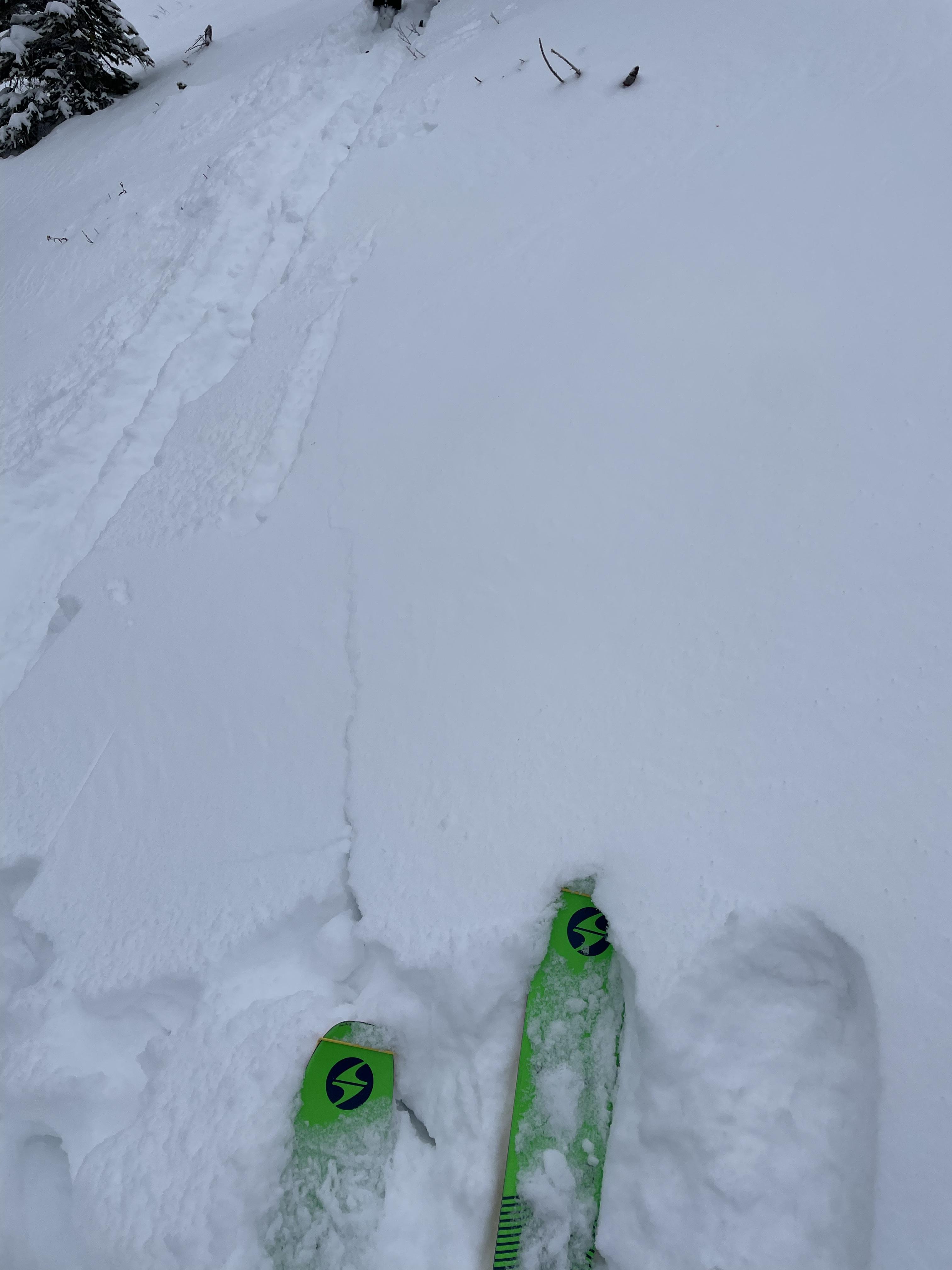
At 9,000 feet there was about an inch of new snow. It was calm at first light, but by mid morning winds were gusty and blowing straight down the gullies. It stripped what little snow there was and did not create an avalanche hazard. However, the 6+" in the gullies are all faceted, and with even a thin wind-load it was easy to get cracking. With snowfall predicted for the next 48 hours and again later this week, we'll need to be on the lookout for pockets or gullies of wind blown snow.
Full Snow Observation Report
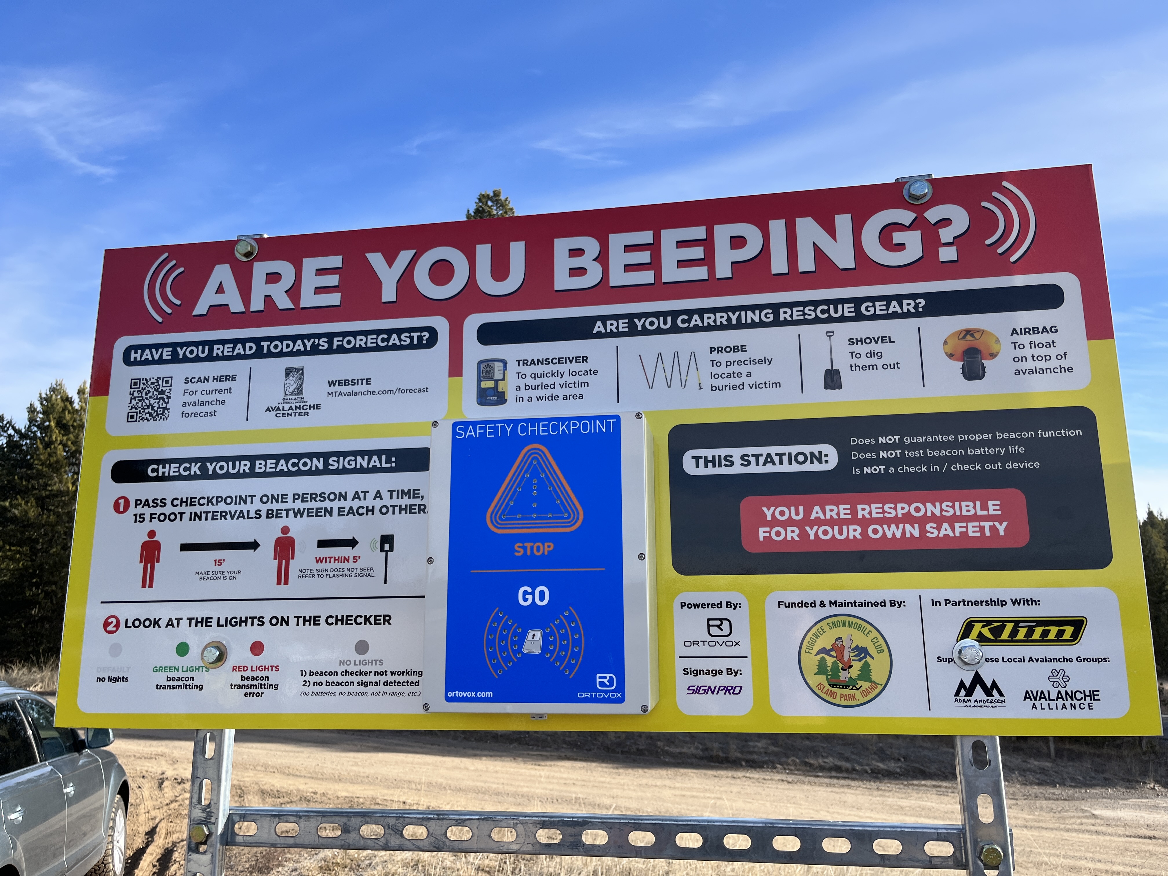
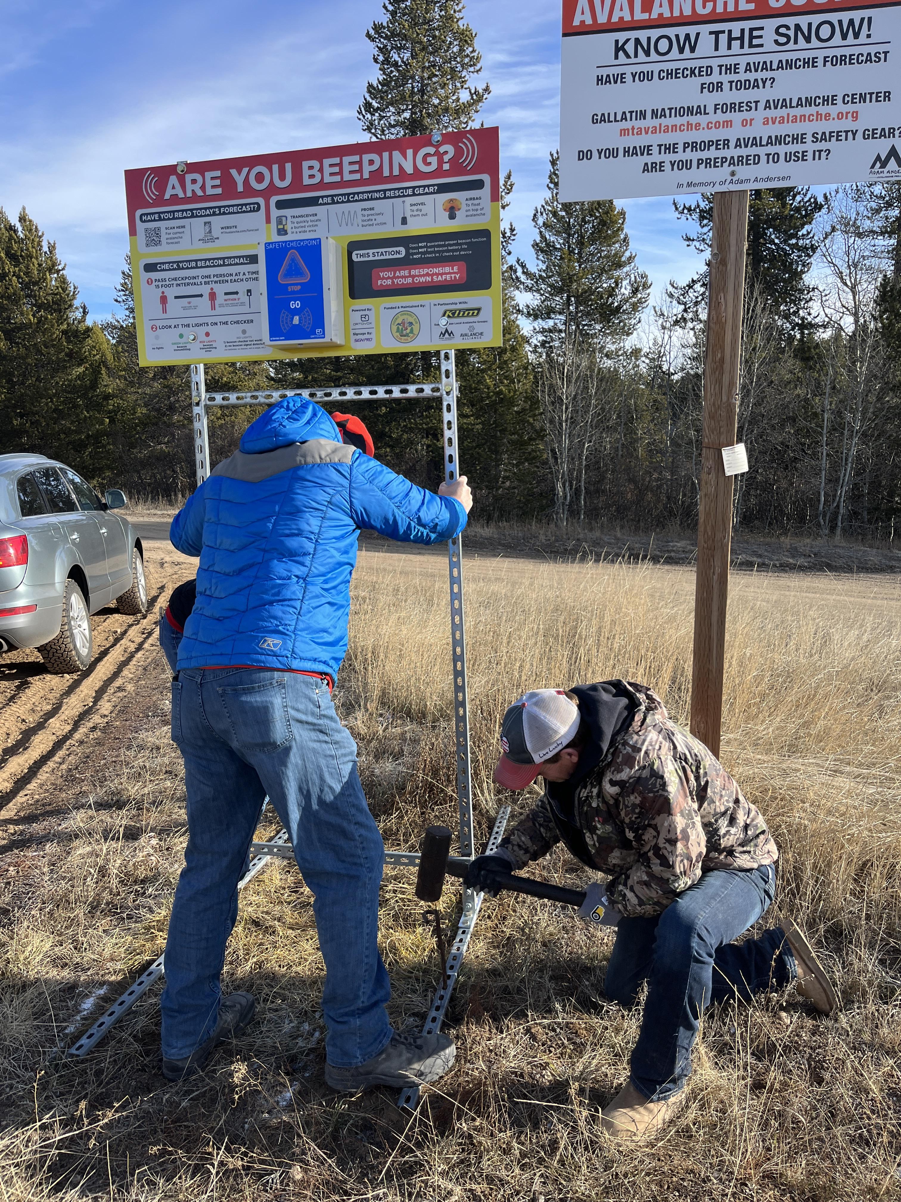
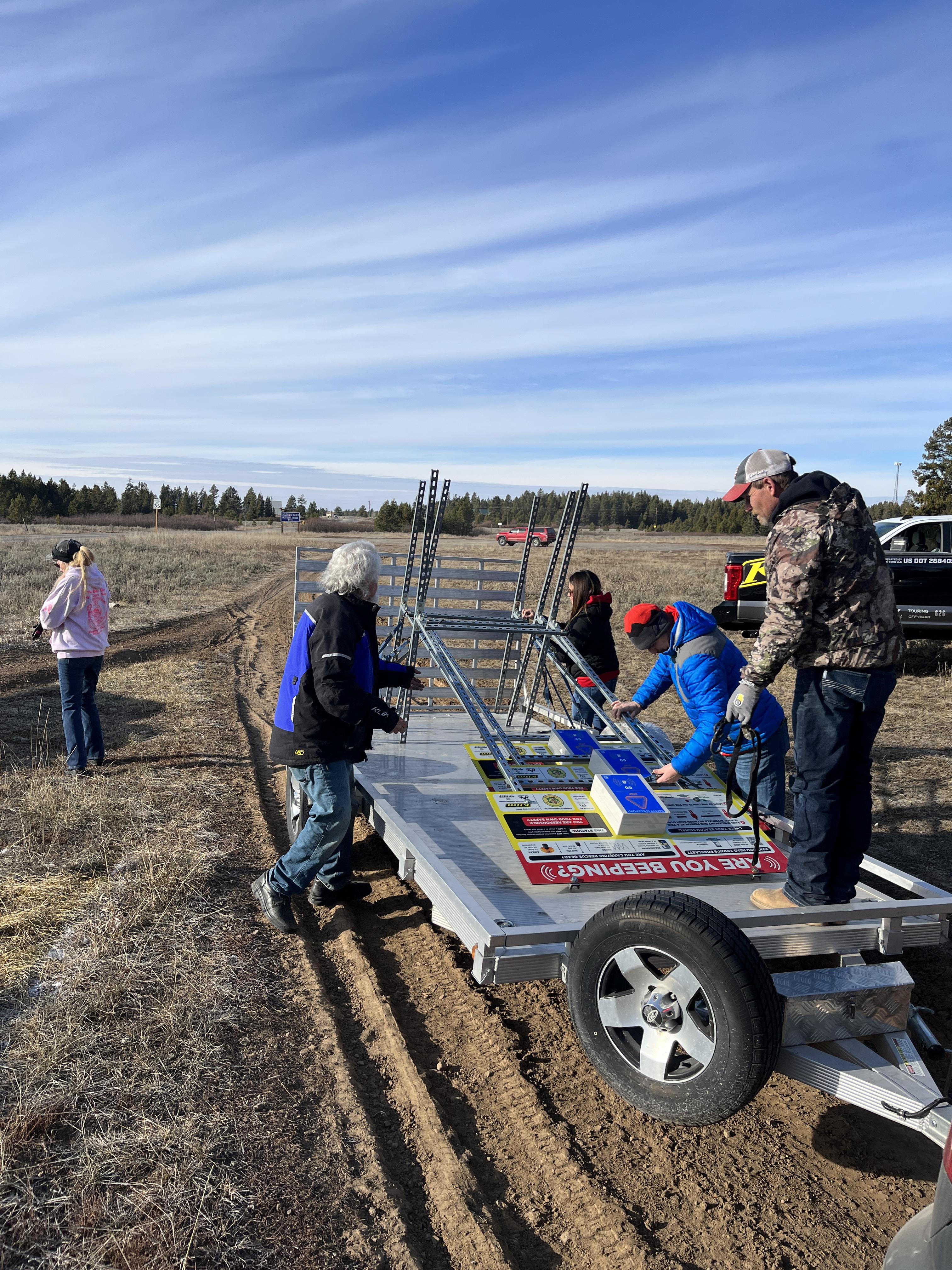
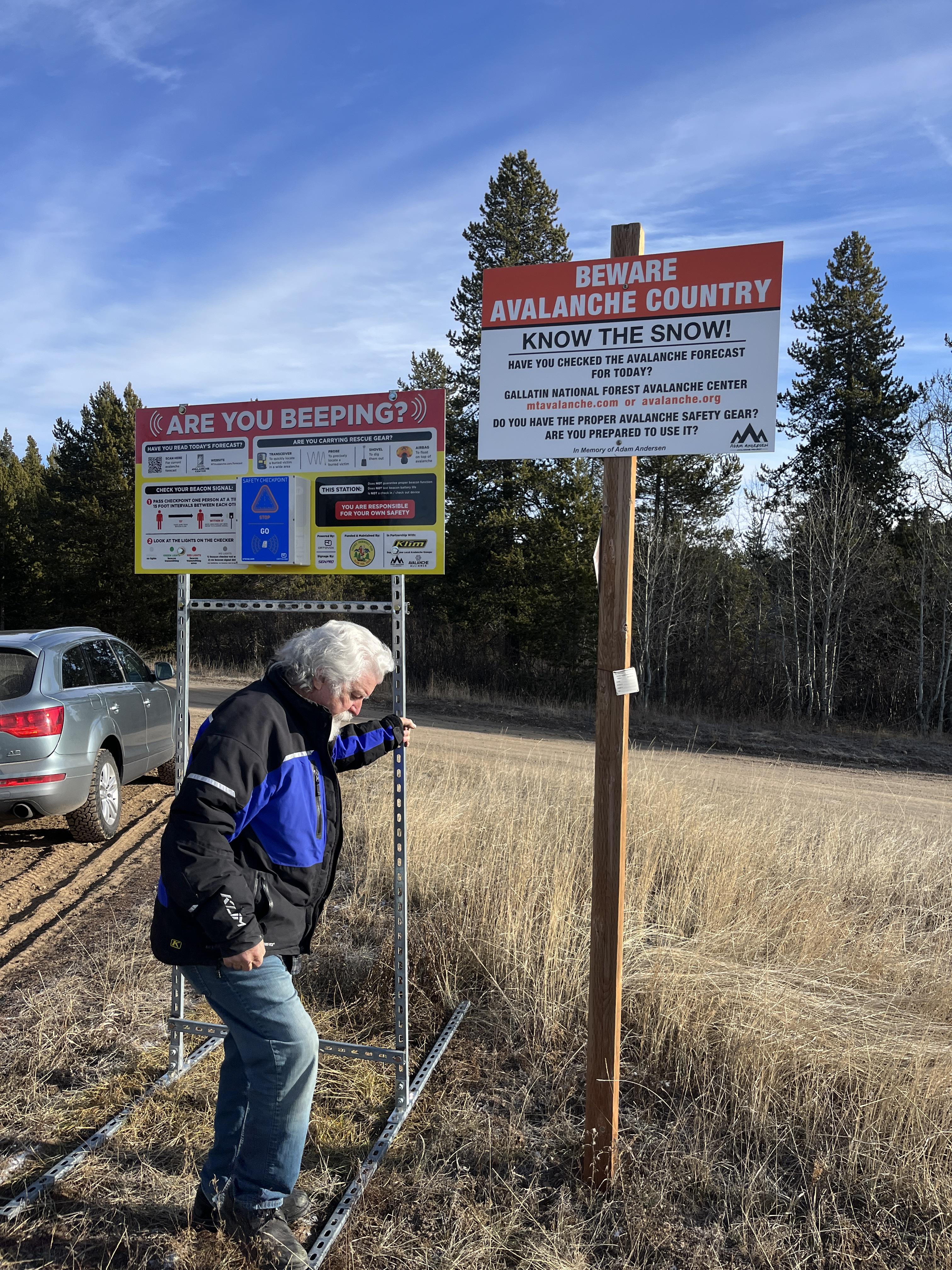
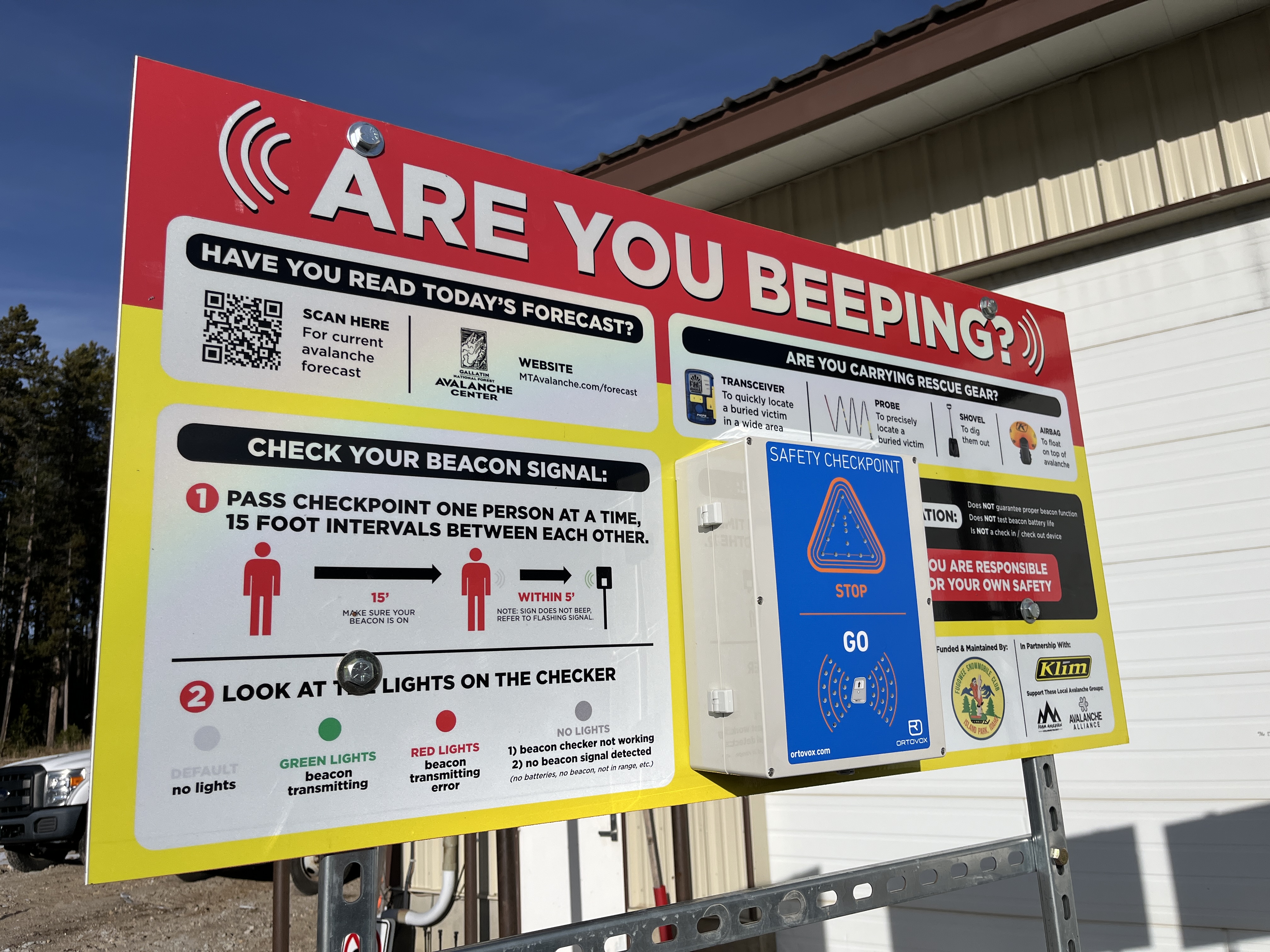
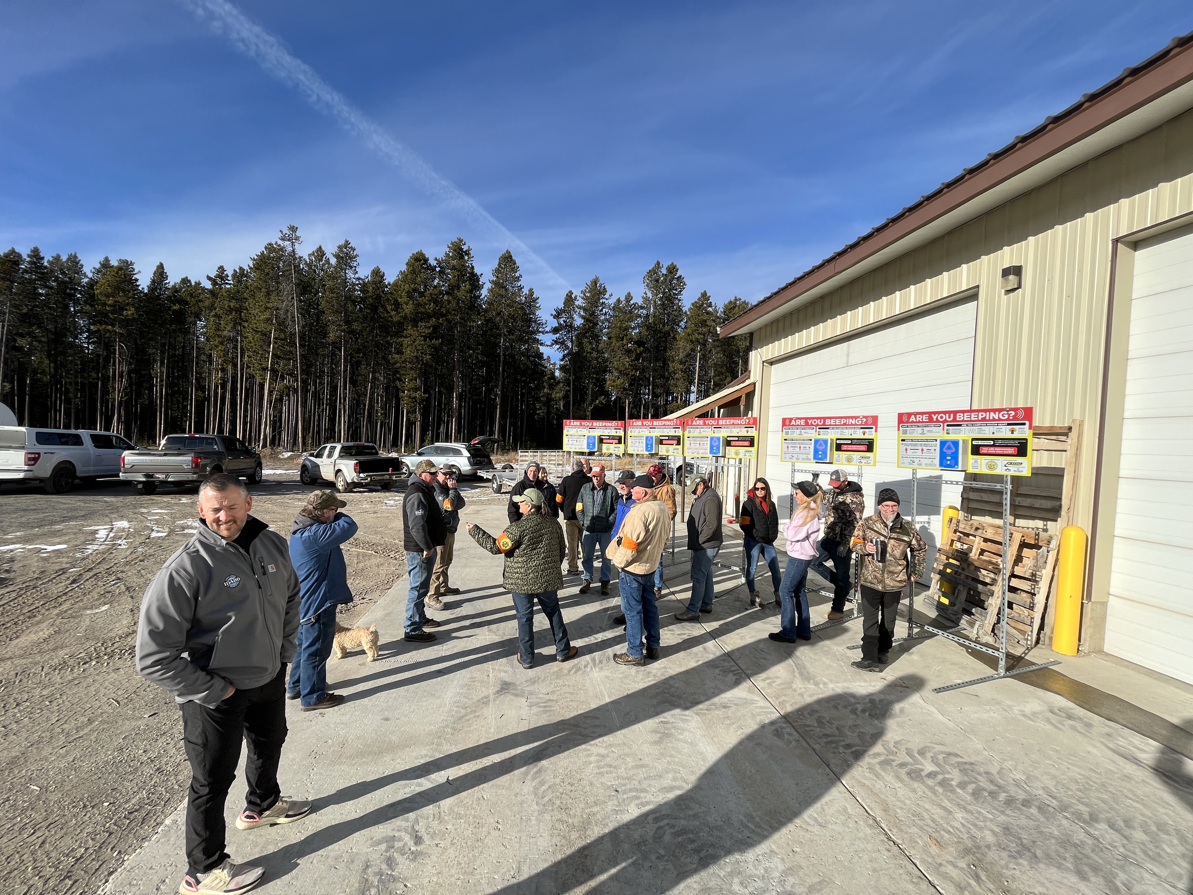
We met up with the Fugawee Snowmobile Club, Idaho Parks and Recreation, and Klim to install new beacon checkers at the trailhead in Island Park. Great work to the team! Photos: GNFAC
Full Snow Observation Report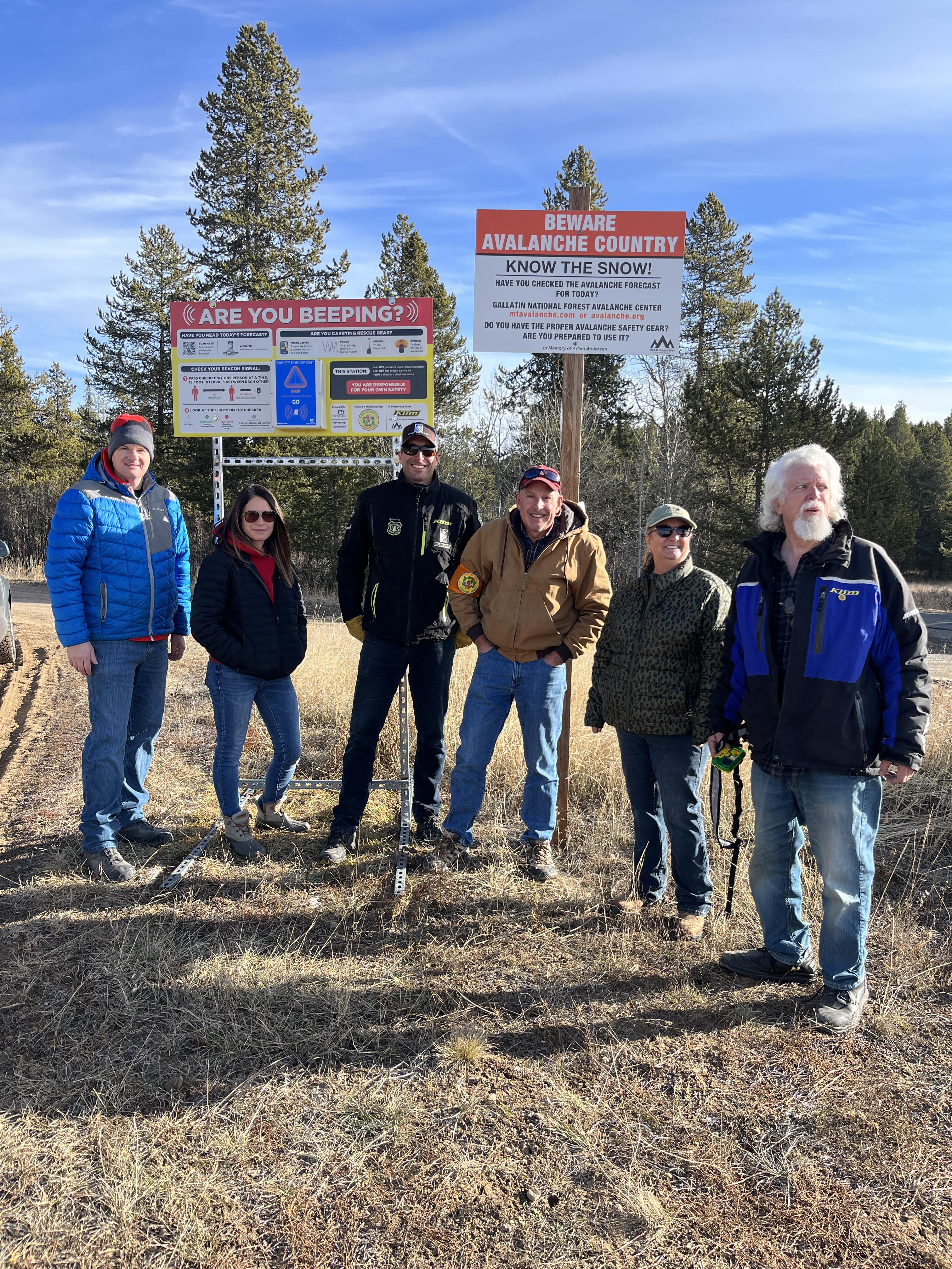
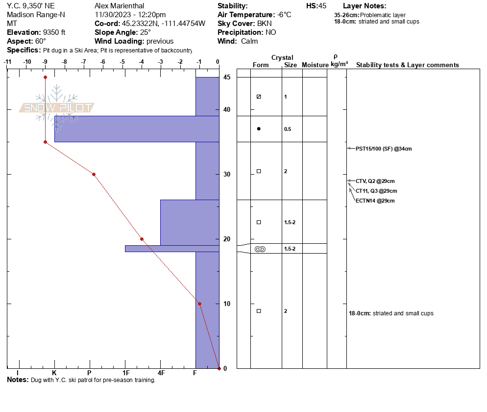
Today (11/30/23) we looked at the snowpack in the northern Madison Range/Big Sky area. At 9,300' on a northeast aspect there was around a foot of snow (30-45cm) which is mostly weak layers of facets. When the mountains get more snow we expect avalanches to break on this weak snow.
Full Snow Observation Report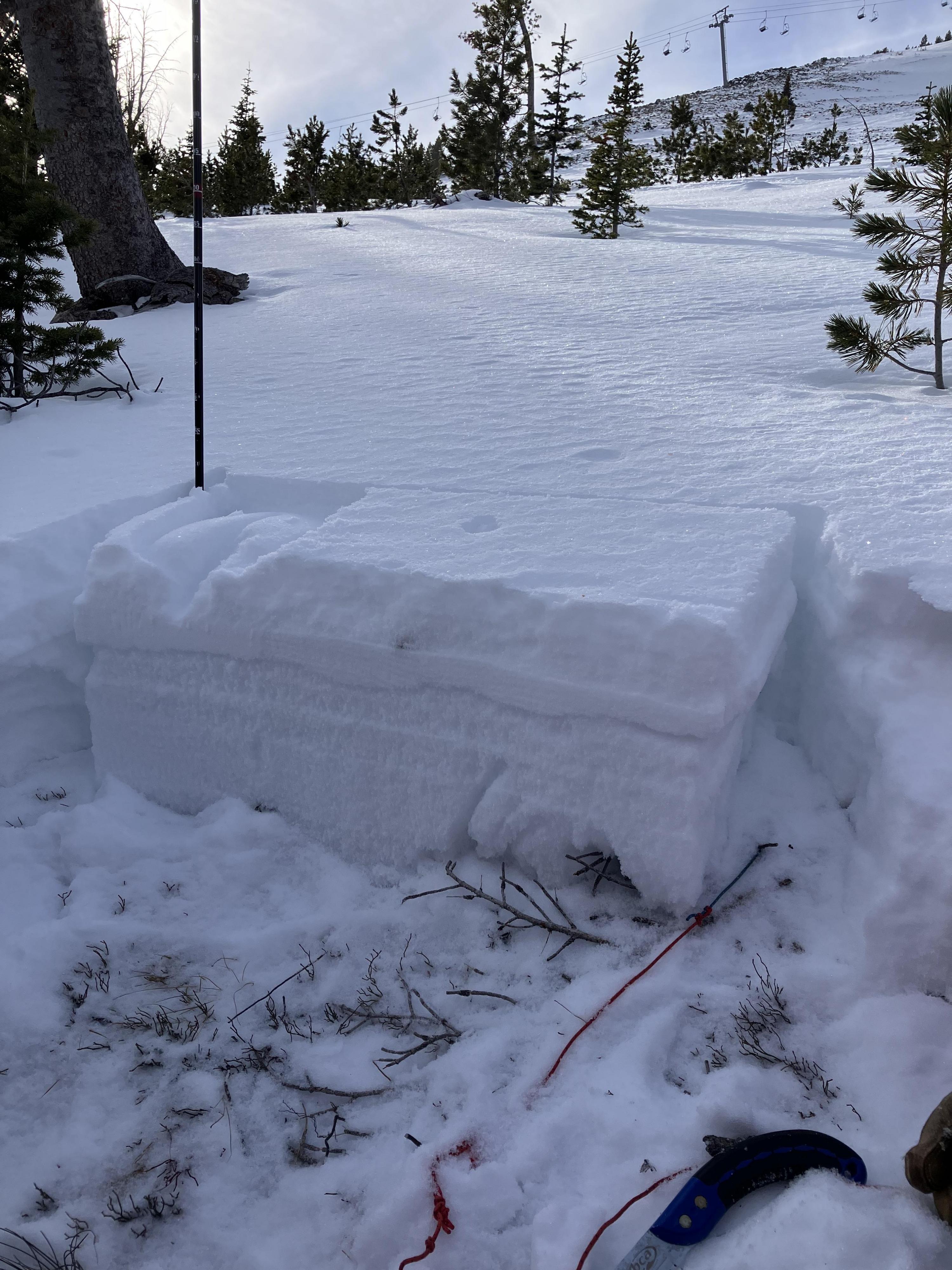

Clear, Light N Wind, No cracking, collapsing, or recent avalanche activity. Snow depth ranged from 6-12" at 8500' to ~2-3' at 9300' and above. Through that whole valley, there is a supportable crust that ranges from 2cm-5cm and is more or less supportable depending on sun exposure. In the trees and shaded areas, this crust doesn't exist. Any shallow and shady area is unsurprisingly a pile of sugary snow. Where the snow is deeper and has been getting sun there is a more layered snowpack.
Full Snow Observation Report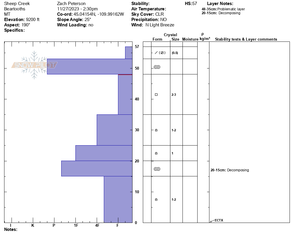
We were in Cooke for the last 3 days skiing around Republic Creek. North of town, the snowpack starts around 8700. South of town is holding snow better with its aspect. We skied and toured every aspect around Woody Ridge and Republic. Slopes that don’t see sun are holding “powder” from weeks ago, but are very rotten and easy to punch a pole down to the ground. Slopes that see the sun have an obvious crust layer. Snow depth varies from upwards of 4 feet in gullies to 1.5 feet in the valleys. There was a very reactive wind slab from the dusting of snow and high wind that occurred over the holidays. We observed it to be 3 inches deep at its max.
Full Snow Observation ReportWe climbed to the Upper Mummy's (west facing) and found relatively little snow at 9,000'. Gullies that usually fill in from wind-loading were not showing much depth. HS was less than 6 inches on the hike up (see pic). Across the valley looking at Elephant and Palace Butte, the bowls were snow covered, but barely (pic). Lower elevation, east facing slopes were mostly dirt.
The avalanche danger is non-existent on most slopes. The exception would be high elevation gullies that happened to get wind drifts, but these are not widespread.
Wind was calm and skies were sunny, with an air temp in the teens F.
Full Snow Observation Report
Went into the Lightning/Taylor Creek area of the Southern Madison’s in search of some powder skiing with the new snow. On our ascent toward Woodward Mountain via the backside, we found fresh snow varying from 2 inches at the trailhead to foot deep lightly drifted areas in the upper elevations. In the protected low angle gully we ascended this new snow sat atop either rocks or a very stout wind crust. The latter of which made for great skiing. We descended Woodward top down and assessed the possibility of thin (3”) wind slabs being reactive on the stout wind crust as the Woodward side seemed to have received a lot more loading from the storm’s E winds. As we rolled over to slightly steeper terrain, I noticed the snow stiffening just below my skis and gave it a few hops where I intentionally popped the pictured slab. With this information, we decided to carefully traverse to more protected trees and descend via a less wind loaded and hazardous route. We ski cut from tree to tree triggering a few more of these very small slabs before finding wonderful powder skiing lower on the mountain where the wind had significantly less effect.
All of the slabs were 1 to 4 inches deep and propagated 5 to 15 feet wide. None of them possessed the mass or were on steep enough terrain to overcome and slide over the stauch wall. Overall was a great lesson in mitigating hazard and we were rewarded with some great turns.
Full Snow Observation Report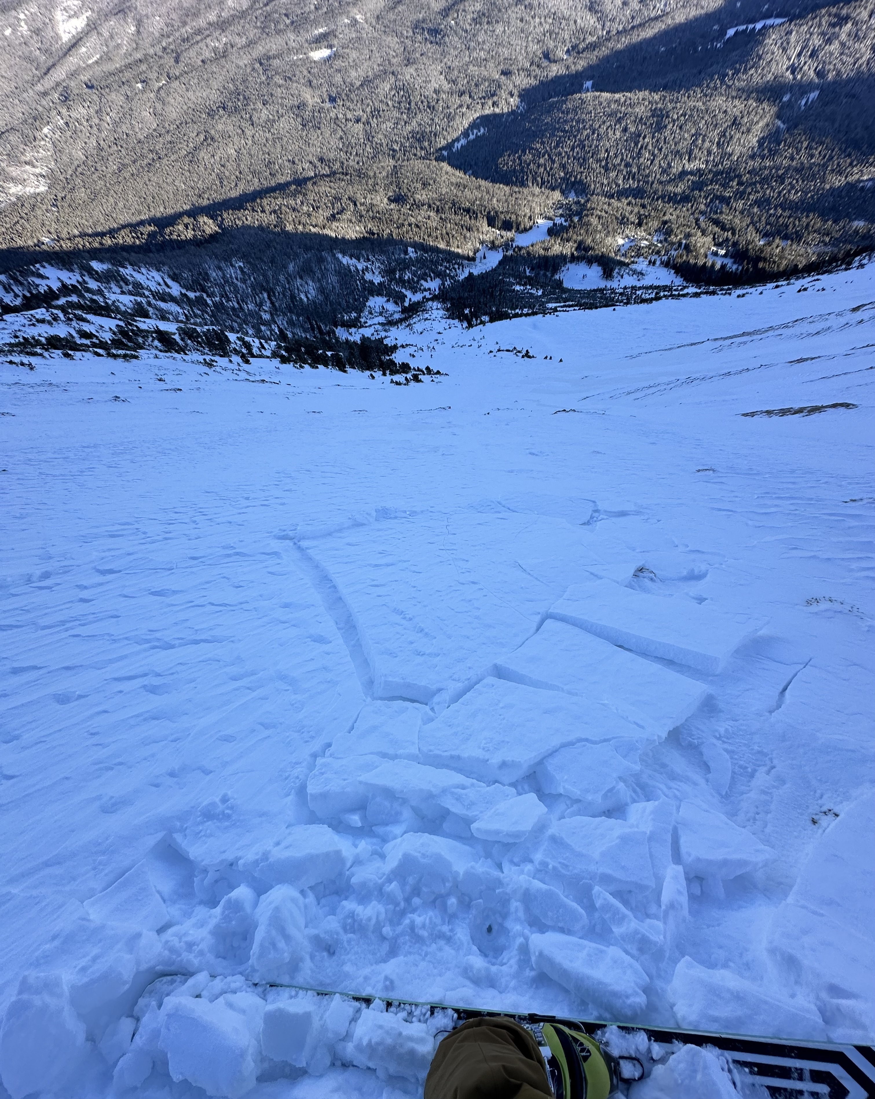
From FB message: "Hi! I’d like to report 2 natural slides that were witnessed in the Flanders fork of Hyalite on Friday 11/24 on the east facing aspect of the canyon. Both avalanches came from a single snow field above “Bobo Like” ice climb. These slides happened at approximately 7:45am and 8:15am"
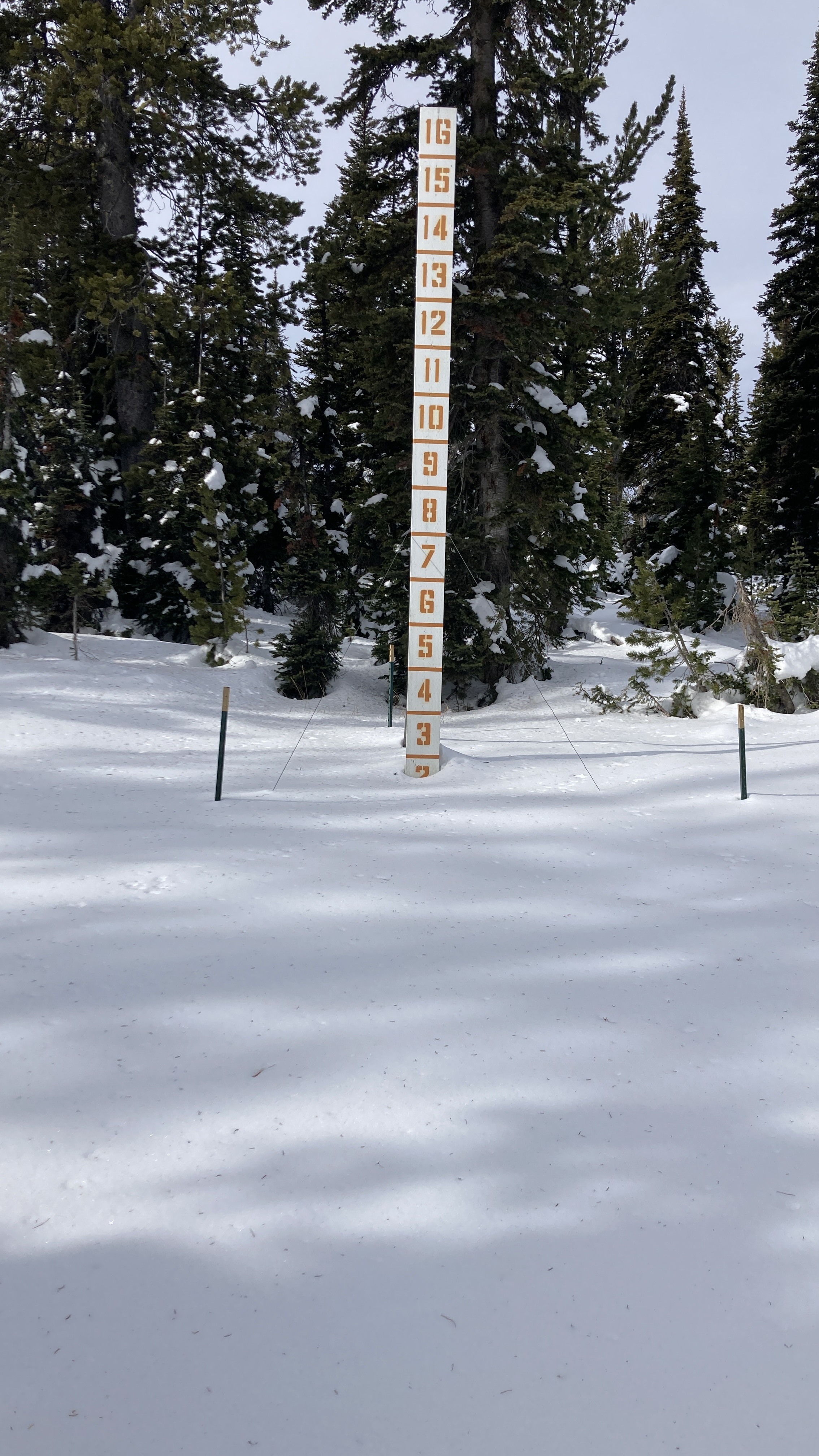
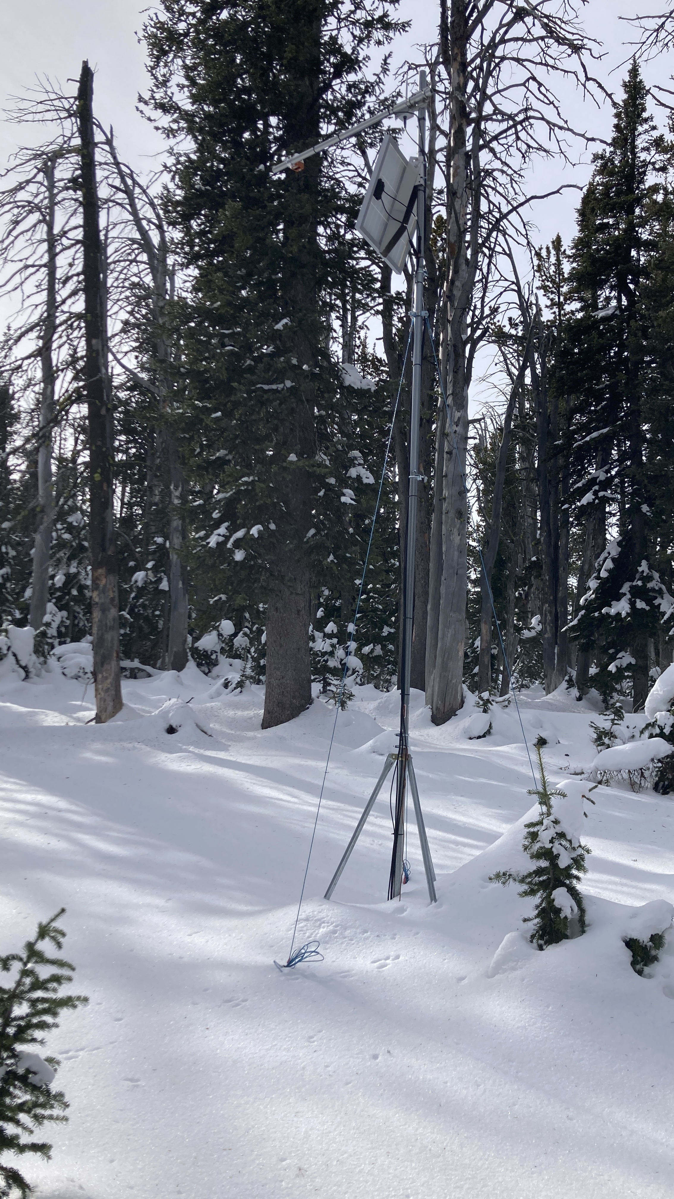
Full Snow Observation ReportWent to do maintenance on the Sawtelle Snowfall weather station at 8800 ft just off the Sawtelle Mountain Road. Continuous snowcover starts around 8000 ft. At 8800 ft there is ~20" of snow with a mix of hard crusts and weak facets. These weak layers near the ground will be something to watch once snows again.
Full Snow Observation Report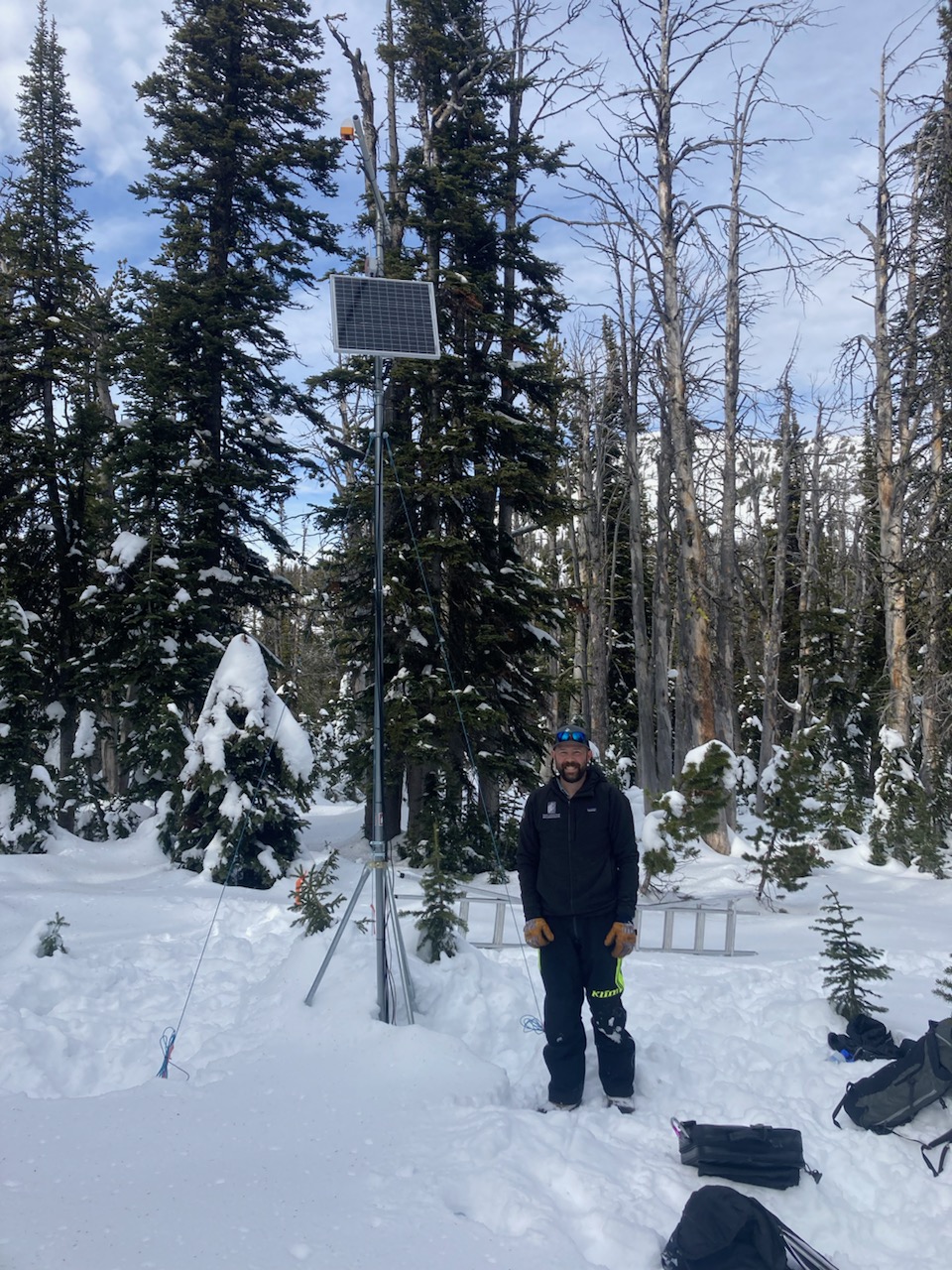
Went for a ski tour in the Southern Madison's up Lightning Creek in search of a deeper snowpack. Our tour brought us up Woodward Mountain via the E sub-ridge with a plan to ski in the bowl to the north on a NE aspect. The snowpack varied immensely due to sun effect/wind loading but overall found 50-60 cm of snow in the deeper locations. We performed 3 CTs in representative locations of our intended ski line and had results of CT21 Q2, CT15 Q2, and CTN. The columns broke on a layer of 4F facets midway down from the surface. Combining this data with a lack of other signs of instability (cracking, whumpfing, recent avalanches, recent loading), we decided to ski our intended line.
Snow quality on the ascent and decent varied from "ripple pow" to breakable wind crust to unbreakable wind crust. Overall, was a great day in the BC getting familiar with our early season snowpack even though good ski conditions lacked.
Full Snow Observation Report