Snow Observations List
Skied into Frazier basin today. Triggered a few small windslabs and saw a lot of cracking on NW aspects. All windslabs were still small breaking a few inches deep 10-15 feet wide and only running short distances in steep terrain. Winds were strong from the NE all morning and still blowing hard and continuing to load slopes when we left at 12:30.
Full Snow Observation Report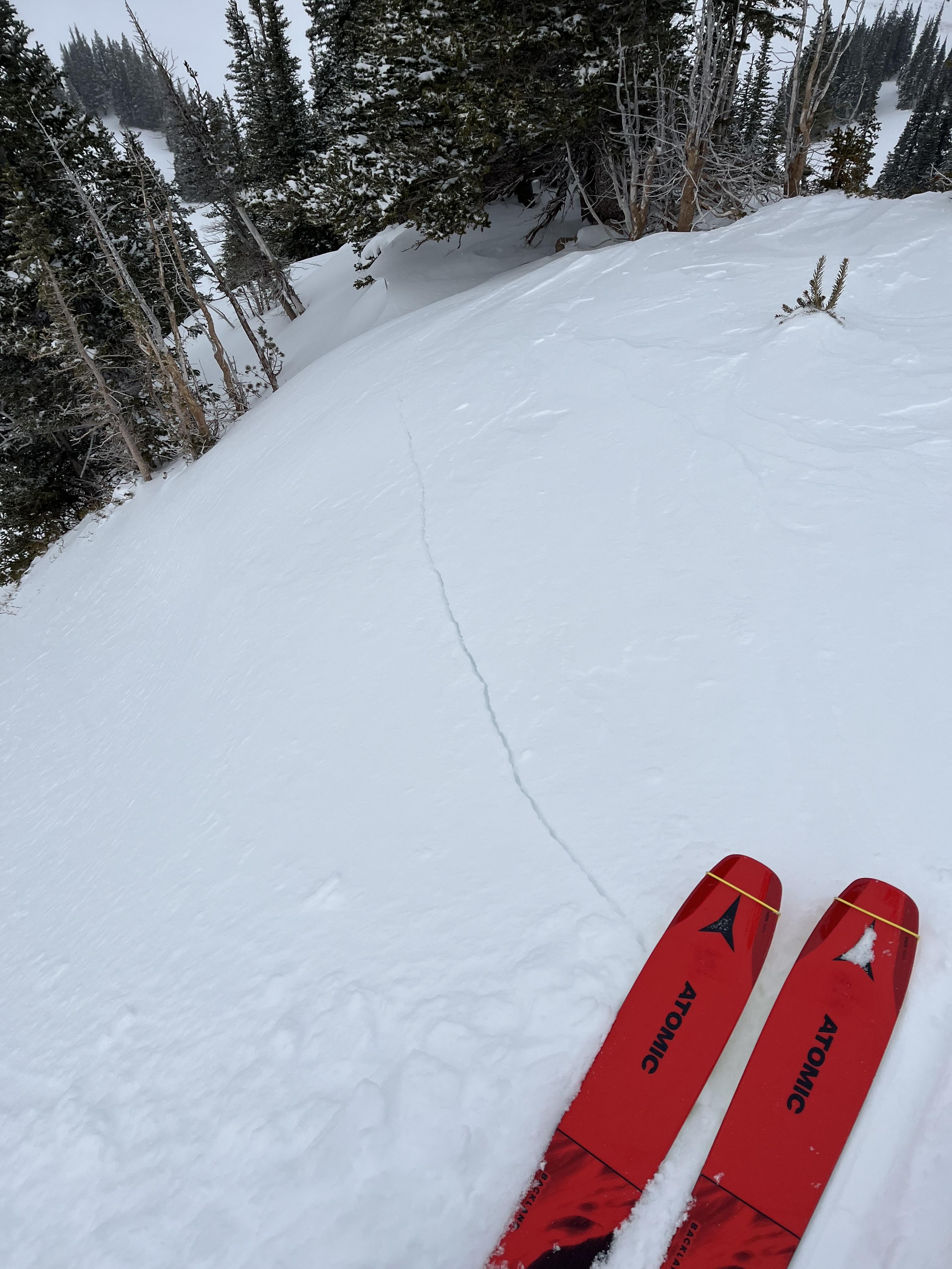
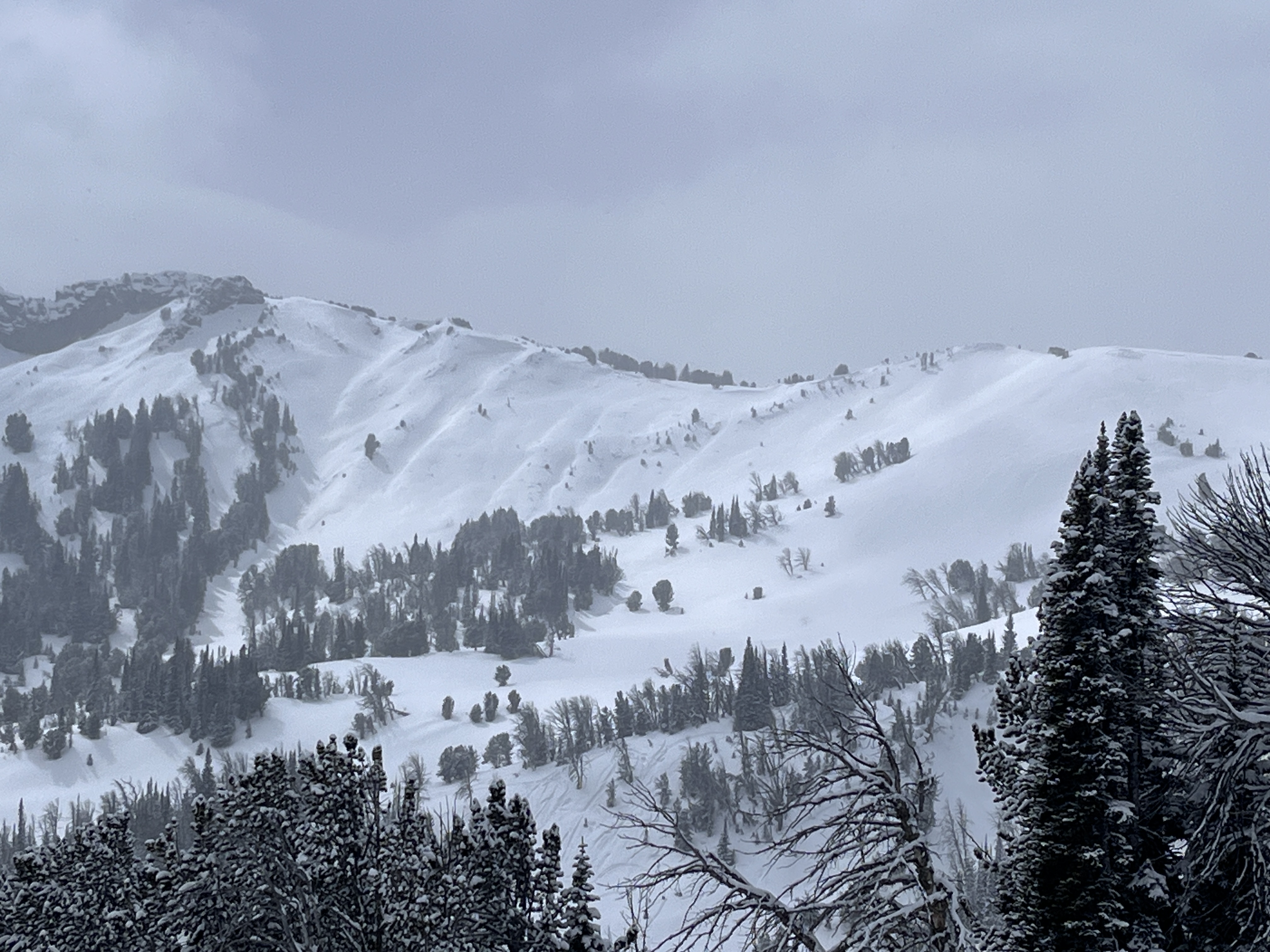
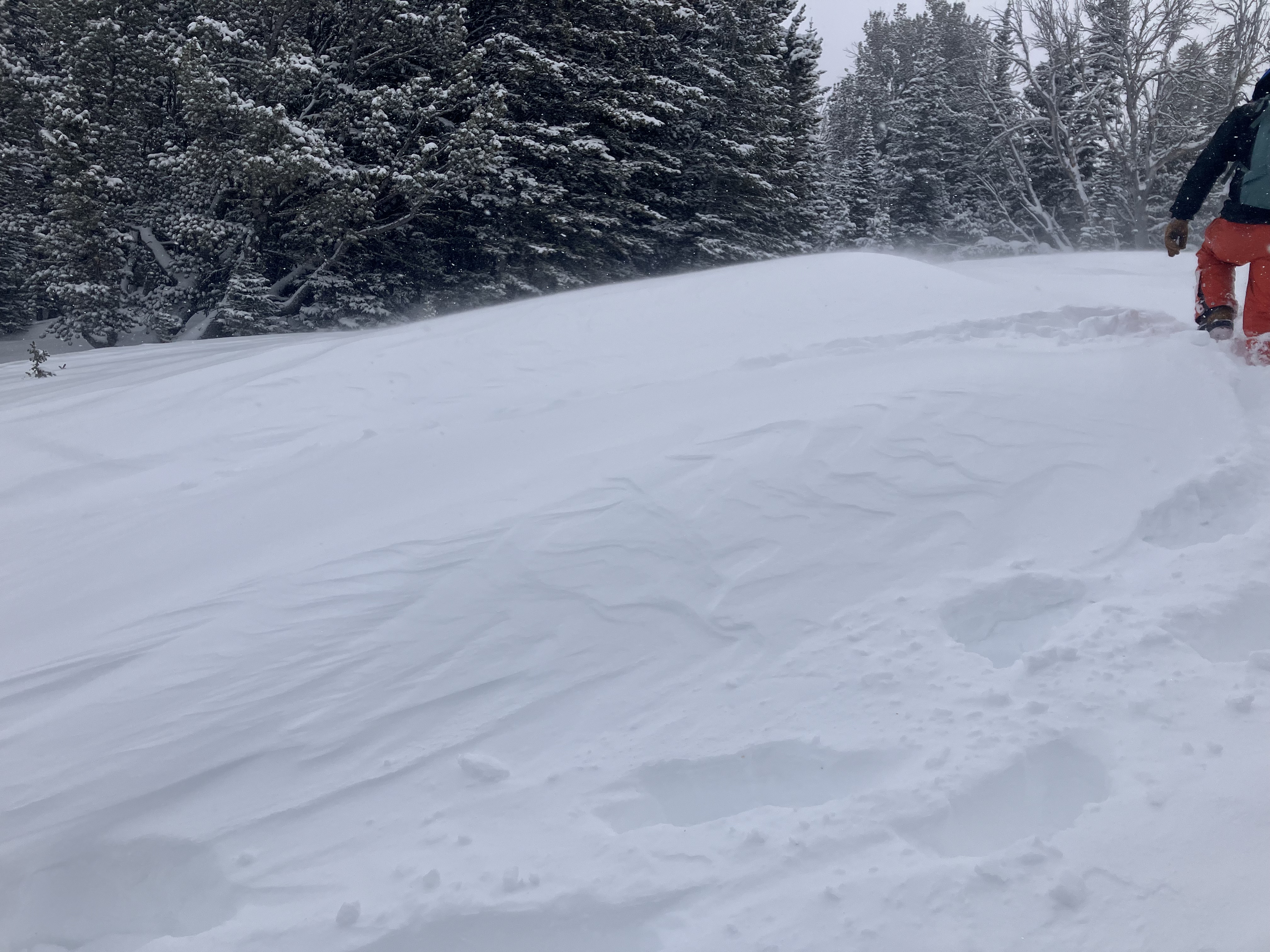
Spent the last few days traveling around the Cooke City Area. New to the area so this is just some general notes/obs of things we saw that seemed interesting:
- weak basal facets/depth hoar widespread across all aspects and elevations travelled
- no cracking or collapsing noted
- anywhere from 1-5" of new snow in the last few days. Surface conditions quite a mixed bag and tricky to predict what would be crusted or not I think due to how the sun has popped out at random times and locations in between snow squalls.
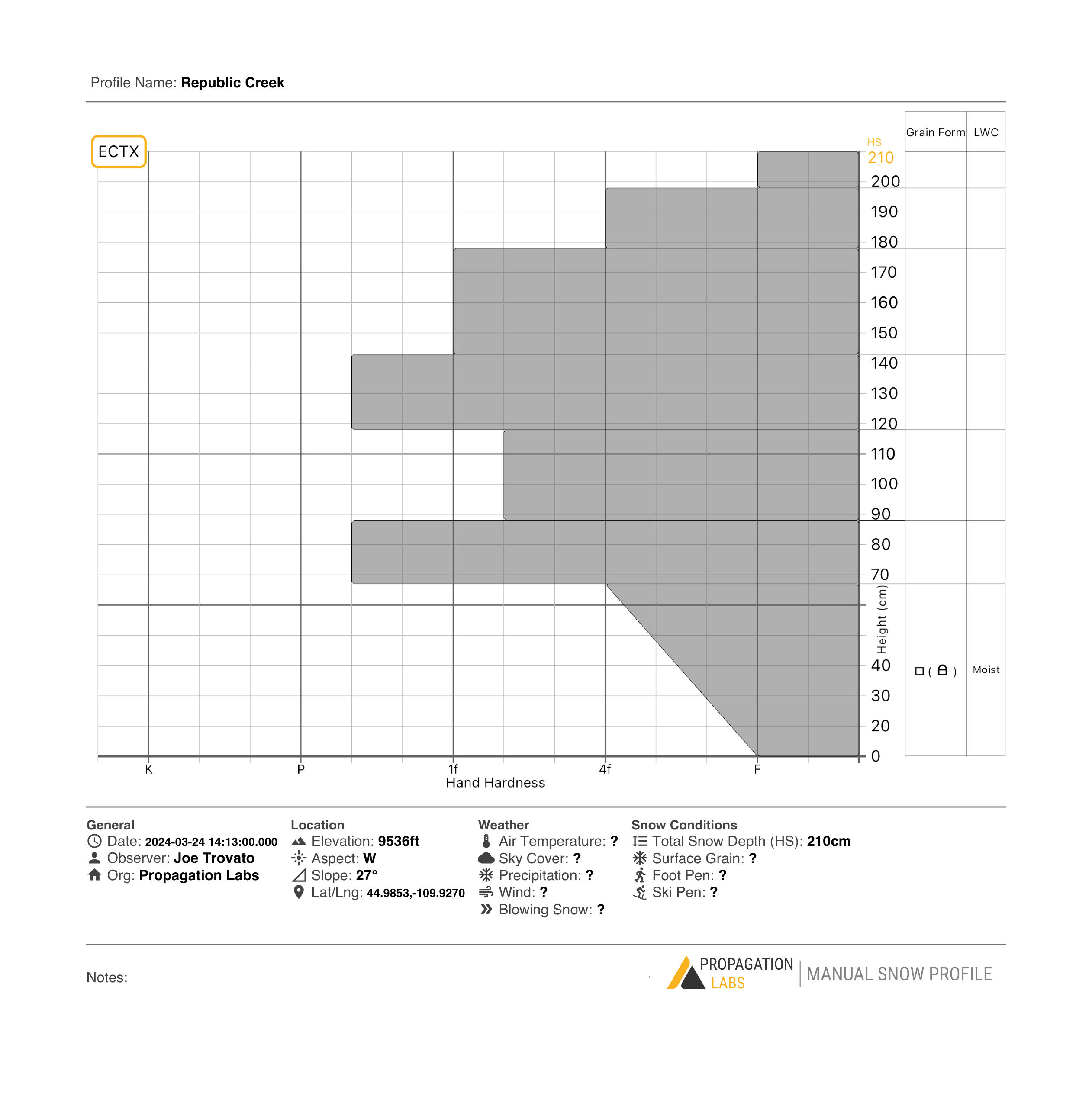
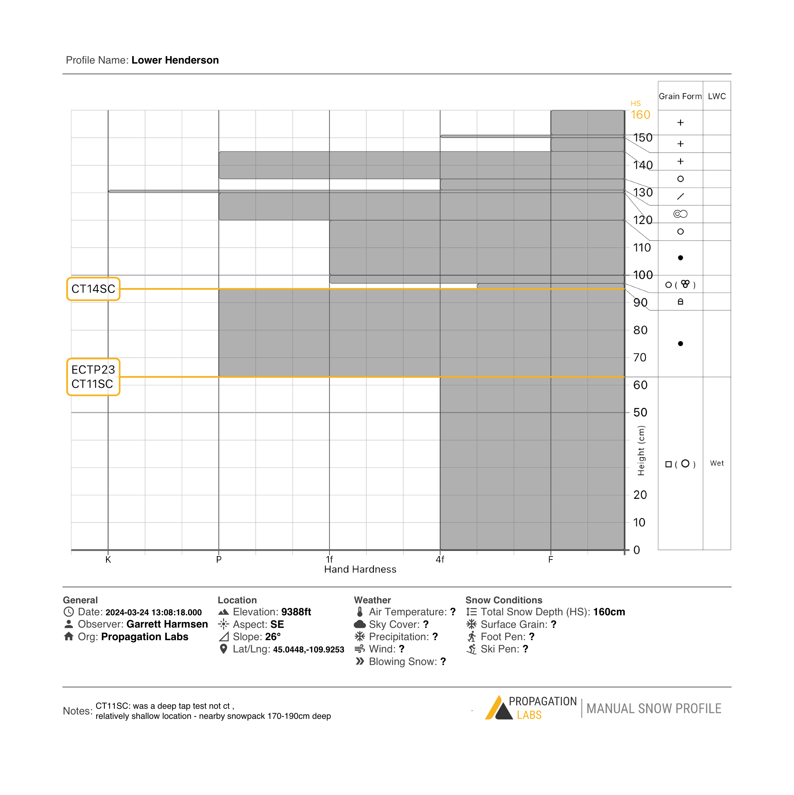
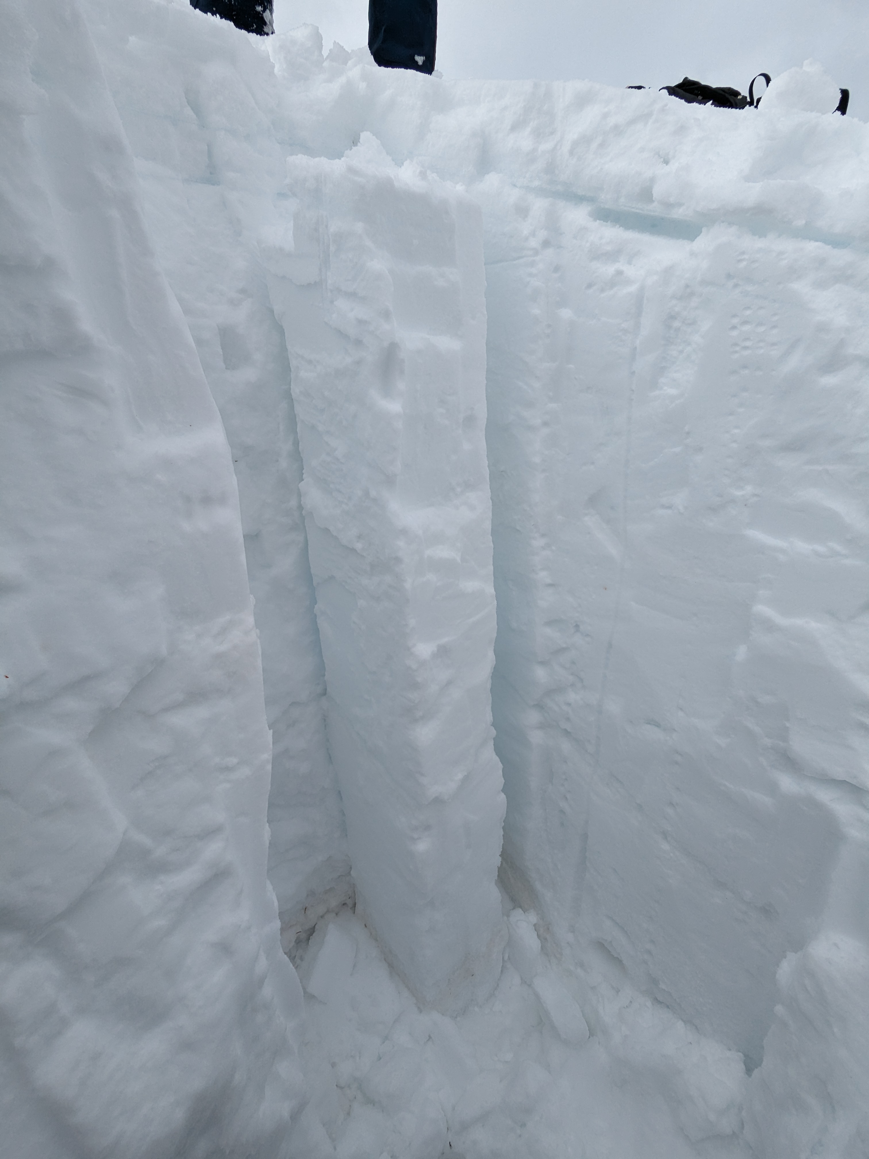
- pits were dug in 2 locations (see images) -
- S aspect on Henderson, many clean CT (Q1/SC) results and ECTP results on both a mid pack facets and basal depth hoar, even though depth hoar was wet (could make a snowball). These test results were repeatable in 2 pits dug nearby each other in same location representing both shallow (~160cm) and deep (~200cm) spots. Video of this pit linked.
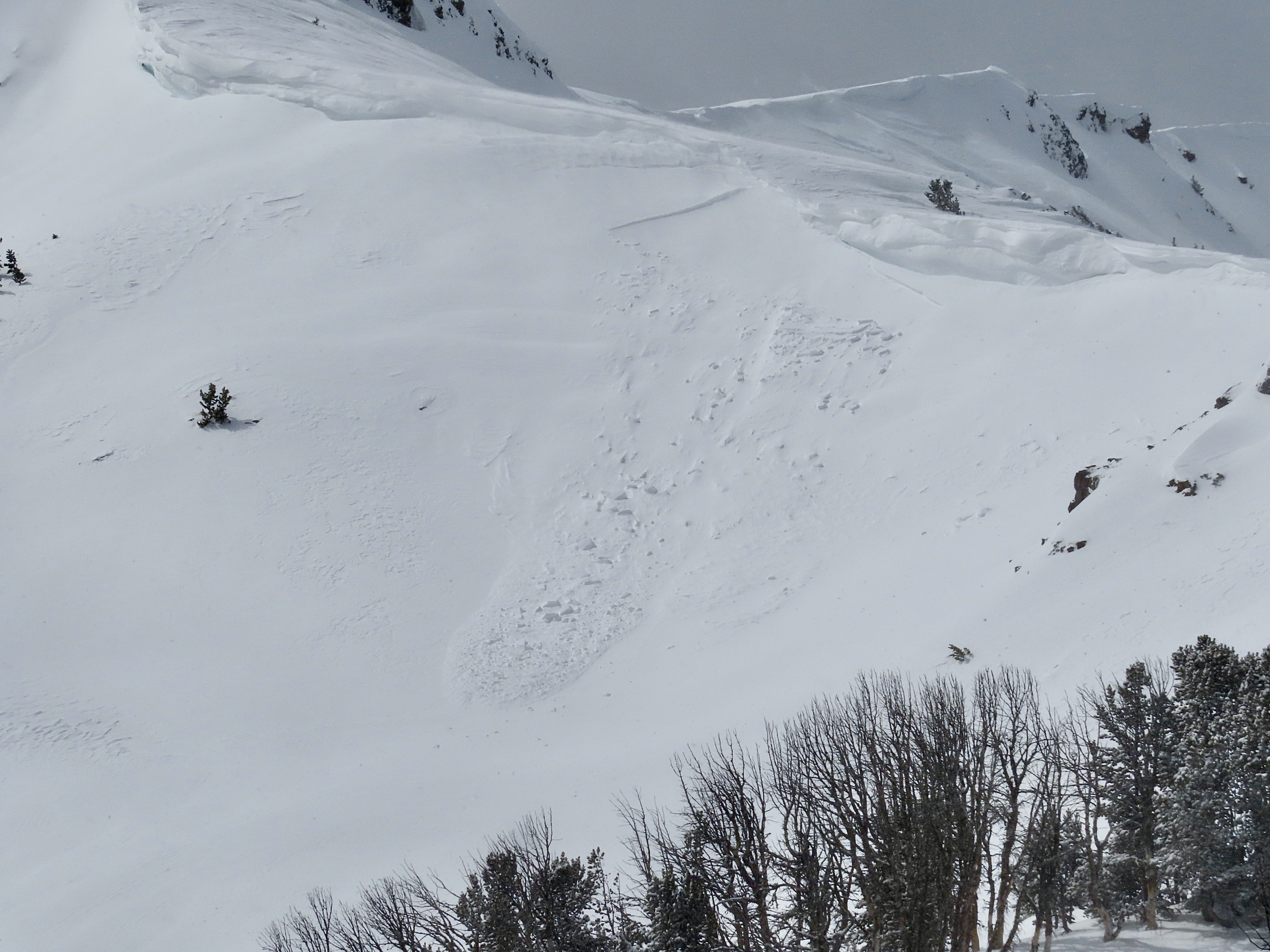
- W Aspect Republic Crk/Woody Ridge - same basal facets/depth hoar noted, but not reactive to ECT (ECTX result), even when top half of snowpack was removed. This is near the collapse ob from another party the other day so points to the spatial variability - no result in our pit but a reactive collapse nearby from another party noted.
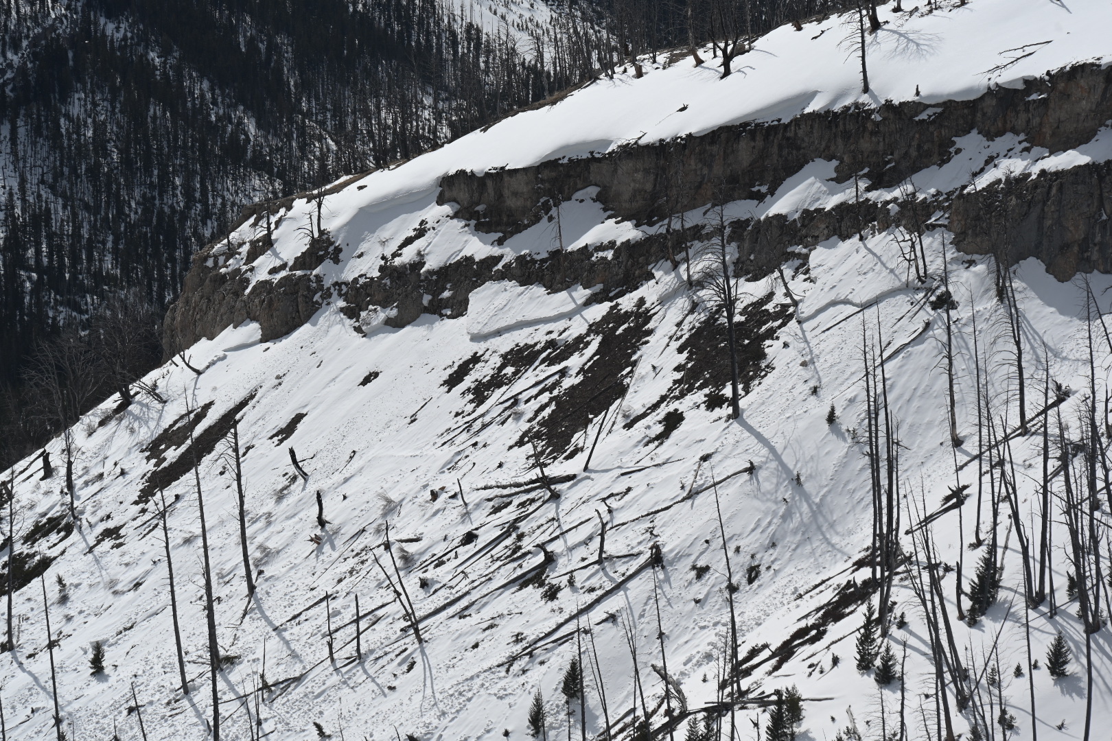
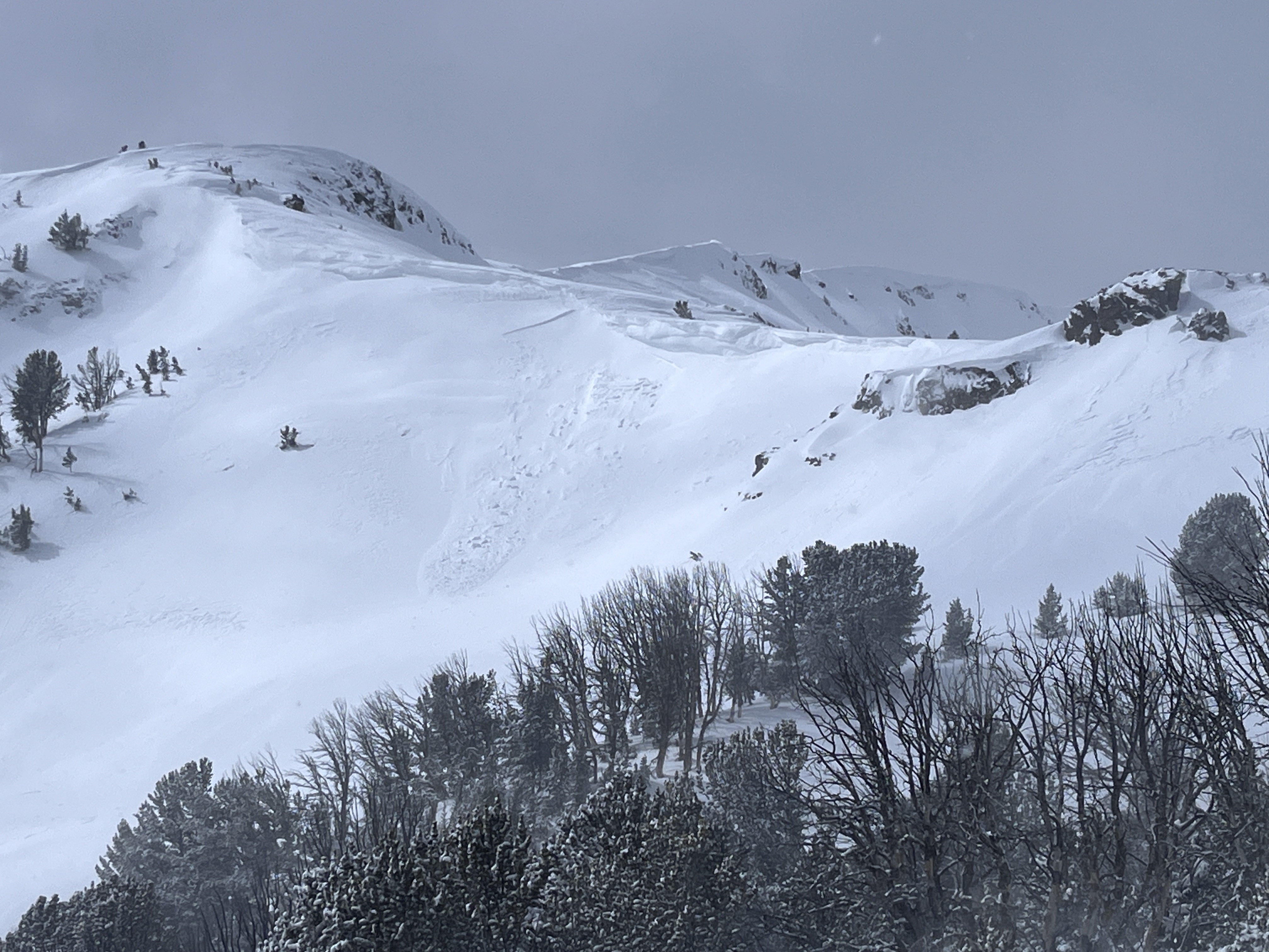
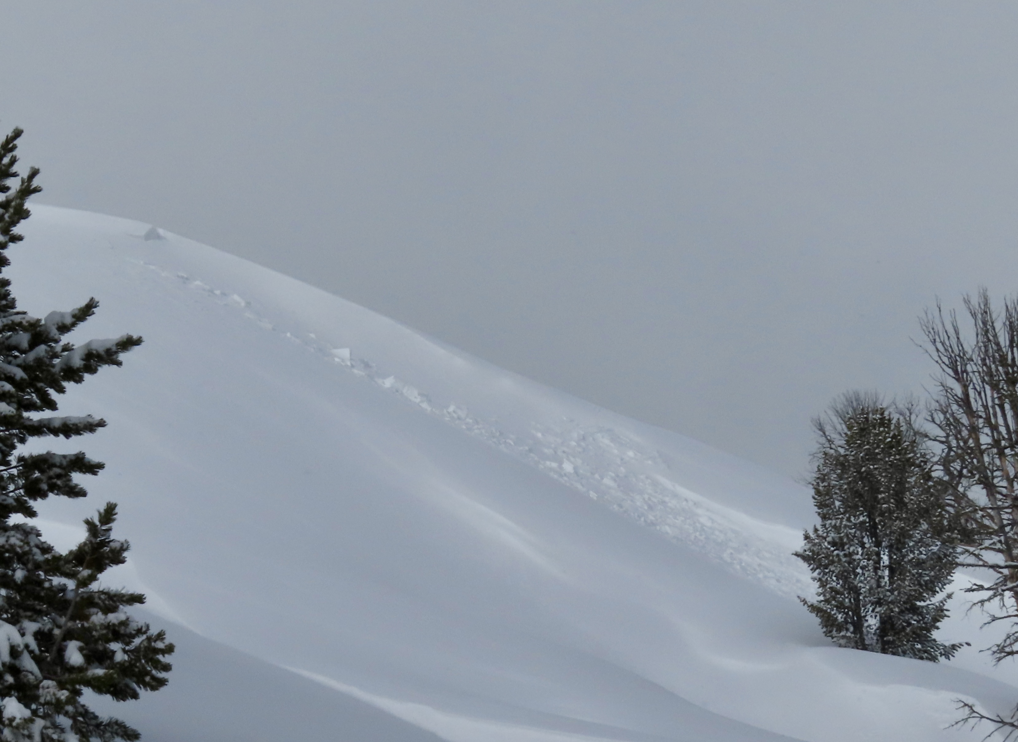
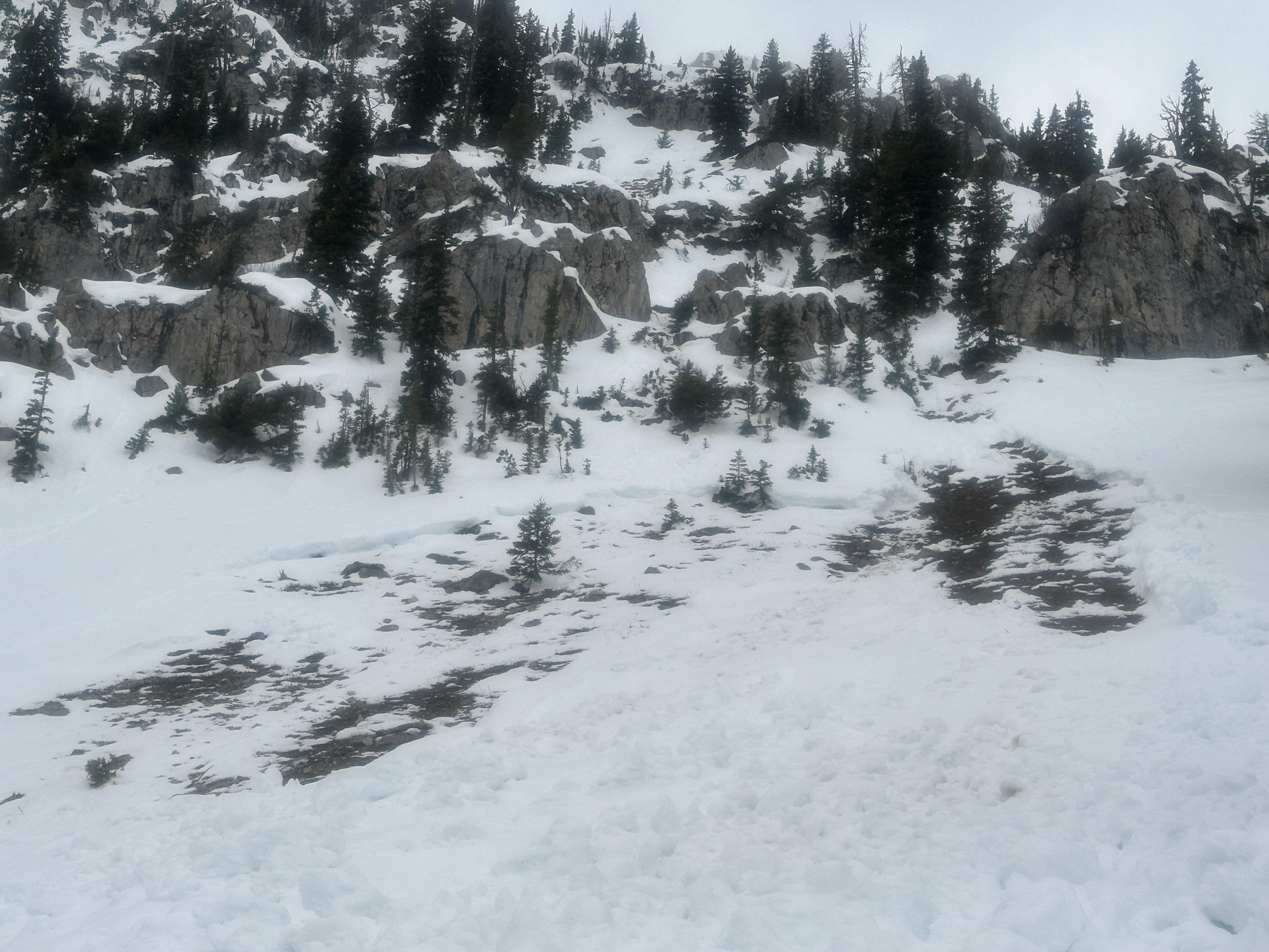
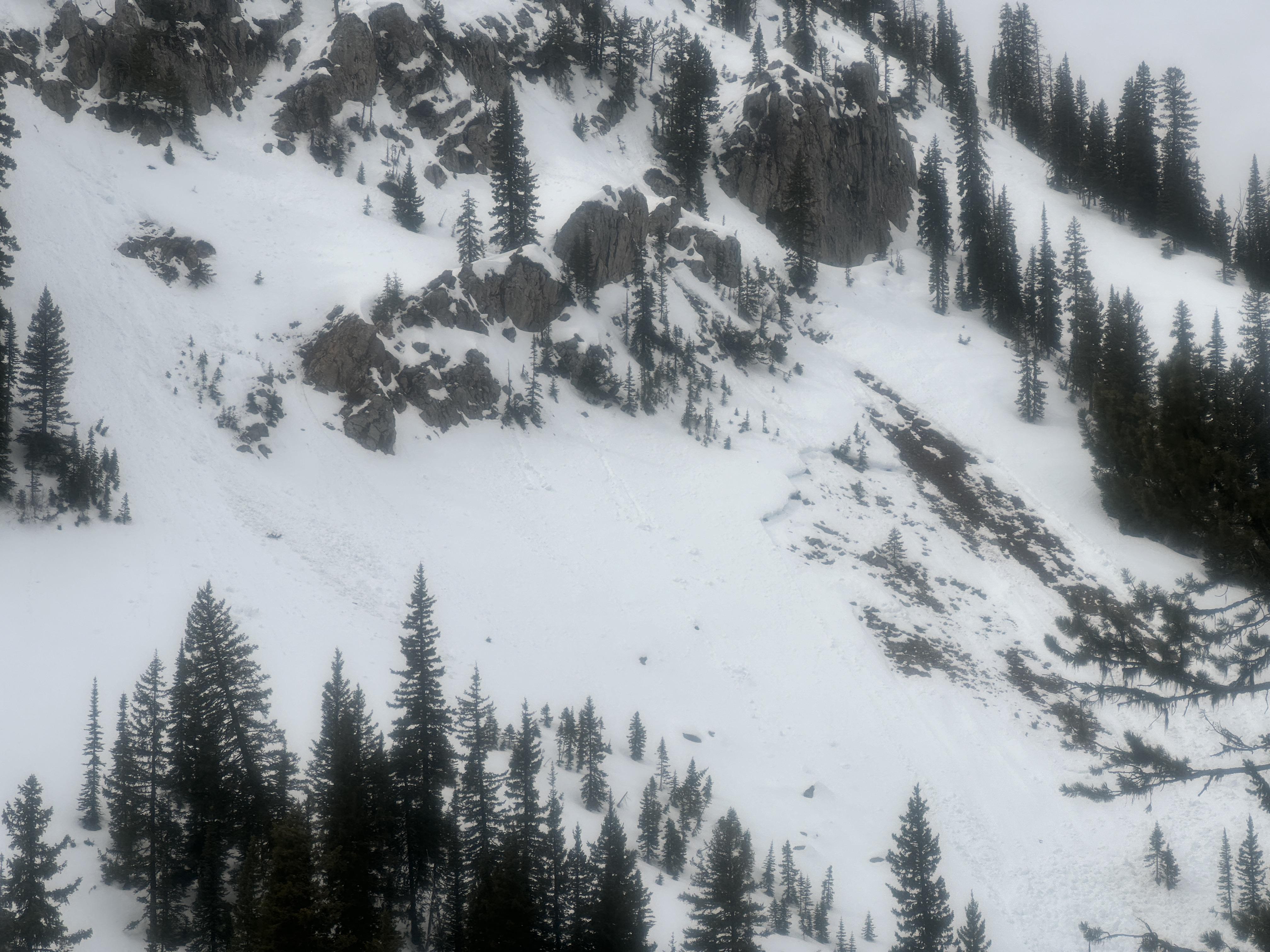
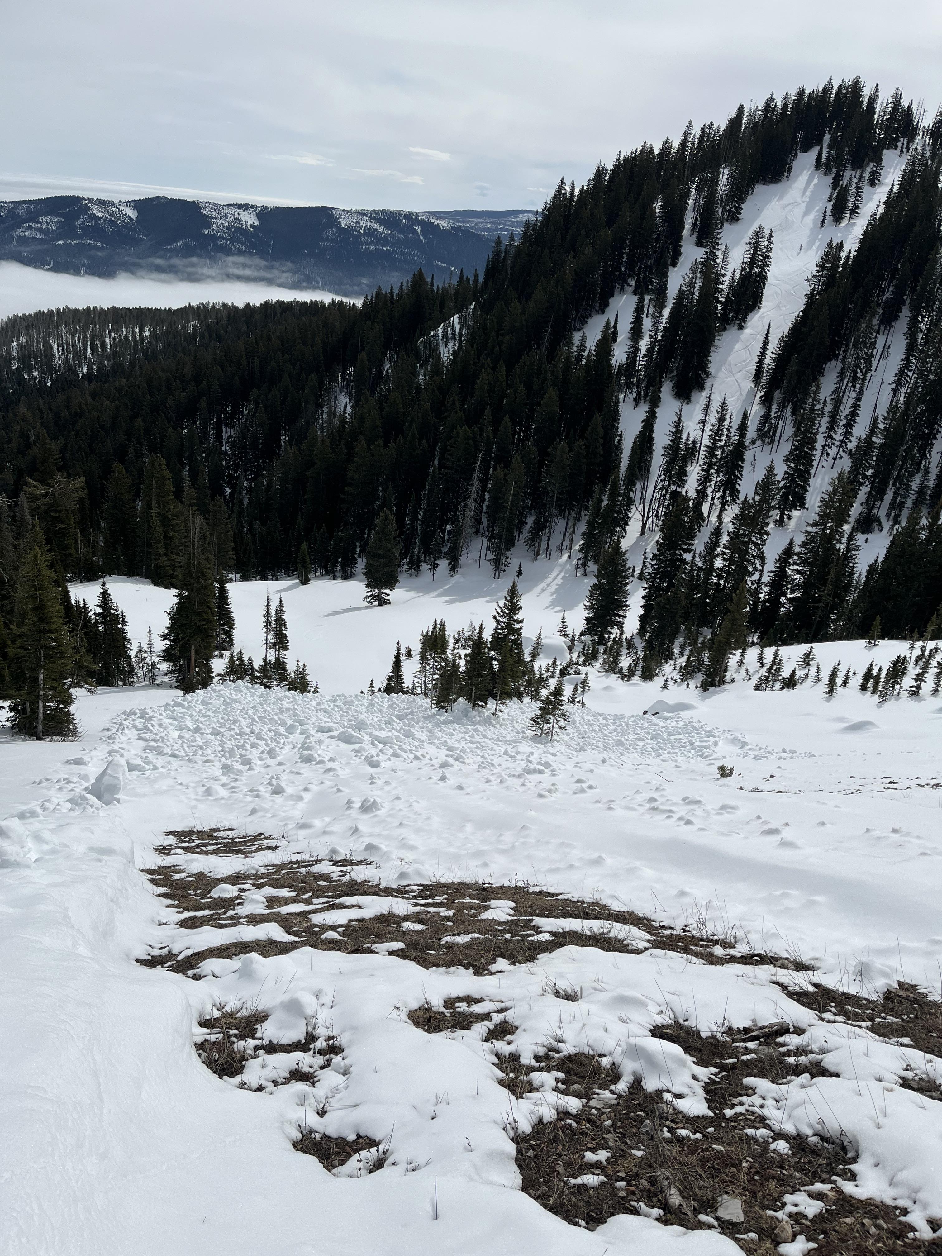
- Widespread crowns visible from previous cycle almost everywhere you could imagine, especially on easterly aspects. Don't think we saw anything that hadn't been reported, but must have been a very impressive cycle. One photo attached is of a shallow SE aspect slide seen in Pilot Crk drainage. I thought interesting because of how shallow the snowpack seemed there.

The snow rangers rode around Battle Ridge, the Throne, and Naya Nuki today. New snow depth ranged from 2" to maybe 4-5" in sheltered/lee locations. Lots of older wet slide debris was visible but no avalanche activity in the new snow. There is a very firm crust in most areas and anything with southern exposure has gotten very thin, including the trail in. We rode through several large mud patches on the way out.
Full Snow Observation ReportToday I released a windslab with a ski cut on town hill. 6-10” deep and approximately 30’ wide. It ran about 40 vertical feet.
Full Snow Observation Report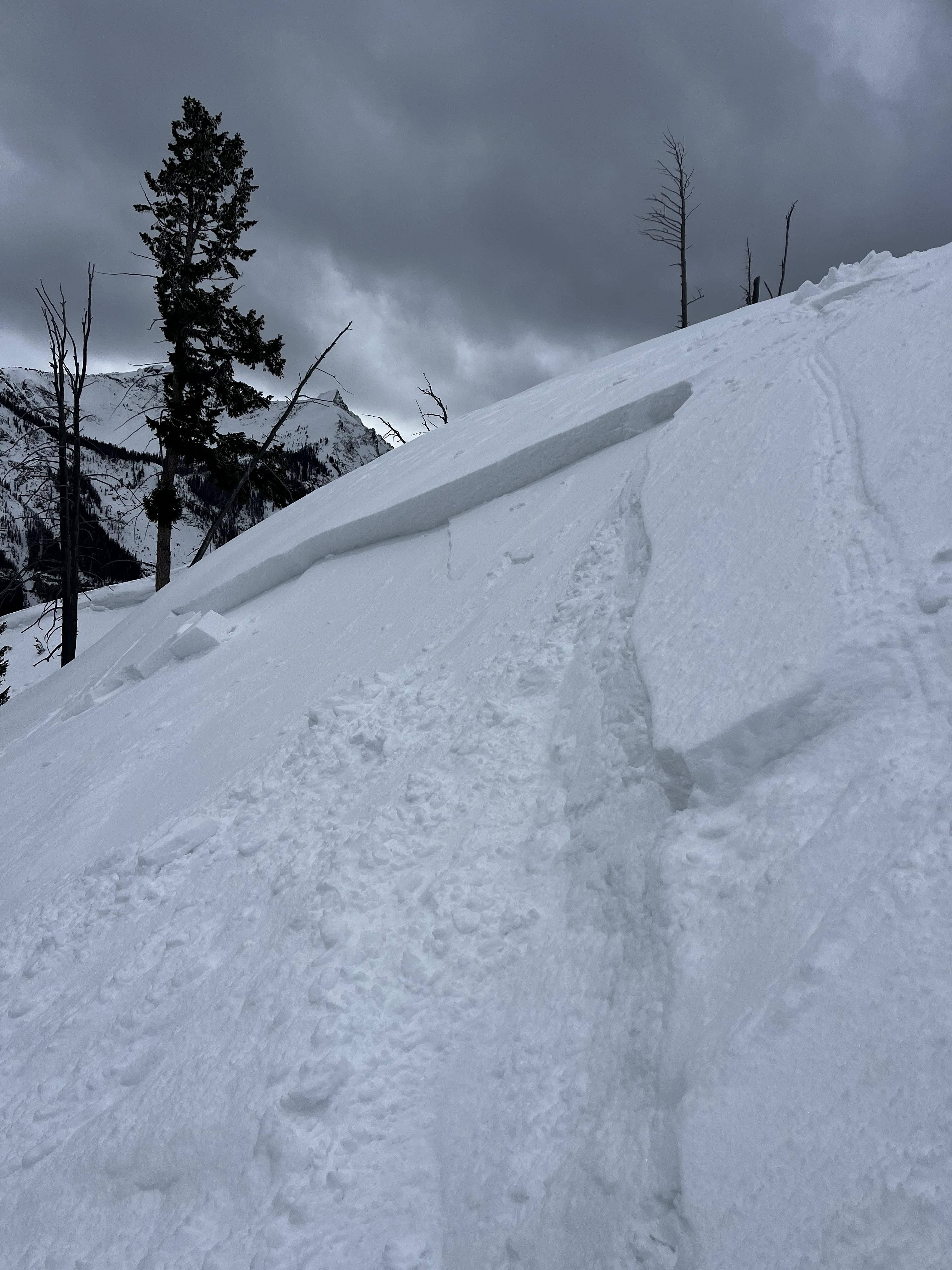
From IG Message: ECTP20 on a NE facing slope on Ross Peak at 8700' elevation.
Full Snow Observation ReportToured out to the playground Sunday. 2-3" new snow provided good riding on smooth surfaces. HS around 1.5-2M at 8-8500' on North side of compass. Did not plan to dig but after observing a significant deep slab from afar that propagated into shallow angled terrain AND took out ski tracks, I found myself with a hypothesis I could not ignore: Have we transitioned to a wet spring snowpack? I assumed this was a wet slab but needed more information. In fact at this location the snowpack was still dry and we still got stubborn propagation at the basal facets (ECTP25). Very difficult to estimate timing of incident however it stands to reason that loose wet snow came down from above and pulled out this slab; most likely caused by rapid warming and a poor refreeze sometime last week. While not a far running avalanche, it did take out the whole snowpack and deposited 10-15' of debris in the trees. We classified it as HS-N-D2-R2-G
Final thoughts: I have not skied in SW MT much this winter but a few things stood out to me yesterday. Thin, shallow snow equals weak snow. Most slabs are hovering right around the 1M mark, just enough for a human to trigger. Recent activity has pulled out many shallow slopes that I have often wondered over the past decade, "can this avalanche?" This winter has provided me many good images of "sneaker" slopes that are just steep enough to run. Despite the allure of untracked snow, seeing propagation at the ground in late winter has my hackles up and I will be staying out of avalanche terrain (sigh) for the foreseeable future. My suggestion: Go to the Tetons where there is 100" sitting on the deck or stay out of avalanche terrain for now.
Note from GNFAC: This avalanche happened on 03/20/2024: details here.
Full Snow Observation Report
Skied in Frazier and fairy lake area today. No signs of instability or wind loading on the north facing slopes we skied. We found a very firm crust layer under a few inches of new snow. The new snow was sluffing quite easily but wasn’t consolidated. It was lightly snowing all day but no wind to speak of moving the new snow around.
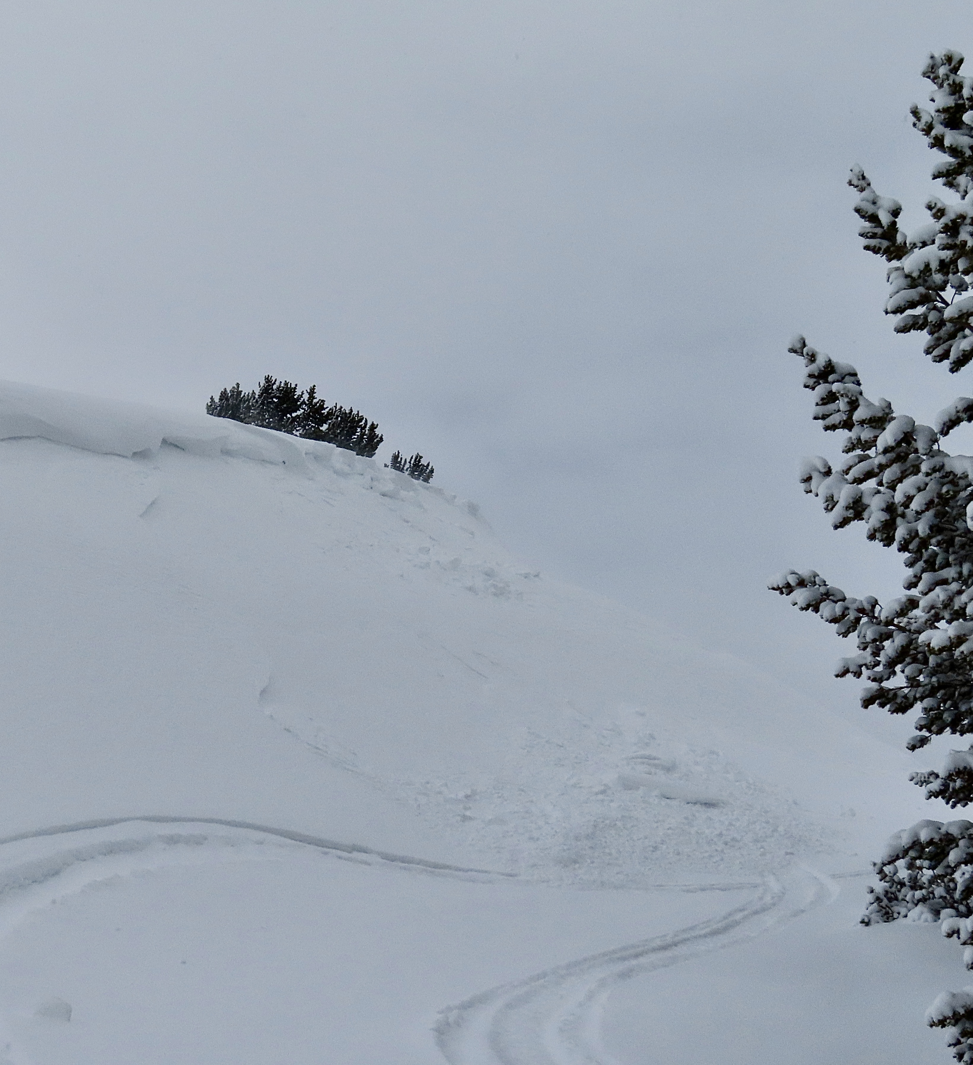
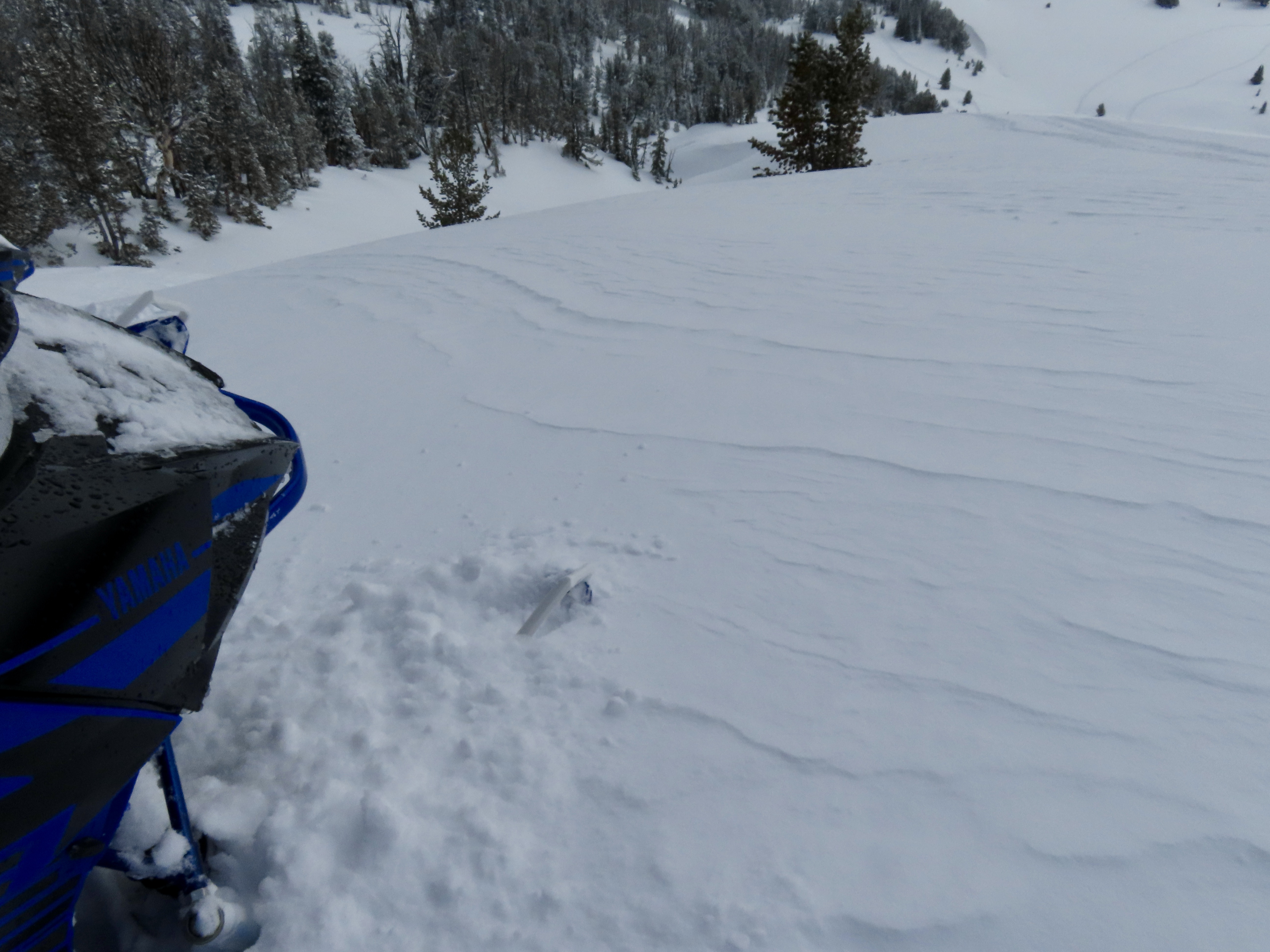
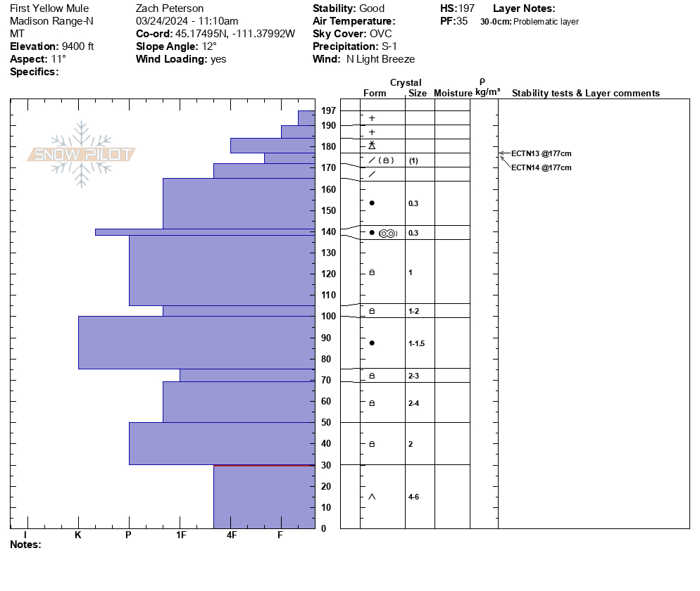
Full Snow Observation ReportWe rode up Buck Ridge towards the Bear Creek Wilderness boundary, along the way we found 6 to 10 inches of new snow that fell over the last 24 hours. In many areas this new snow has formed large drifts even in treed areas. Behind McAtee Basin, we saw a small natural wind slab avalanche on an east facing slope, and we saw a natural wind slab in Bear Creek. From a nearby ridge line we could see snow being transported at ridge tops. On a small test slope near Muddy Creek we intentionally triggered several small avalanches in wind loaded terrain. In First Yellow Mule we dug a snow pit on a north facing slope, at 9,300’. We saw ECTN 13 and 14 scores below the new snow.
Strong north wind prevailed through most of the day at or near ridge lines. We saw lots of evidence of both cross loading and wind loading on many slopes.
Full Snow Observation Report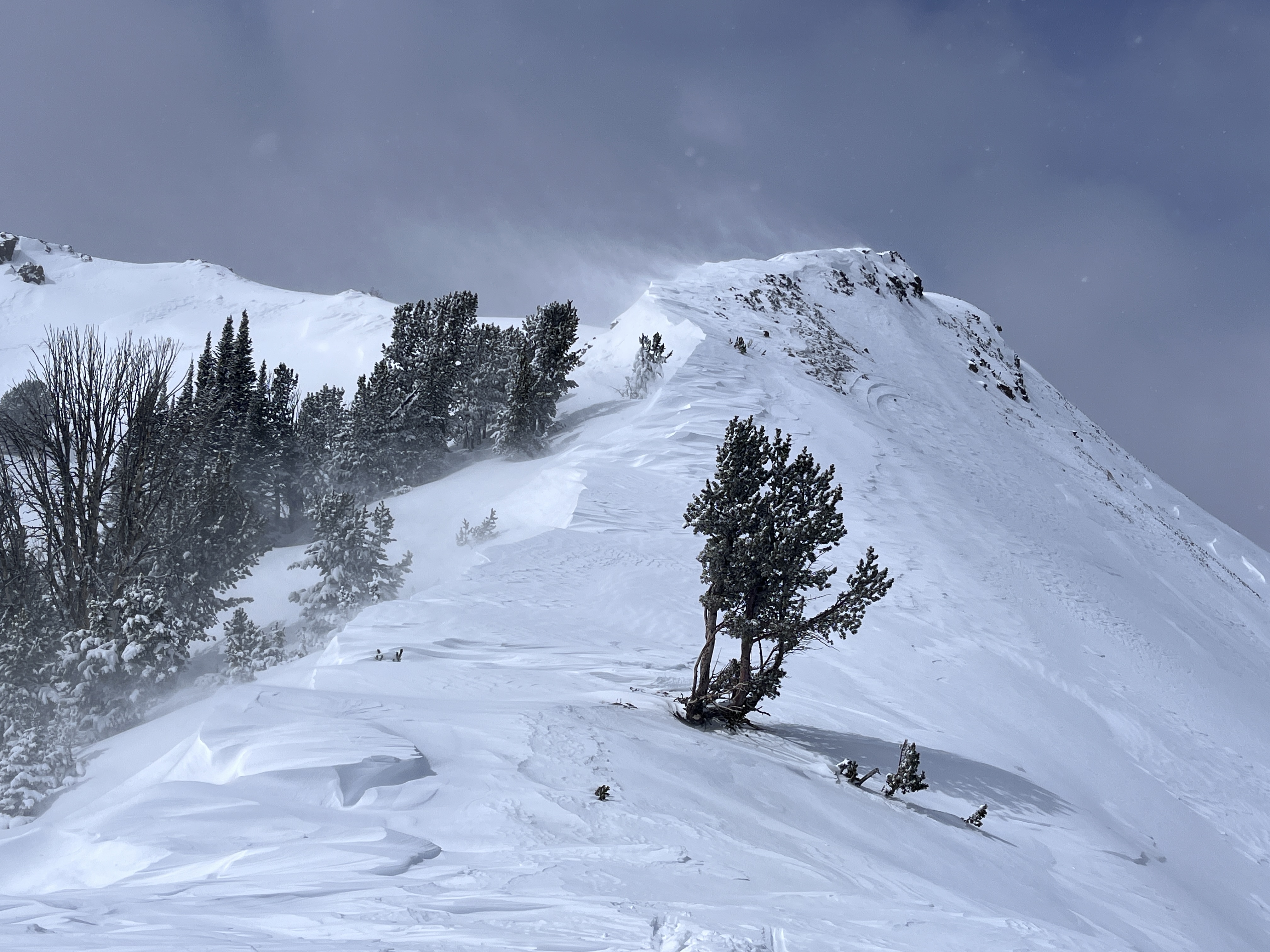

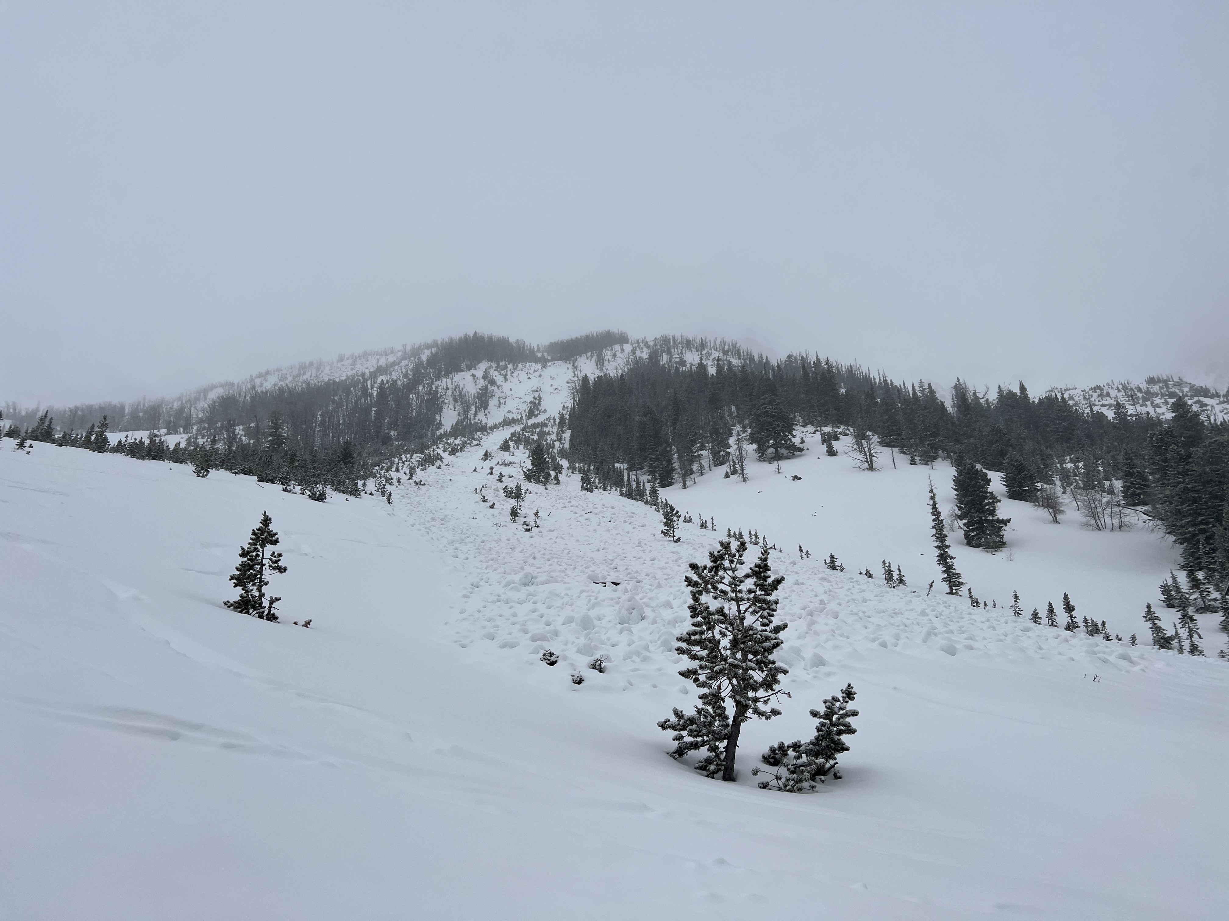
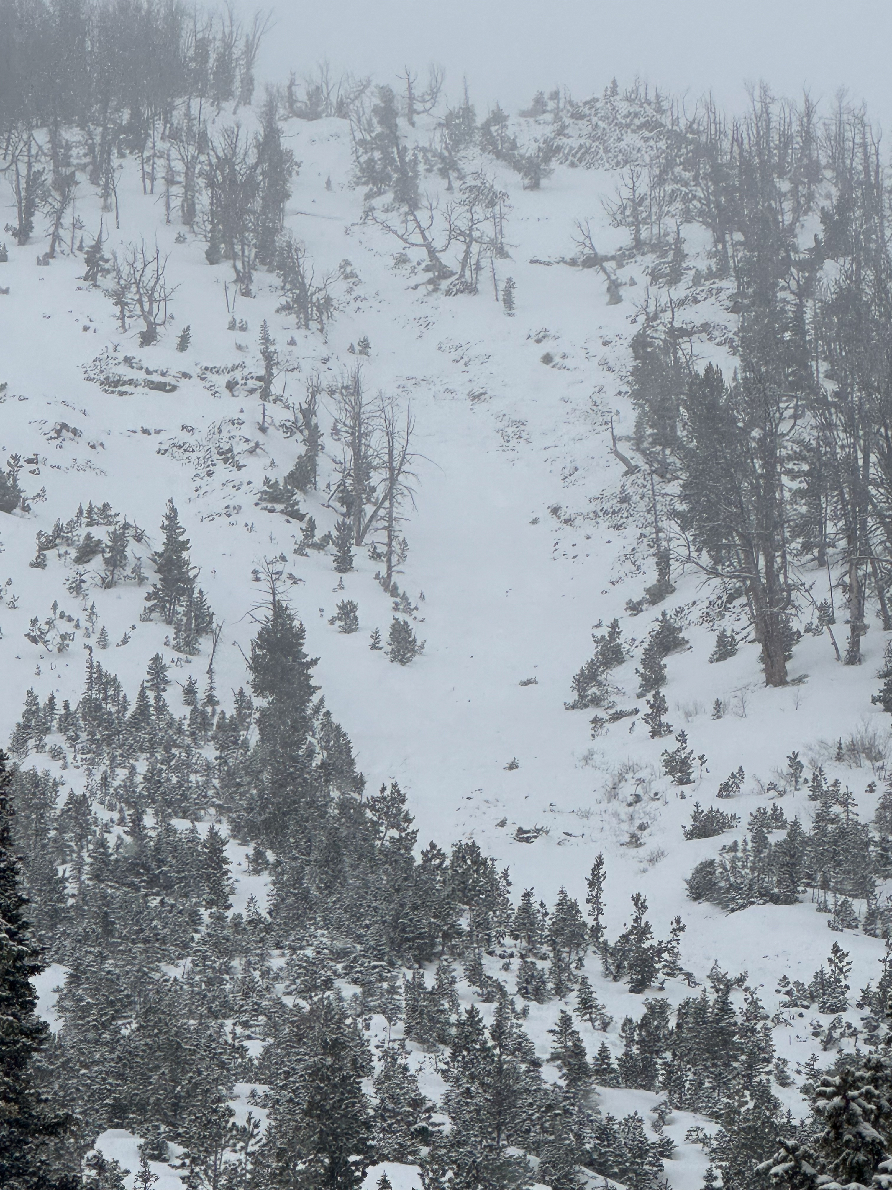
Toured up to Emigrant Gulch Bowls. Saw a pretty big natural avalanche on a NE facing slope. Saw the crown, it looked deep, and the debris was in large chunks and carried large trees down to the bottom. Our guess is wet-slide stepping down to deep slab on the weak layer at the bottom of the snowpack. We saw another decent natural on an adjacent slope with a similar aspect and many old wet-slides from last week on various aspects surrounding the Emigrant Gulch uptrack.
Full Snow Observation Report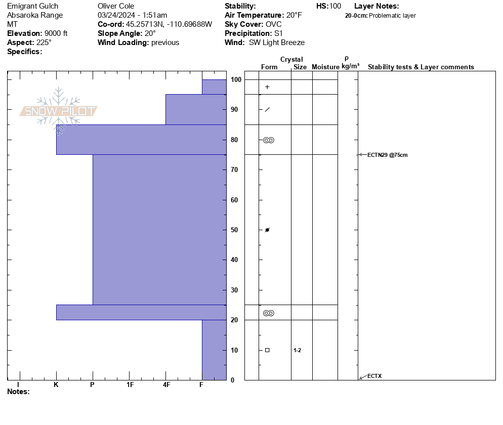
A partner and I toured up into the southeast bowl of Emigrant peak earlier today. New snow ranged from ~3-10 cm, increasing with elevation, and with surprisingly little wind affect. The consequences of the recent warm spell were still obvious, with a pervasive crust under the new snow, and one large recent wet slide. We dug on a northeast aspect at 9000' and got unremarkable test results (CT 15 Q2 on Depth Hoar, ECTN15 beneath the recent crust), and a similar structure to the rest of the region (Basal Facets, a large mid pack slab of rounds, and a complex of recent wet snow and crusts near the surface). Clouds obscured our view of the alpine, and we decided to keep to mellow terrain due to the low visibility and possibility of a consequential slide.
Full Snow Observation ReportObserved a D1 Natural wet slab avalanche in the Playground, just North of Texas Meadows. It seemed to have been triggered from a wet loose avalanche that released from the cliffband above. Estimated that the avalanche occurred on 3/22 during the period of warming after the snow tapered off. Crown was estimated at 1.5-2', approximate slope angle 35-40 degrees, E-SE slope, debris was 4-5' deep. Slide ran approximately 275'. HS just below the toe of debris was 115cm.
Also observed wet loose activity in S facing run off Texas (first run to the W of the summit)-photo attached.
Full Snow Observation Report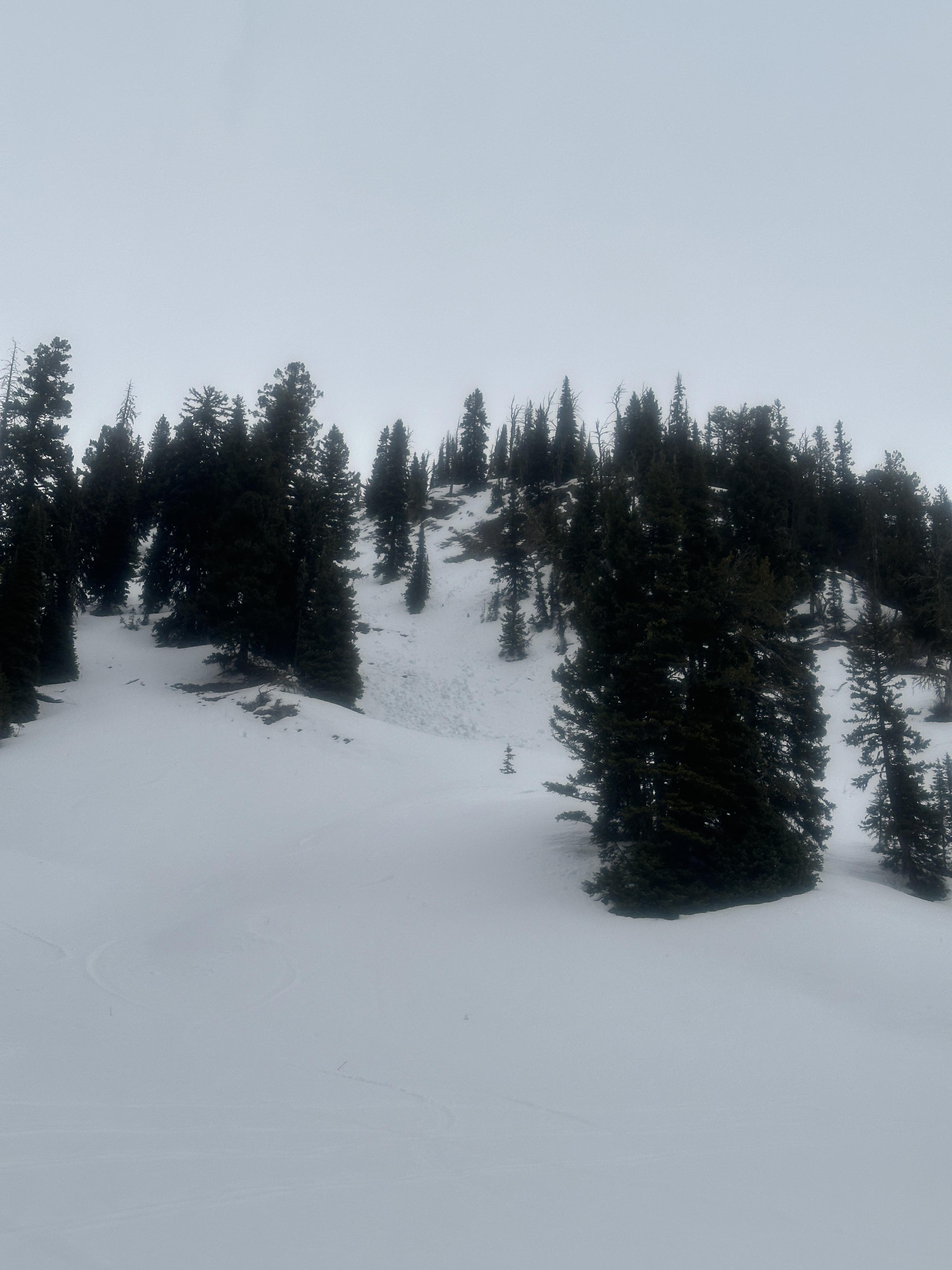

Would like to preface this by saying my buddy and I have limited experience testing and poor technique, but we gave it hell anyway.
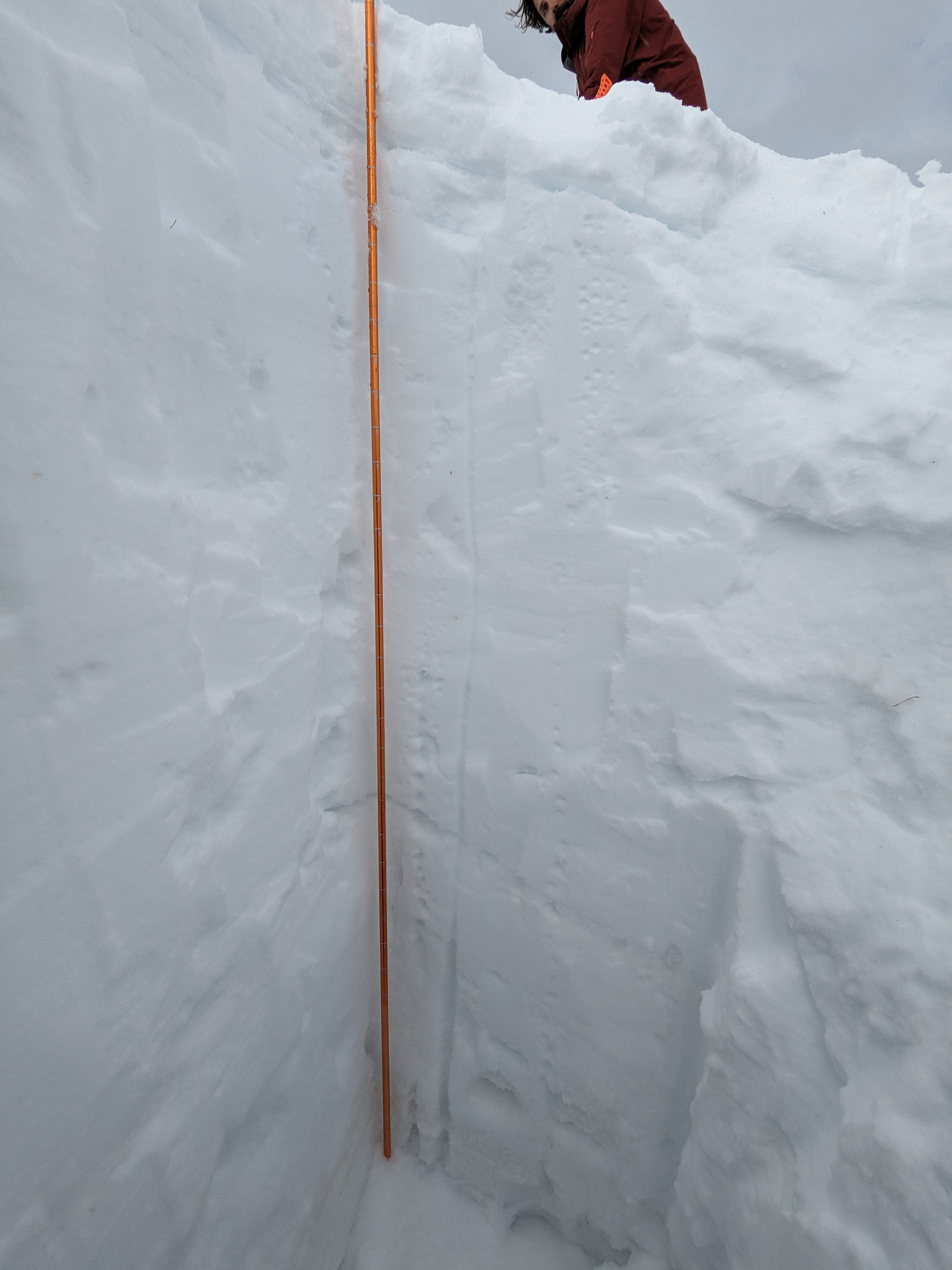
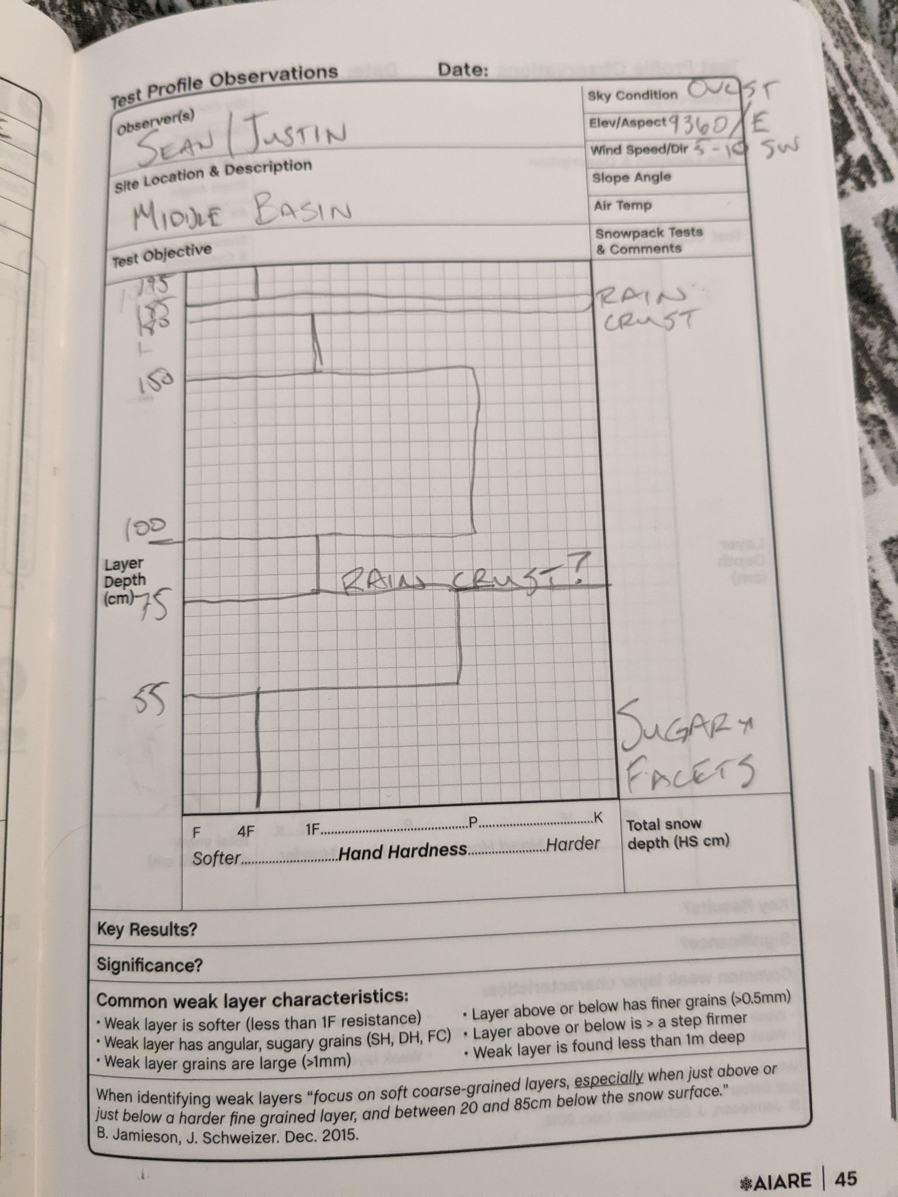
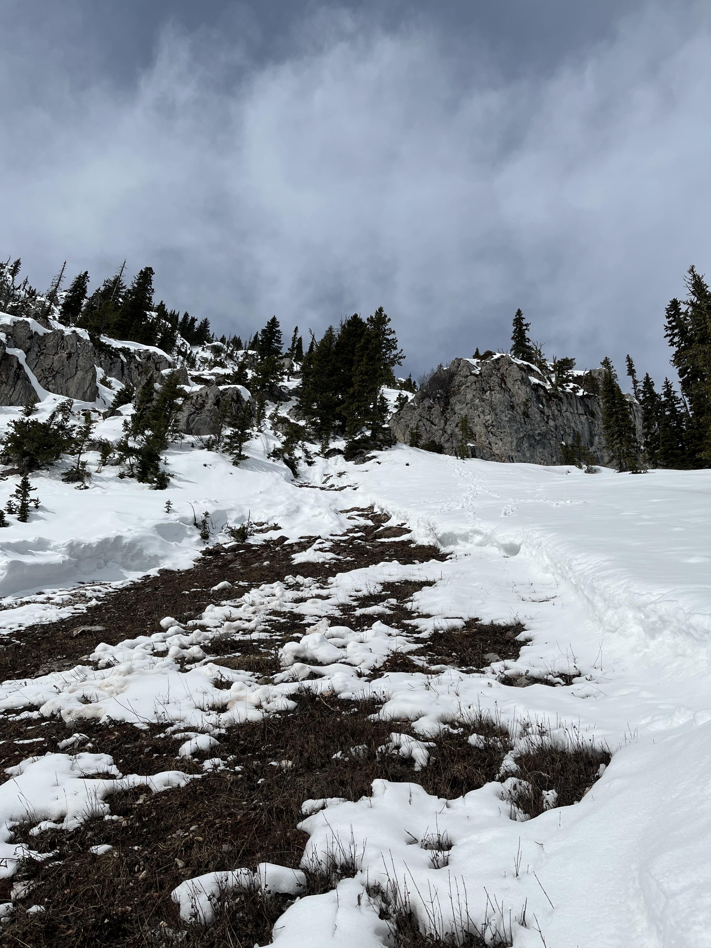
We dug a pit on the east side of the ridge between beehive and middle basin, and did a compression test. The column was somewhat poorly isolated, and we were not able to get it to fail with a normal tap test. By stomping on it from above, we got a fracture at about 75cm depth on what looked like an earlier season rain crust. Everything above that level was very dense, stable and hard to dig. The surface had about 10cm fresh snow with a hard crust below. Image of snow profile is attached. Pit coordinates were 45.32897, -111.38197. Overall we felt like this aligned with the forecast quite well. Snowpack appeared very stable and cohesive until it got down to a depth below the crust at 75cm.
While traveling, we saw significant snow accumulation midday and clearing in the afternoon, followed by light snow in the evening. Test slopes and cornices we tested were stable, and we didn't see shooting cracks or hear any whumpfing. No natural avalanches observed, but visibility was poor most of the day. Wind across the ridge was substantial with notable blowing snow, blowing from the west and southwest.
Thanks for all you do!
Full Snow Observation Report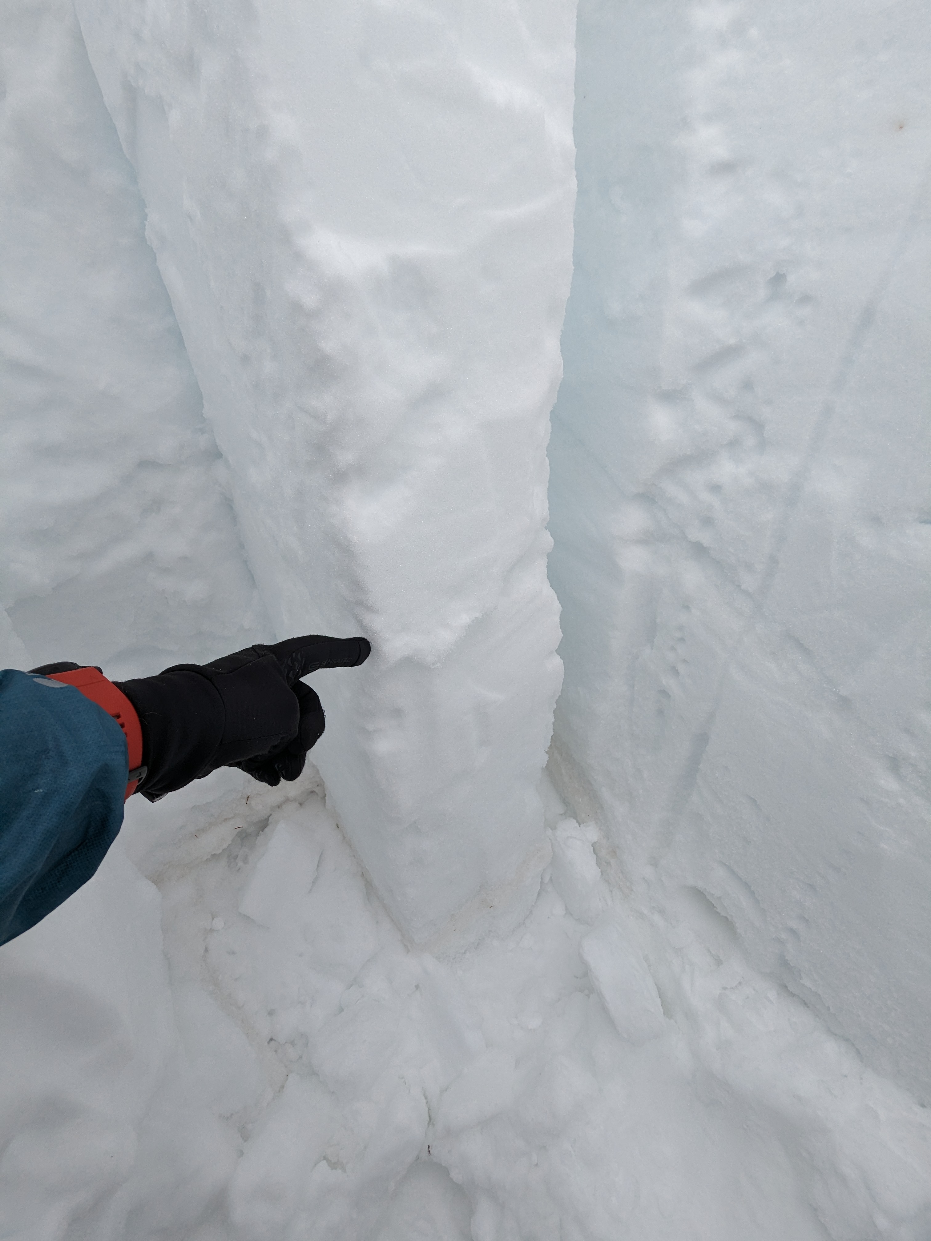
Collapse with shooting cracks approx 50 feet out
1 skiers boot broke through the crust layer during transitioning and sank to the waist causing collapse of about 2” according to standing skiers feeling of drop
elevation: 9940
Republic side of woody ridge
Full Snow Observation Reportat history rock today we did an extended column test and a regular column test. Both tests were performed a few feet from one and other, and both pits were dug to the ground on a 26ish degree slope. The extended column test fully propagated on the 4th tap from the elbow scoring ectp 14. The regular column test failed after one tap from the wrist. Both failed on the sugary facet near the bottom of the snowpack I did not record any exact depth measurements or perform further tests. estimated coordinates (45.48811,-111.00942) I think it was the first powder field.
Full Snow Observation ReportWalked out the north gate of bridger to the playground. Just north of Texas meadows observed a slide that ran sometime earlier in the week on a E aspect. Seems to have been triggered naturally by a loose wet coming out of the steep rocky terrain above. Ran about 200 feet was about 50-60 feet wide and crown was roughly 2-3 feet deep. Snow around the slide and on similar aspects was wet in the top 40 cms or so.
Around the corner dug a pit on a N aspect. Snow was significantly drier and deeper. HS 160 with plenty of weak snow at the bottom still. ECTX but did get failure and propagation on that lower layer with extra hits. PST 45/100 on the same layer 120 cms down.
Full Snow Observation Report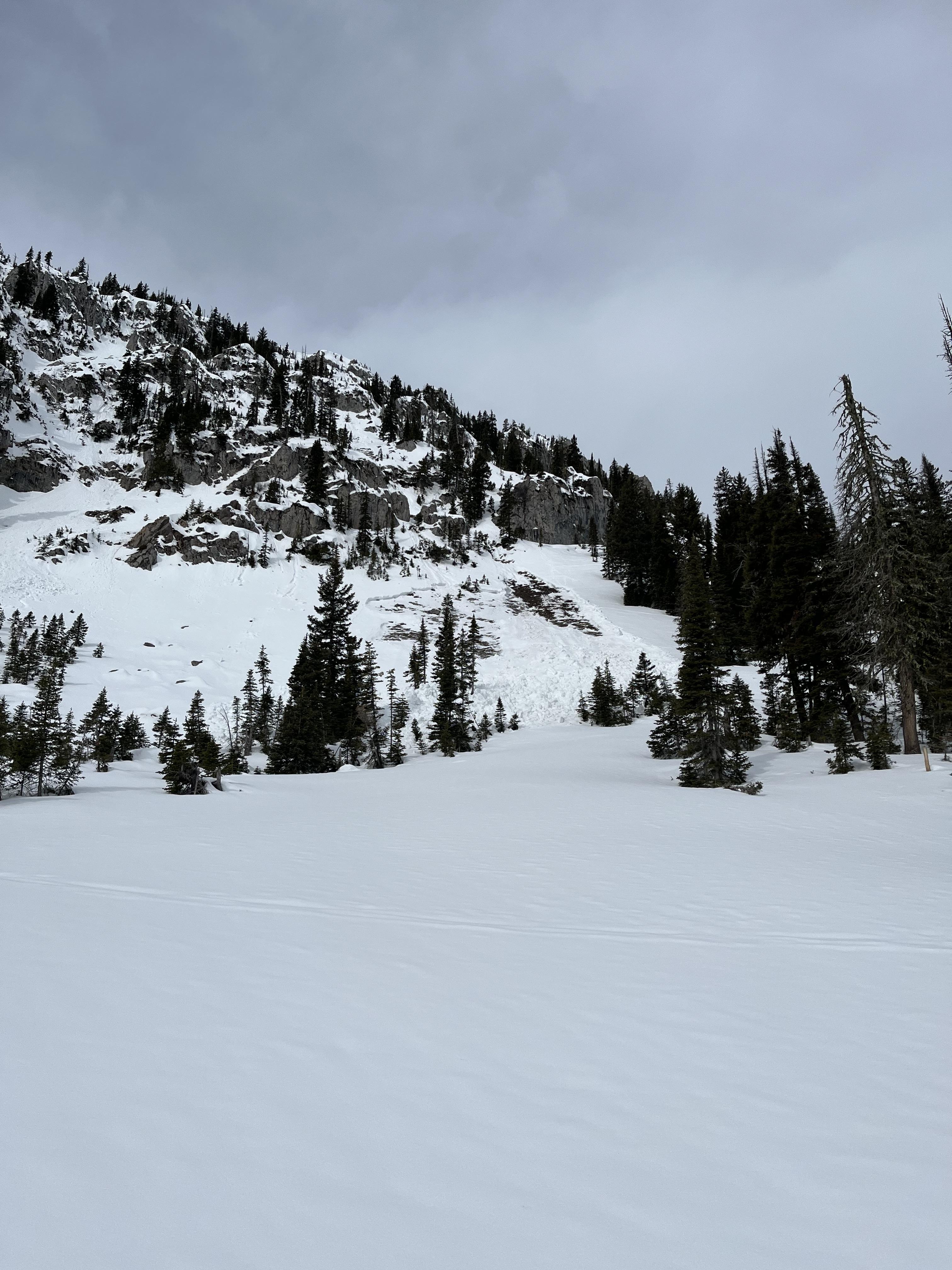
Debris field from likely a wet slide on a steeper slope in the back bowl near Emigrant peak. Slide was on an east-south/east facing slope. Not sure the date of slide.
Full Snow Observation Report
From email: "New snow: 10-15cms.
No collapsing, no cracking, no fresh avalanche activity to report.
Snowpit attached from a SE aspect at 9100'. HS: 113. ECTP18 @ 78."
Full Snow Observation Report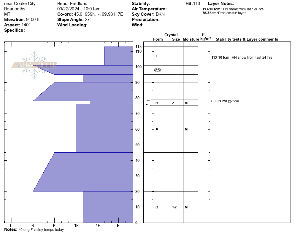
Skied at Cinnamon Mountain today. The recent warm spell was not kind to the snowpack off 191. South facing slopes at all elevations had lost significant amounts of snow, with those below 7500 ft mostly bare and muddy.
Where there was still snow a thick yet loosely frozen crust capped weaker layers lower in the snowpack. Out of the wind this crust had barely refrozen, and I crashed through it many times, sometimes with the slab propagating further and shaking nearby saplings. Near treeline the crust became stout and supportable, and the 2-3 cms of new snow were bonding well (i.e. wet snow on wet crust).
Light winds with moderate gusts out of the WSW were lightly drifting the new snow, and precip was falling intermittently and as rain below ~7 kft. Certainly a funky day out there.
Full Snow Observation ReportOur party took a slow tour up and down the SE face of Blackmore today. New rollerballs were observed on E aspects, and we witnessed a natural D1 loose wet slide occur on the east face of Blackmore at around 1:00. Dug a quick pit on the way up (NE aspect, ~8700’) out of curiosity about snowpack structure and fracture initiation. HS 110 cm. A compression test yielded CTM (15 taps), with a Q2 resistant planar shear at 60 cm depth. Was surprised to not find faceted snow near the bottom of the pit, despite the avalanche incident that occurred the day prior on the northeast ridge of Blackmore on a similar aspect and elevation.
Full Snow Observation ReportI pulled the last sentence of his ob: This suggests significant uncertainty in the distribution of the persistent weak layer in the forecast area.
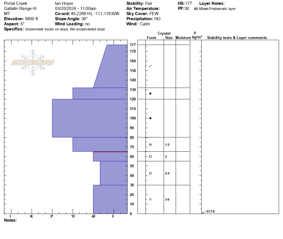
Rode up to the head of Portal Creek to area beneath Eaglehead Mtn and then around to the ridge overlooking Hidden Lakes. The trail is very low snow near the Portal Creek trailhead and the snow was wet to the ground beneath a stout crust. As we got higher up the coverage increased and even sunny slopes only had a couple inch thick surface crust over dry snow. On shady slopes there was still dry snow at the surface. We dug on a N aspect at 9400 ft just north of Eaglehead Mtn. The snowpack was 180 cm deep. We got an ECTX, but the facets near the ground were still soft and sheared off cleanly when pulling on the column.
We had no signs of instability today. The only avalanche we saw was a large slide on Eaglehead that had been previously reported over two weeks ago.
Full Snow Observation ReportGreat day out. Really good to see some more of the terrain up Portal. MODERATE seems like it was appropriate this morning, with the increasing cloud cover I'm not sure if it reached CONSIDERABLE this afternoon, but we were head down by 12:30 so it may well have.
